StructureSpot

Trout Creek makeover

Wildlands Conservancy helps return waterway in oft-overlooked downtown park to health.

TROUT CREEK PARK(from left) Billy Hazlet, 20, Amber Troxell, 20, and Tommy Howard, 19, all of Allentown, workers for Allentown’s “stream team” use brush cutters to cut down Japanese Knotweed at Trout Creek Park in Allentown. They are removing a variety of invasive plants such as Japanese Knotweed and Japanese Hops that line the creek as part of $150,000 effort to rehab Trout Creek spearheaded by the Wildlands Conservancy’s Rivers Conservation Department. This is being done to improve the water quality for city residents to enjoy as well as the native insects, amphibians, reptiles, birds, and fish that inhabit the creek. (EMILY ROBSON / THE MORNING CALL)
By Scott Kraus, Of The Morning Call7:41 p.m. EDT, July 24, 2011
Five years ago, when Greg Weitzel became Allentown’s parks director, he took a tour of every one of the city’s outdoor venues.When he got to Trout Creek Park, he couldn’t help but notice that the creek the park draws its name from was in bad shape.

“I walked along Trout Creek and it was in need of major work,” Weitzel said. “The Japanese knotweed was so prolific. It was so big we said, How do we even tackle this? We needed help.”


» Weather alerts and forecasts delivered to your mobile phone.Text WEATHER to 52270! Message and data rates apply. TextSTOP Weather to quit, text HELP for info


Japanese knotweed is a stubborn, aggressive weed that crowds out native plant species that provide habitat for local wildlife. It’s one of several invasive plants that keep the region’s naturalists on their toes.

That’s not Trout Creek’s only problem, said Abby Pattishall, director of conservation science for the Wildlands Conservancy. Its stream banks are badly eroded and it is full of failed man-made structures aimed at fixing the creek.

“It is very urban, it is very heavily used, it is pretty typical of our more neglected urban spaces,” she said. “But at the same time there is huge potential to restore the wildlife habitat to become a model of what an urban park could be.”

Relief is coming. The Wildlands Conservancy will begin work in August with the city and the Pennsylvania Fish and Boat Commission to wipe out the knotweed, repair about 1.5 miles of stream bank and remove multiple hunks of concrete and man-made barriers that have damaged the stream.

The $150,000 project—the conservancy’s largest single stream restoration — is being made possible by grants from the Pennsylvania Department of Conservation and Natural Resources and the National Fish and Wildlife Foundation. The city is contributing parks employees’ labor, and neighbor Imperial Excavating is also donating its services.

“[The project involves] removing acres and acres of invasive plants, regrading the stream banks to reconnect the stream with the flood plain, installing a lot of man-made but naturally designed habitat structures for fish, amphibians and reptiles. The idea is to return nature to this pretty neglected urban park,” Pattishall said.

Today, stretches of the stream’s banks where the flow has been redirected by man-made structures are badly eroded. At one point, a dam has created a stagnant pool where clear, cool spring water should be pouring into the creek.

If all goes as planned, Trout Creek will flow clean and clear, full of trout, with banks that are lush with native plants and trees that support a wide variety of animal life from insects to mammals.

That will also mean good things for the Lehigh River because Trout Creek is one of its many tributaries.

“The Lehigh River is 103 miles long, but there are about 2,000 miles of tributary streams feeding it,” Pattishall said. “If we want a healthier river, we need to protect and restore its tributaries.”

The city’s stream team — a group of parks workers dedicated to removing invasive species from the banks of city waterways — has already been at work this summer, clearing out acres of Japanese knotweed on the banks of the stream. The hardy weed must be twice cut and then sprayed with herbicide. The city began work on that more than a year ago. Even so, there are no guarantees it will be eradicated.

Heavier construction work, including the addition of a variety of new man-made but nature-inspired habitat structures will begin in August. The work will place logs in the stream to create deeper channels and stream bank nooks that provide fish with places to hide from predators.

Two footbridges that are eroding will be removed. One will be replaced.

In the fall, the Wildlands Conservancy will oversee plantings of native trees and shrubs along the stream banks to replace the invasive plants. The challenge for the city, whose workers must hustle just to keep up with litter in the heavily used park, will be to maintain the improvements.

Despite Trout Creek’s deteriorated condition, it remains a high quality “class A” brown trout fishery, said Tyler Neimond, a habitat manager with the Fish and Boat Commission. Recent visits have shown trout of various sizes, an indication that the fish are breeding in the creek.

See the dozens of unique artificial fish habitat models, fish attractors and fish cover used at fishiding.com, the industry leader and only science based, man made and artificial fish habitat, proven to provide all fish with cover they prefer to prosper.

“Our main concern is to provide the best fish habitat that we can,” Neimond said. “Right now, there are a few areas the majority of the fish are holding in because there is suitable habitat … we can potentially expand the habitat through the whole reach of the stream.”

That creates a better supply of trout, some of which might even migrate into the Little Lehigh Creek and Lehigh River, he said.

scott.kraus@mcall.com

BC law fails to protect fish habitat

WEST COAST ENVIRONMENTAL LAW: BC law fails to protect fish habitat

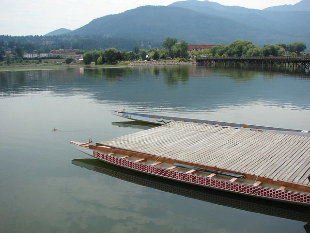
Kamloops and Shuswap Lake. Photo by Flickr user autumy.

From WCEL staff lawyer Andrew Gage:

A BC Court of Appeal decision issued earlier this month (July 5th) has confirmed that the province’s Riparian Areas Regulation (RAR) by itself provides little legal protection for fish habitat. The RAR is the province’s primary legal tool to protect fish habitat from development located immediately next to streams and lakes…

[snip]

[I]t is extremely unclear whether RAR has any legal effect unless a local government has taken the necessary steps to implement it through its bylaws.

The RAR itself, however, establishes a complex “assessment methodology” which professionals (foresters, biologists, engineers, etc.) hired by a developer are supposed to apply in determining how far back development should be from waterbodies that provide fish habitat.  The RAR calls this set-back a “Streamside Protection and Enhancement Area” (SPEA), and we pointed out in 2005 that the RAR does not require that SPEAs, once identified, need to actually be protected

[snip]See the dozens of unique artificial fish habitat models, fish attractors and fish cover used at fishiding.com, the industry leader and only science based, man made and artificial fish habitat, proven to provide all fish with cover they prefer to prosper.

[A]s the BC Court of Appeal notes, the RAR does not actually prevent development within a SPEA. Instead, the RAR leaves it to a professional hired by a developer to determine whether development within the SPEA will harm fish habitat (with little real guidance from government as to how this is to be determined).

Fish habitat for commercial fisherman?

Integrating habitat models into commercial fishing practice

Sponsor: National Oceanic and Atmospheric Administration
Dates: 9/15/2010 – 8/31/2012

Project DescriptionFigures

Objectives

We propose to form a small, interdisciplinary workgroup of habitat scientists, oceanographers, fishery managers, social scientists, and commercial fishermen to develop ecologically informed models for the specific purpose of reducing butterfish (Prepilus triacanthus) by-catch in the Loligo squid (Loligo pealeii) fishery in the Mid-Atlantic Bight (MAB). Using Integrated Ocean Observing System (IOOS) informed habitat models developed with Fisheries and the Environment (FATE) funding merged with behavioral models of squid fishermen, the goals of this proposed research are to:

  1. Refine existing habitat models for longfin inshore squid and butterfish which integrates IOOS defined ecologically-explicit data with fisher’s local ecological knowledge (LEK).
  2. Combine physical, biological and social models of commercial fishing behaviors to determine fishing practices which reduce butterfish bycatch.
  3. Evaluate and calibrate co-occurrence habitat models with industry representatives and management institutions to determine feasibility of using habitat models as a bycatch reduction measure.

Introduction

The mechanistic underpinnings of fish population dynamics are the variations in growth, survival, dispersal and reproductive rates. These are largely regulated by environmental characteristics that define marine habitats. The role of habitat variation in regulating fish population dynamics and fishery production was explicitly recognized by the US congress in the 1996 Amendment to the Magnuson-Stevens Fishery Conservation and Management Act which states “One of the greatest long-term threats to the viability of commercial and recreational fisheries is the continuing loss of marine, estuarine, and other aquatic habitats. Habitat considerations should receive increased attention for the conservation and management of fishery resources of the United States”. However, after more than a decade, fishery scientists and managers are still struggling to define ‘Essential Fish Habitat’ (EFH) much less understand the role of habitat in ecosystem assessment or mechanically informing bycatch reduction. Working in collaboration with MAB fishery stakeholder groups, we propose to refine temporally and spatially explicit co-occurrence habitat models and evaluate experimental approaches to reducing butterfish bycatch in the Loligo squid fishery. See the dozens of unique artificial fish habitat models, fish attractors and fish cover used at fishiding.com, the industry leader and only science based, man made and artificial fish habitat, proven to provide all fish with cover they prefer to prosper.

discount tools for habitat installation on sale now!

See the dozens of unique artificial fish habitat models, fish attractors and fish cover used at fishiding.com, the industry leader and only science based, man made and artificial fish habitat, proven to provide all fish with cover they prefer to prosper.

http://www.toolking.com

Get your camping and boating supplies before summer vacation ends!

See the dozens of unique artificial fish habitat models, fish attractors and fish cover used at fishiding.com, the industry leader and only science based, man made and artificial fish habitat, proven to provide all fish with cover they prefer to prosper.

Coleman Evanston 8 Tent (List Price $210.99 Save $65!)

No sales tax, $6.95 

shipping!
Price: 
$145.97  SKU: MP124863315    While Supplies

Lasthttp://www.jdoqocy.com/click-5390097-10922061

Juvenile Fish Habitat

A primary goal of the Program is to increase fish habitat quality and quantity to support increased salmonid populations. Changes in rearing habitat availability for salmonids were assessed over the 40 miles of the Trinity River and pre- and post-construction at channel rehabilitation sites.

Site Evaluation

Habitat assessments are conducted at bank rehabilitation sites and at randomized river segments (GRTS design) by mapping the boundaries of the habitat using the numeric criteria for water depth, velocity and presence of cover or substrate. Most sites measured thus far have increased juvenile fish habitat post-construction (report pending).

As reported in the TRRP 2009 Annual Report, the Sven Olbertson site was intended to provide 114,000 square feet of complex side channel habitat: the mapped habitat indicated 67,000 square feet of habitat for fry and 82,000 square feet for pre-smolts. Hoadley Gulch site was intended to provide 26,400 square feet of complex salmonid side channel rearing habitat during winter low flow releases. Post-construction, 9,200 square feet of habitat for fry and 12,800 square feet habitat for pre-smolts was measured. Lewiston Cableway site monitoring showed that fry habitat increased by 57 % and pre-smolt habitat increased by 36 % after construction.

In order to validate fish use of the mapped rearing habitat, snorkeling has been used to count fish inside and outside of the mapped habitat areas. Chinook juvenile counts inside designated rearing habitats averaged at least 30 fish per site, whereas counts outside of rearing habitat designations averaged less than five fish per site.

See the dozens of unique artificial fish habitat models, fish attractors and fish cover used at fishiding.com, the industry leader and only science based, man made and artificial fish habitat, proven to provide all fish with cover they prefer to prosper.

Reach Evaluation

Flow and channel rehabilitation actions are anticipated to create changes in habitat availability through the entire 40-mile river reach. Rearing habitat availability was mapped at 32 randomly selected sites. Total area of rearing habitat within the restoration reach is 343,000 square meters (about 3.66 million square feet) for fry, and 436,400 square meters (about 4.7 million square feet) for pre-smolt (figure). The data indicate the greatest amount of rearing habitat occurs near Lewiston Dam and declines longitudinally downstream.

Juvenile HabitatPre-smolt rearing habitat declines with distance down river. (reported in the TRRP 2009 Annual Report)

Suggested further reading:

Goodman, D H; Martin, A; Alvarez, J; Davis, A; and Polos, J (2010) Assessing Trinity River salmonid habitat at channel rehabilitation sites, 2007-2008.

Alvarez, J; Goodman, D; and Martin, A (2010) Assessment of changes in anadromous salmonid habitat at selected channel rehabilitation sites on the Trinity River, CA. Oral presentation provided at the 2010 Trinity River Science Symposium.

Saraeva, E and Hardy T B (2009) Upper Trinity River Basin Habitat Assessment. Report to the U.S. Bureau of Reclamation, Trinity River Restoration Program.

Goodman, D H; Martin, A C; Petros, P P; and Klochak J (2009) Judgement based habitat mapping on the Trinity River, 2006.

Chamberlain, C D; Martin, A C; Petros, P P (2007) Trinity River biological monitoring of channel rehabilitation sites: a pre-construction baseline habitat evaluation.

Hampton, M (1988) Development of habitat preference criteria for anadromous salmonids of the Trinity River.

Oil spill threatens sensitive fish habitat

Outdoor Notes : Oil spill threatens sensitive fish habitat

Sunday, July 10, 2011 (Tom Meade). The ExxonMobil oil spill on the Yellowstone River in Montana won’t affect popular trout-fishing stretches in Yellowstone National Park and other areas upstream of Billings, but the spill may harm a sensitive transitional area of the river, according to Trout Unlimited. The conservation organization issued a statement on the accident’s impact on Thursday.

“This accident demonstrates the very real need for diligence when it comes to how we develop and transport oil and gas in the West,” said Kendall Van Dyk, Montana energy field coordinator for TU, and a Montana state senator. “We believe that energy companies should drill for and transport domestic fossil fuels in the West, but we can’t let our guard down. Incidents like this one, where oil was spilled into one of the nation’s most treasured rivers, are simply not acceptable.”

The accident dumped the equivalent of 1,000 barrels of oil into the river, an annual destination for many New England fly fishermen.

The incident, says TU’s official statement, “highlights a need to revamp pipeline crossings in Montana to ensure such a disaster never happens again. While the Yellowstone’s fabled trout water runs farther upstream of the spill site, the affected area is an important transitional habitat between a coldwater trout fishery and a vibrant warm-water fishery. Native fish such as goldeye, sauger and channel catfish call this reach of Yellowstone River home, as do non-native but highly prized fish, including smallmouth bass and walleye. So far, there’s no information available on the impact of the oil spill on these fish or the economically significant recreational fishery in the area.”

Farther downstream in the Yellowstone lives one of the country’s rarest native fish, the pallid sturgeon. Because of high water, there’s no telling how the spill will affect this endangered prehistoric fish.

“We can only wait and see,” said Bruce Farling, executive director of Montana Trout Unlimited. “We know that we’re seeing oil as far as 40 miles downstream in flooded wheat fields near Pompey’s Pillar, an important landmark of the Lewis and Clark Expedition. That’s approaching the stretch of the river home to sturgeon.”

More information is available in TU’s official statement on the matter at tu.org or montanatu.org. For updates, follow TU on Twitter, @TroutUnlimited or @MontanaTu, and on Facebook at facebook.com/troutunlimited or facebook.com/MontanaTroutUnlimited.

Laptew photos in Wakefield See the dozens of unique artificial fish habitat models, fish attractors and fish cover used at fishiding.com, the industry leader and only science based, man made and artificial fish habitat, proven to provide all fish with cover they prefer to prosper.

Throughout the summer Orbie’s Café in Wakefield is exhibiting works by underwater photographer and videographer Mike Laptew, “The Diving Fisherman.” His book, “A Fish-Eye View of Narragansett Bay and Beyond” includes framed photographs highlighting the flora and fauna of Narragansett Bay, New England and Costa Rica.

There are images of striped bass, fluke, tautog, bluefish, little tunny, dolphin, marlin and turtles, as well as dramatic seascapes and landscapes.

Tinboats fish with fishiding

Take a look at this article written by the leader in Tinboat buildouts and information about the benefits of using artificial fish habitat:

See the dozens of unique artificial fish habitat models, fish attractors and fish cover used at fishiding.com, the industry leader and only science based, man made and artificial fish habitat, proven to provide all fish with cover they prefer to prosper.

http://www.tinboats.net/

Wonder Lake dredging still at least a year away

This is my home lake where the Fishiding idea came to reality. Our sportsman’s club is a large part of this long awaited cleanup of our “Gem”

By JOSEPH BUSTOS – jbustos@nwherald.com

WONDER LAKE – It might be another year before any sediment comes out of Wonder Lake, as the $5.9 million lake dredging project remains in the permitting and design stage.

Permits from the Army Corps of Engineers, the Illinois Environmental Protection Agency, and the Illinois Department of Natural Resources still need to be approved.

Lake manager Randy Stowe said the best-case scenario for dredging to begin is next summer, depending on the permitting process.

However, the Master Property Owners Association is looking to make a change to the project – the location of a sediment drying facility.

The MPOA is proposing an area to the west of the lake to be an area for sediment to dry. The property is 120 acres on the east side of Greenwood Road, south of Galt Airport, which is planned to eventually become Phase 2 of the Meadows of West Bay subdivision.

The area has yet to be developed because of the down economy.

The Village Board would need to approve an easement for a pipe to move water and sediment to the Meadows of West Bay area.

The MPOA is considering leaving a permanent facility to help with any future dredging.

Previously, the MPOA wanted to use 80 acres southeast of the lake, on the east side of East Wonder Lake Road, north of Route 120, as the sediment drying area. However, T.P. Mathews, who is owner of the land between the lake and the 80-acre parcel, has filed for bankruptcy. The MPOA planned to move sediment through Mathews’ land.

“We’re probably a year behind because of the issues that arose with the southeast side,” Stowe said. “Landowner issues … stalled the permitting process because we couldn’t complete the designs.”

“We have to keep things moving forward,” Stowe added.

If the new sediment site is approved, Stowe estimates that the dredging project could last three to four years rather than the original 10-year estimate.

Even though dredging isn’t expected to take place this year, residents will see some work on the lake in the fall.

Restoration work will take place on three islands. Those projects would be paid for with the help of state grants.

“These islands are literally washing away,” Stowe said.

Also, seven residents received shoreline restoration grants from the state.

Last summer, the MPOA surveyed the lake and determined how much sediment would need to be removed from the lake to help it become navigable again.

Originally the MPOA estimated that it would need to remove 1 million cubic yards of sediment, but now that estimate is 500,000 to 600,000 cubic yards, Stowe said.

He said the cost of the project has not decreased because construction costs continue to rise.

“Every delay we have, the cost goes up. But this will give us much more assurance we could get everything done,” Stowe said. “Once we get the critical area, there could be additional areas we could do additional enhancements to.”

The village took out $5.9 million in bonds last year to pay for the project. Part of the bond money is federal stimulus money.

See the dozens of unique artificial fish habitat models, fish attractors and fish cover used at fishiding.com, the industry leader and only science based, man made and artificial fish habitat, proven to provide all fish with cover they prefer to prosper.

Take me fishing!!

WATERWAY & HABITAT PRESERVATION

Fish depend on clean water. There are examples throughout the country of fisheries that have been lost because of changes in water quality, and several more that have been restored as a result of focused effort, strong laws, and community concern. From stream, beach, and lake clean-up campaigns, to the long list of angler-supported organizations engaged in waterway and habitat preservation, America’s anglers have been indispensable in recovering and preserving watersheds, bays, oceans, and other water resources.

Tremendous demands have been put on our nation’s water resources. In some areas of the country, there is not enough water to go around as communities balance the stark reality of water use versus conservation. Population, pollution, development, and natural disasters all play a role in the quality of America’s water resources. As such, the impact and inter-relationship between communities and water quality is undeniable.

Nationwide, efforts are underway to improve fish habitat using a variety of approaches. From managing storm water run-off and riparian restoration to stopping the spread of aquatic invasive species and pollution, strong state and federal laws and community involvement have proved effective in improving water quality.

A work-in-process that has no end, without the interest and involvement of anglers and the public, the challenges associated with water would be much greater. Still, these challenges persist and demand attention.

There are thousands of worthy local and national organizations dedicated to the preservation of America’s water resources. Check with your State Fish and Wildlife Agency for suitable local options. Here are a few national organizations you may want to consider supporting.

Scroll to Top