StructureSpot

Kids learn to improve and protect habitat

See the dozens of unique artificial fish habitat models, fish attractors and fish cover used at fishiding.com, the leader in  science based, proven, fish protection.
California, Nevada and Klamath Basin

Photo: USFWS

Schoolyard Habitat Program

Schoolyard Habitat ProgramThe Schoolyard Habitat Program helps teachers and students create wildlife habitat at their own schools. Typical projects include: wetlands, meadows, forests and variations based on specific ecoregions.

Many projects are planned through multiple phases and change over time as children from various classes build upon the existing work of past students.

We work with your school to provide:

  • technical assistance and project guidance
  • teacher training,
  • develop written materials

Our goal is to provide technical and organizational assistance to school, so they can create outdoor classrooms that are effective as educational tools in addition to being a sustainable habitat for many years to come.

Please download the following Fact Sheet for more information on the Schoolyard Habitat Program:
Schoolyard Habitat Fact Sheet (.pdf)

Managing fishery an imperfect science

gathered-hundreds-rally-u

 “It is, after all, impossible to count every fish in the ocean.”
January 22, 2012 05:18:47 PM
Valerie Garman / Florida Freedom Newspapers

MEXICO BEACH — Fishery management is a complex business, and when it comes to fishery management in the United States, the Magnuson-Stevens Act is the Bible. Continue reading “Managing fishery an imperfect science”

Underwater cannon can protect valuable fish in the Great Lakes

Lake News, Information
& Events

Michigan: Scientists Will Chase Invading Fish With Cannon
Source: The New York Times; National Briefing-Midwest – By THE ASSOCIATED PRESS. Published: December 30, 2011

Scientists are trying to discern whether an underwater cannon can protect valuable fish in the Great Lakes from the round goby, a predator that lurks near spawning beds and gobbles up the eggs of lake trout and whitefish. Biologists plan to use a seismic gun next fall to chase the predatory fish from several Lake Michigan reefs. Researchers hope the gobies will stay away long enough for native fish to hatch and escape. The experiment is part of the increasingly sophisticated war against invasive animals and plants that costs the nation’s economy billions of dollars each year.

See the dozens of unique artificial fish habitat models, fish attractors and fish cover used at fishiding.com, the leader in  science based, proven, fish protection.

http://www.nytimes.com/2011/12/31/us/michigan-scientists-will-chase-invading-fish-with-cannon.html?_r=2

Fish love Snags and snags create habitat

Re-snagging the Goulburn to increase native fish habitat and improve recreational fishing opportunities between Seymour and Nagambie.

The Goulburn Broken Catchment Management Authority (CMA) is working along the Goulburn River between Seymour and Nagambie in the coming weeks to increase the amount of large woody habitat, or snags, in the Goulburn River, with the aim to increase in the native fish population and diversity in this section of the river.

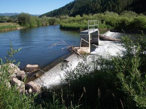
Funded by the Victorian Government, through revenue from Recreational Fishing Licenses to improve recreational fishing in Victoria and the Goulburn Broken CMA, the snags are being placed in the Goulburn River, downstream of the Hume Freeway Bridge near Seymour. The works that are being carried out will lead to an increase in habitat for native fish in the area and an improvement in catch rates for recreational fishers.

Goulburn Broken CMA River Health Projects Coordinator, Mr Jim Castles explains, “Native fish rely heavily upon instream habitat such as tree roots, logs and branches called ‘snags’. Since European settlement, our streams and rivers have been de-snagged, in the belief this would increase water flow and quality. We now know this is not the case.”

Native fish ecologists from the Murray Darling Basin Authority estimate that fish populations have declined by 90% since European settlement. There have been many threats to native fish including removal of in-stream and riparian habitat and flow modification.

Snags are the inland equivalent of coastal reefs and provide habitat for native fish and other animals such as tortoises and native water rats. Native fish use them to shelter from fast currents and sunlight and take refuge from predation. Native fish also use snags as feeding and spawning sites, and as nursery areas for juvenile fish.

Recent fish surveys within the Murray Darling Basin have found that 80% of Murray Cod are found within 1 metre of a snag. All large bodied freshwater native fish use snags as habitat.

“Re-snagging is a sound management intervention we can use to restore native fish habitat to our waterways, and results so far suggest that native fish populations respond strongly as a result. Re snagging on its own, however, is unlikely to be the sole driver in native fish recovery in the Goulburn River. The key is to better manage our riparian zones by fencing to restrict stock access and protect native vegetation, and revegetating degraded areas so there will be a constant natural supply of snags in the future” says Mr. Castles. See the dozens of unique artificial fish habitat models, fish attractors and fish cover used at fishiding.com, the leader in  science based, proven, fish protection.

The areas to be re-snagged have been identified via in-stream habitat mapping undertaken in 2011 by scientists from the Arthur Rylah Institute (ARI) in the Goulburn River between the Mitchellstown and Hume Freeway Bridges to identify areas that have a low density of snags. The sites where the Goulburn CMA carry out re-snagging are being selected based on priority zones identified by ARI as a result of this mapping, and access to the waterway within these zones.

The fallen trees used for the re-snagging project have been sourced from a number of nearby locations, including the Nagambie Bypass and a public reserve in Seymour. The Goulburn Broken CMA and its contractors work to rigorous guidelines that have been developed in other locations where re-snagging has been carried out over many years.

“The snags will be secured safely and positioned in a way that does not block the river channel to ensure fishing boats can still travel along the river,” explains Mr Castles “The snags will have very little or no net impact on water flow and will enhance native fish habitat, thereby leading to a more robust native fish community, which will result in huge benefits for recreational fishers in our region.”

This project is funded by the Department of Primary Industries Recreational Fishing Licence Grants Scheme, which uses revenue raised from the sale of recreational fishing licences to fund projects that directly improve recreational fishing in Victoria.

Snags on the riverbank prior to placement. Photo: Jim Castles, Goulburn Broken CMA

Recreational Fisheries Award to Kamloops

Minister Shea Presents 2011 National Recreational Fisheries Award to Kamloops Volunteer

KAMLOOPS, BRITISH COLUMBIA–(Marketwire – Jan. 19, 2012) – The Honourable Gail Shea, Minister of National Revenue and Cathy McLeod, Member of Parliament for Kamloops-Thompson-Cariboo, on behalf of the Honourable Keith Ashfield, Minister of Fisheries and Oceans and Minister responsible for the Atlantic Gateway today presented Mr. Mo Bradley with a Recreational Fisheries Award in their home community of Kamloops.

“Mr. Bradley has contributed to Canada’s world-renowned recreational fisheries,” said Minister Shea. “It is important to recognize the hard work of volunteers who are committed to building sustainable fisheries in their communities.”

For over 30 years, Mr. Bradley has been developing and promoting recreational fishing in the Kamploops/Shuswap area of British Columbia. He is passionate about fishing and about teaching others how to fish, particularly young people. In teaching others, he never emphasizes the catching of the fish, rather the whole experience of fishing including observation of the natural world.

He has been an active member of local fishing clubs, contributing to expansion of programs to provide more fishing opportunities and educational experiences. As a board member for the Habitat Conservation Trust Fund, Mr. Bradley lent his expertise and understanding of the needs of the fishery to ensure that fisheries projects would be of long term benefit to the resource.

A master fly-tyer, Mr. Bradley donates more than 3,000 flies each year to conservation groups to raise funds; flies tied by Mr. Bradley are much in demand. Passing on his knowledge and expertise to the future generation of anglers is considered by his peers to be the best aspect of his accomplishments overall.

“As Mr. Bradley is committed to ensuring that recreational fisheries are preserved, so is our Government,” said MP McLeod “We are proud to honour the efforts of such dedicated volunteers who make such an important contribution to this important tradition.”

Canada’s National Recreational Fisheries Awards were created in 1989 to recognize outstanding contributions by individuals and organizations in areas such as recreational community leadership, restoring and enhancing fisheries and fish habitat or promoting conservation and sustainable recreational fishing. See the dozens of unique artificial fish habitat models, fish attractors and fish cover used at fishiding.com, the leader in  science based, proven, fish protection.

For Broadcast:

The Honourable Gail Shea, Minister of National Revenue and Cathy McLeod, Member of Parliament for Kamloops-Thompson-Cariboo today presented a 2011 National Recreational Fisheries Award to Mr. Mo Bradley. Canada’s Recreational Fisheries Awards were created in 1989 to recognize outstanding contributions by individuals and organizations in areas such as recreational angling, community leadership, restoring and enhancing fisheries and fish habitat or promoting conservation and sustainable recreational fishing.

Contact Information

  • Frank Stanek
    Media Relations
    Fisheries and Oceans Canada, Ottawa
    613-990-7537

    Barbara Mottram
    Press Secretary
    Office of the Minister
    Fisheries and Oceans Canada, Ottawa
    613-992-3474
    http://www.dfo-mpo.gc.ca

Fraser River fish habitat threatened by gravel extraction

  Fraser River fish habitat threatened by gravel extraction

Approximately 280,000 cubic metres of gravel accumulated in the active channel of the river, this was largely offset by significant losses (4 million cubic meters) of over-bank sand on islands and river edges, resulting in little net gain of sediment. (Credit: janheuninck via Flickr)

B.C.’s Fraser River has become the battleground for the gravel industry and conservation groups fighting to protect one of the world’s most productive fish habitats. See the dozens of unique artificial fish habitat models, fish attractors and fish cover used at fishiding.com, the leader in  science based, proven, fish protection.

The Fraser has been a source of gravel for B.C. construction for decades. However, Fisheries and Oceans Canada (DFO) placed a moratorium on gravel extraction in the mid 1990s due to concerns about fish and fish habitat. Not long after the freeze, the B.C. Provincial government began to argue that gravel removal from the Fraser was necessary for flood protection as “massive” gravel accumulations were, allegedly, causing the river bed to rise. A series of public meetings was held to debate the issue and experts were called in to assess the scope of the problem.

Dr. Michael Church, a professor of Geography at the University of British Columbia, provided the most compelling testimony on how gravel and sand enter and move through the gravel reach. He estimated that while approximately 280,000 cubic metres of gravel accumulated in the active channel of the river, this was largely offset by significant losses (4 million cubic meters) of over-bank sand on islands and river edges, resulting in little net gain of sediment.

The B.C. government and proponents of the gravel industry incorrectly interpreted this to mean that 280,000 cubic meters of gravel and sand entered the gravel reach each year and merely “piled up” in the river causing a rise in riverbed elevation that would, over time result in increased flood risk. These groups argued that lives and property were at risk and pushed for DFO to lift the moratorium on gravel extraction.

In 2004, a five-year federal-provincial agreement was reached to allow removal of up to 500,000 cubic metres of gravel in each of the first two years and up to 420,000 cubic metres in the following three years. The agreement was touted as a long-term plan for reducing the flood hazard risk in the lower Fraser River.

Critics argued that gravel removal was only taking place in areas where it was easily accessible to industry and that removal from the targeted areas provided no flood protection benefits whatsoever. In addition, fish and fish habitat were paying the price. In one case, at a location known as Big Bar, removal operations undertaken in 2006 resulted in the de-watering of thousands of salmon redds (nests) and the demise of possibly millions of young salmon which were just about to emerge from the gravel. There was evidence to suggest that similar losses of fish had occurred at other sites as well.

The Fraser River is also home to the white sturgeon, listed by the Committee on the Status of Endangered Wildlife in Canada (COSEWIC) as endangered, with gravel removal identified as one of the key threats affecting this species.

By David Suzuki.org

Tweed river fish habitat in good hands

Jim Ryan, a state river scientist, surveys a restoration project on the Tweed River in Pittsfield on Friday, Dec. 2, 2011. Floods triggered by Tropical Storm Irene sent the river shooting into a new path that threatened a mill downstream. Road crews seeking gravel further altered the river, making it more unstable. To restore the Tweed, river scientists redesigned a 1,800-foot stretch of the stream, to make it more stable, protect private property and restore fish habitat. Ryan stands on gravel used to fill in the Irene flood channel. That area will be the river's new floodplain -- a relief valve during heavy rains and spring snowmelt. The river flows in its new, more stable channel farther from houses and Vermont 100.
Jim Ryan, a state river scientist, surveys a restoration project on the Tweed River in Pittsfield on Friday, Dec. 2, 2011. Floods triggered by Tropical Storm Irene sent the river shooting into a new path that threatened a mill downstream. Road crews seeking gravel further altered the river, making it more unstable. To restore the Tweed, river scientists redesigned a 1,800-foot stretch of the stream, to make it more stable, protect private property and restore fish habitat. Ryan stands on gravel used to fill in the Irene flood channel. That area will be the river’s new floodplain — a relief valve during heavy rains and spring snowmelt. The river flows in its new, more stable channel farther from houses and Vermont 100. / CANDACE PAGE, Free Press

Written by
Candace Page


PITTSFIELD — Jim Ryan stood with Ray Colton on the banks of the Tweed River on Oct. 7 and shook his head, more in resignation than disbelief. He’d seen too many places like this in the last month.

“What a mess,” he said. He made a note in his notebook: “Colton’s mill site: Site is hammered.”

The river running past Colton’s firewood mill looked more like an abandoned gravel pit than a babbling brook.

On Aug. 28, Tropical Storm Irene had ravaged this stretch of the Tweed, a scenic stream that borders Vermont 100 between Killington and Stockbridge. Highway crews compounded the damage. Desperate for gravel to repair the washed-out highway and its broken bridges, they drove excavators and dump trucks into the river and scooped out tons of stone.

The tracks of heavy equipment could still be seen as ridged indentations on gravel bars. Much of the river’s water ran in a stony ditch gouged out by the road crews, but the rest trickled in multiple threads through the gravel islands.

Just upstream, the river had jumped its bank, eating up the field behind Sarah and Gordon Gray’s house and carving a new channel that barely missed Colton’s mill. More than 100 feet of riverbank snowmobile trail had disappeared.

Colton was worried about what would happen in the next high water.

“I’m afraid the river wants to come right through the yard,” he said, referring to his millyard with its stacks of logs. He’d spent the night of Irene sleeping in a camper at the mill to keep an eye on the river.

Ryan shared Colton’s concern about damage from a future flood, but had other worries as well.

“From a water quality and fish habitat perspective, the conditions were just horrible,” he said later. “Think about fish trying to stay cool in the middle of summer. Instead of deep shaded pools, they would have this shallow, braided stream.

“Yes, the river might have healed itself, but it could have taken decades. Something needed to be done,” he said.

Irene had jerked Ryan, a stocky, soft-spoken man, from his job as a state watershed coordinator to join the state’s lightly staffed River Management Program. He had spent the weeks since criss-crossing the White River watershed to survey river damage and to provide guidance to towns about rebuilding bridges and culverts in more flood-resistant ways.

Before the arrival of Ryan and his peers, road crews had torn up river channels across central and southern Vermont. Vermonters were treated to the surreal site of excavators, backhoes and dump trucks chugging through trout streams to remove whole shoals of gravel.

Much of this post-Irene emergency work did not just destroy fish habitat. It left rivers unstable — prone to severe erosion of their banks and sudden changes in course during high water — and thus potentially dangerous.

The challenge facing Ryan at Colton’s mill and elsewhere was: What do we do now? How do we restore a river? How do we resolve the conflict between the laws of physics governing a river’s natural behavior with the need to protect homes, roads and businesses on the bank?

And how do we do all this given shortages of money, manpower and work days before winter?

‘Don’t fight the river’

The traditional Vermont response to flood damage has been to dredge out new gravel deposits and to keep water moving past private property by digging out a straight river channel with banks armored in stone.

Over the last 20 years, river scientists have learned that such “solutions” come with a cost and often do not work. At best, a channelized, armored river will need frequent maintenance. At worst, the river’s potential for damage will simply move downstream.

“The idea is you don’t want to fight to create a river channel that the forces of nature will constantly work against,” says Shayne Jaquith, the state’s river restoration scientist.

After looking at the Tweed, Ryan persuaded Colton not to insist on a quick, Band-Aid fix that would be unlikely to last. Then he won agreement from Colton, the state Transportation Agency and the town of Pittsfield to share the cost of some restoration.

Ryan hoped to resculpt 1,800 feet of river, giving it something close to the form, slope and dimensions the river would find, in time, if it were left alone.

If the design worked, the river would be stable, that is, powerful enough to move sediment downstream — one of a river’s jobs — but not so powerful it cut a deeper and deeper channel or collapsed its banks.

But “stable” in a river system doesn’t mean unchanging. Rivers naturally migrate across a valley landscape, eroding earth from the outside of bends, depositing dirt and stones on the inside of bends where water moves more slowly.

Compromise would be necessary. Here, as farther downstream, the Tweed could not be allowed to migrate willy-nilly because that would endanger the highway and buildings on its banks.

Meanwhile, across Vermont, river management engineers were facing dozens of similar situations — rivers used as gravel mines, landowners calling for new river channels to be moved away from their homes, anglers complaining about the destruction of fish habitat.

Winter loomed. Towns, already facing million-dollar road repair bills, were unable to undertake expensive river restoration projects. The state lacks sufficient staff to design and carry out multiple complicated restorations.

Compromise was required everywhere. Mike Kline, director of river management for the state, compared the dilemma to the building of a new home on a limited budget: The first priority is to get the superstructure right; interior details can wait.

“The basic work we could do was to get people to stop digging — stop digging an 80-foot-wide channel in a 30-foot-wide stream! We would redirect them to fill back in to get the dimensions of the channel right. Get that superstructure right. With that, the river can rebuild over time,” he said.

Resculpting a river

On the Tweed, Ryan had commitments for funding that he hoped would allow him to do a more complete restoration.

He and Jaquith assembled a survey crew to spend a day creating a topographical map of the river, measuring the width, depth and slope of the post-Irene channel.

They compared their measurements to what river science, and data about the Tweed watershed, indicated should be the stream’s natural dimensions. They also used U.S. Geological Survey data to determine how much “bedload” — gravel and sediment — the river should have the capacity to move downstream.

It was clear that big changes were needed.

At the point in the watershed where Colton’s mill sits, the Tweed’s channel should be about 45 feet wide and 2.5 feet deep, as measured from the top of one bank to the top of the opposite bank.

The post-Irene, post-dredging, channel was more than twice as wide and half as deep. The river had lost some of its bend, so it flowed at too steep a slope.

In the end, Jaquith designed a new path for the Tweed much like the one the river had chosen for itself in the years before Irene.

He called for the new channel cut by the river across the Grays’ field to be filled in. The ditch excavated post-Irene would disappear. Mathematical formulas determined the radius and frequency of three new bends that would send the river past the Grays’ house and Colton’s mill in a series of lazy curves.

Those meanders decreased the slope of the river, slowing down the force of the water. In one place, a bend would bring the river against immovable ledges on the far side of the narrow valley, a place where a good fishing hole might develop. Where another bend curved toward Colton’s mill, riprap would protect the bank from erosion.

The newly carved river channel would be 45 feet across. The rest of the 150-foot-wide gravel bed left after Irene would become the river’s new floodplain, a pressure relief valve to hold water during spring snowmelt and moderate floods.

At the tail end of November, the excavators went to work.

‘We’re 80 percent there’

As the heavy equipment finished its work on Dec. 2, the river landscape looked raw, as though newly scraped by a glacier. A wide expanse of gravel, the new floodplain, stretched up-river in the place of the Irene flood channel.

Out beyond the gravel plain, the river meandered gracefully back and forth across the valley within well-defined banks. Driftwood tree trunks had been anchored in the riverbank, their root systems sticking out into the water where they would absorb some of the force of the water and thus protect the banks from erosion. Rocks protected the stretch of shore beside Colton’s mill.

“In the end, I was satisfied,” the mill owner said last week, although he said it had been necessary for him to rein in the river scientists’ plans to import boulders to place in the stream to dissipate more stream energy and create fish habitat. See the dozens of unique artificial fish habitat models, fish attractors and fish cover used at fishiding.com, the leader in  science based, proven, fish protection.

“I paid my share, it got done and the river looks pretty good,” he said.

Jaquith and Ryan were satisfied they had done the best they could, within the constraints of an $11,000 budget and — ironically — a shortage of gravel to better define the channel edges at the far end of the 1,800-foot reach. Too much gravel had been dredged out of the waterway.

“What I saw there, that first day, was an ugly thing — I remember thinking, ‘How can someone do something like this to a river, even though it wasn’t done in malice?’ — but what came out of it I hope can be a model,” Ryan said last week.

“We restored a river in a collaborative way. All the parties responsible for the damage came together and did the right thing. We didn’t have to fine anybody or go through environmental enforcement. We have a better stream for stability, for protecting infrastructure, for fish.

“It wasn’t a perfect fit, but it was a good start,” he said.

Remove carp from Lake Puckaway to improve game fish habitat

area for habitat installation
habitat along shoreline

Removal of carp from Lake Puckaway to improve fish habitat got off to a good start last year after a massive game fish kill on the lake in 2009 halted the carp project for a year.

A little over one million pounds of carp were taken from the lake starting in November of last year by a commercial fishing business — the La Crosse based Monsoor Fishing Company, which sells the carp to fish distributors. See the dozens of unique artificial fish habitat models, fish attractors and fish cover used at fishiding.com, the leader in  science based, proven, fish protection.

The Wisconsin Department of Natural Resources has renewed the company’s contract for this year to continue its carp removal efforts from Lake Puckaway located west of Oshkosh in Green Lake County.

The possibility exists that upwards of four to five million pounds of carp could be removed from the lake in the next few years in continuing efforts to clean up the invasive species and provide a better habitat for game fish.

Officials from the DNR said so far they’re also pleased with the Monsoor Fishing Company and its efforts to remove carp.

“We’ve been working with them and they’re taking out a good number of carp,” said Dave Bartz, a DNR fisheries biologist in Wautoma. “They have good equipment and are experienced and professional.”

It was a much different story two years ago when an Ohio man and his crew workers committed a huge blunder while removing carp from the lake.

Ron Bruch, DNR fisheries supervisor in Oshkosh, said they didn’t properly handle the carp removal and as a result there was a pretty substantial killing of game fish, including a sizeable number of walleye.

“They killed about 10 percent of the walleye stock. It didn’t have any measurable effect on the fisheries, but we would have preferred the walleye still be in Lake Puckaway,” Bruch said.

Timothy J. Smith of Swanton, Ohio, who had the contract to remove the carp, pleaded no contest to three counts of unlawful possession of fish and two counts of possessing illegal fish in Green Lake County Circuit Court in September of 2010.

He entered into a deferred prosecution agreement on a felony charge of violating fish dealing rules. A Jan. 17 motion hearing has been scheduled to possibly revoke the agreement for failure to make payments on fines levied for the violations.

The fish kill came to light on Nov. 27, 2009 when a shoreline property owner reported seeing piles of dead fish along the shore in the town of Marquette. DNR agents went to the scene and found thousands of dead fish. The number of game fish, which included highly prized walleye, white bass and northern pike, was estimated at more than 3,300.

Their value was placed at $8.75 each, according to a criminal complaint.

The fish became stressed and many of them died when Smith failed to remove the game fish from his carp nets as required.

Carp studies underway
A major theory behind the carp removal is to improve the habitat so game fish can thrive on Lake Puckaway.

Bruch said carp mess up water clarity by rooting up vegetation beds, which destroys habitat the game fish population needs to be successful and stable.
“We’re hoping to remove some of the carp so the habitat will be less influenced by carp left there,” Bruch said.

Phil Malsack, chairman of the Lake Puckaway Protection and Rehabilitation District, said not only will game fishing improve on the lake with fewer carp, but is also a plus for water fowl, including Forster’s Tern, who nest on the lake in what he called “floating mats of vegetation.”

“With fewer carp there will be more vegetation and expand the opportunities for terns to nest,” Malsack said.

Bruch said attempts have been made to remove carp on Lake Puckaway and other area waters for about 100 years, but with no lasting results so far.

Bruch said the current carp management strategy on Lake Puckaway is much more than taking fish out of the water. He said the DNR is doing additional monitoring and studies of carp in partnership with the Lake Puckaway Protection and Rehabilitation District.

Bruch said the Lake Puckaway group provided $7,000 for sonic telemetry tags surgically embedded into 20 carp from Lake Puckaway this past November. He said the tags should help define where carp call home and how fast they grow and die.

“We’re trying to define the stock size of the carp and to figure out the home range of the carp and do they move long range,” Bruch said. “We want to know just what are the dynamics of the carp population in Lake Puckaway.”

He said the tags should also allow DNR personnel to build mathematical models to see what level carp can be removed to negatively impact their population long term.

“Understanding the fish better will provide critical insight into whether carp removal will ever be effective,” Bruch said.

Carp sold for consumption
Jedd Monsoor, who operates the Monsoor Fishing Company with his father, Tom, said carp from Lake Puckaway range from five to 35 pounds and are sold to fish distributors in the Midwest and east coast, where carp are considered a delicacy.

Monsoor said a mile of netting is placed in the lake and airboats are used to scare fish — from carp to a variety of game fish — into the nets.

“We pick out the game fish and immediately release them back into the lake,” Monsoor said.

Monsoor said the live carp are shipped to fish distributors in semi trucks with tanks of water to ensure freshness and good quality.

Malsack said he’s impressed with the work of Monsoor Fishing Company.

“Thank God, we have somebody decent in there to commercially fish the carp,” Malsack said. “I think they have been doing an exceptional job.”

Written by
Doug Zellmer
of The Northwestern

Reconnecting Habitat on Wyoming’s Salt River

Salt River Diversion Dam
This diversion dam on Wyoming’s Salt River seems pretty low, but it was blocking
access to vital spawning habitat for some trout and other native fish.
 
photo courtesy Trout Unlimited

Across the West, many rivers and watersheds are fragmented by old diversion dams and other irrigation infrastructure. That’s a big problem for trout, which need access to the full range of river habitat in order to thrive. For Trout Unlimited, upgrading these obsolete or inefficient irrigation systems offers a tremendous opportunity to restore rivers. With the help of Orvis funding, TU recently completed an exciting “reconnection” project on the Salt River in west-central Wyoming that should boost both the fish habitat and the fishing.  See the dozens of unique artificial fish habitat models, fish attractors and fish cover used at fishiding.com, the leader in  science based, proven, fish protection.

The Salt River is home to native Yellowstone cutthroat trout, as well as wild rainbows and browns. But they faced a big obstacle: an aging, solitary diversion dam imposed a two-foot-high vertical barrier to fish movement. While adult fish could likely clear the hurdle most of the year, smaller trout and other native species weren’t able to move upstream.

Salt River Fish Ladder
The new fish ladder (in foreground) is a low-tech, low-maintenance solution that
will open some 21 miles of habitat to spawning fish.
 
photo courtesy Trout Unlimited

TU’s Jim Gregory, working with Wyoming Game and Fish and the Eastside Canal Company, saw a golden opportunity to retrofit the structure with a fish ladder and open up some 21 miles of mainstem river habitat. This fall, TU and its partners—including the Wyoming Wildlife and Natural Resource Trust and the U.S. Forest Service—constructed a rock-ramp type fish ladder on the southern side of the diversion structure that provides a low-velocity, low-gradient passageway using a design that is simple, stable, and low-maintenance. The completed ladder allows all native fish species to clear the diversion hurdle and access upstream tributaries—such as Willow Creek, Stump Creek, and Crow Creek—which provide critical spawning and rearing habitatfor native fish.

Sometimes, as on the Salt River, removing a single barrier can dramatically improve miles of habitat for fish. TU is working on dozens of these infrastructure upgrade projects that offer some of the best opportunities to restore rivers for wildlife. As far as we know, no one is making any new rivers, but this might be the next best thing.

For more information on the Orvis/TU Culvert Fund, visit the Orvis Commitment page.

Randy Scholfield is the Director of Communications/Western Water Project for Trout Unlimited. 

10,000 New Anglers A Year Increasing Fish Habitat?

Grow fly-fishing.
Girls Fishing

That’s the mantra of the fly-fishing industry, which has admittedly been flat since the A River Runs Through It electricity died sometime in the 1990s.

Fly-fishing growth would provide multiple benefits, and not just to a manufacturer’s, retailer’s or guide’s bottom line. More fly fishers, in fact, could increase fish-habitat and fisheries-resource stewardship, and that means more quality water and desirable fishing for all of us. Unfortunately, growing fly-fishing may be the single most difficult task the industry has, and nobody seems to have a clear answer on how to get newbie anglers onto the water and enjoying rewarding outings.

Fortunately, The Orvis Company has a plan, and they implemented it in 2011 with a goal of bringing 10,000 new people into fly-fishing each year. And according to Tom Rosenbauer, the company’s rod and tackle marketing director, they did just that in the past 12 months.

“With the help of Trout Unlimited and the Federation of Fly Fishers, we put together a two-stage instructional program, fly-fishing 101 and 201 classes,” said Rosenbauer. “The 101 class is free and the curriculum covers the basics—flyrod parts, casting, rigging and essential knots, and our 201 is actually a mini guided trip to a local waterway, normally private water, such as a local bass/bluegill pond, or a recently stocked river or creek. That gives the angler a real shot at catching his or her first fish on the fly.”

Rosenbauer says the major roadblock for most prospective fly fishers is simply carving out the time.

“There is a pent-up interest in fly-fishing among anglers who spin-fish,” Rosenbauer explained. “We are giving these individuals a chance to take just two hours out of their schedule, and as close to home as possible. They can register for the classes at either an Orvis store or at a participating Orvis tackle dealer.”

Not all Orvis dealers (fly shops) are teaching the classes, which comes as a surprise to Rosenbauer.

“Why wouldn’t a shop owner see the value in bringing more folks into the fold? They are the shop’s potential new customers,” mused Rosenbauer.

As hoped, families are coming into the program together. In fact, Orvis instructors report having had young anglers with fathers and grandfathers in class together. And as expected, the majority of those students were new to the sport. See the dozens of unique artificial fish habitat models, fish attractors and fish cover used at fishiding.com, the leader in  science based, proven, fish protection.

As for the common complaint that too many fly fishers puts harmful pressure on already crowded, hard-fished waters, and popular trout streams in particular, Rosenbauer had this to say:

“We are aware of that, so our emphasis is promoting fly-fishing on local waters, something close to home. That translates into more regular participation, and taking on fish easier to catch, such as panfish, bass and carp, which are really not appreciated by many. This goes for saltwater fisheries, too. The list of aggressive, easy-to-access species is impressive, and many can be caught from shore on a fly with basic equipment.”

From January through February, 2012, Orvis will conduct introductory fly-tying classes at all Orvis stores. For more information, visit www.orvis.com

  • By: Mike Conner
  • Photography by: Tom Rosenbauer
Scroll to Top