StructureSpot

Fish rising on the San Juan for $300,000 worth of improvements in fish habitat

Upgrades under way at popular fishing spot near Navajo Dam

Chris Arnold of Durango lands a brown trout in the Texas Hole of the San Juan River below the Navajo Dam in New Mexico. The New Mexico Department of Game and Fish has begun work on $300,000 worth of improvements to the fish habitat on a popular 4-mile stretch of the river below the dam.

Chris Arnold of Durango lands a brown trout in the Texas Hole of the San Juan River below the Navajo Dam in New Mexico. The New Mexico Department of Game and Fish has begun work on $300,000 worth of improvements to the fish habitat on a popular 4-mile stretch of the river below the dam.

NAVAJO DAM, N.M.

A fisherman catches a fish in the braids section of the San Juan River near Navajo Dam in New Mexico.

A fisherman catches a fish in the braids section of the San Juan River near Navajo Dam in New Mexico.

The San Juan River is seen near the Navajo Dam in New Mexico.

The San Juan River is seen near the Navajo Dam in New Mexico.

A trout rises in the Texas Hole of the San Juan River near Navajo Dam.

A trout rises in the Texas Hole of the San Juan River near Navajo Dam.

A trio of wading fly fishermen worked the Texas Hole in search of rainbows and browns earlier this fall as the sound of trickling water mixed with motorized purring.

Front-loading tractors hummed and beeped in the background, digging a large hole on the southern edge of the San Juan River.

Upgrades are under way at the world-renowned San Juan tailwater fishery, improvements to the trout habitat that officials hope will keep the anglers coming – and keep them happy.

Catch-and-release trout fishing on the 4-mile stretch of river downstream of Navajo Dam lures anglers from across the globe and pumps an estimated $20 million to $30 million into the local economy each year, according to a 2008 report by the New Mexico Department of Game and Fish.

Out-of-state visitors include Chris Arnold of Durango, who reported that his success on the San Juan has been waning. See the dozens of unique artificial fish habitat models, fish attractors and fish cover used at fishiding.com, the industry leader in science based, man made and artificial fish habitat, proven to provide all fish with cover they prefer to prosper.

“Three years ago, it was super good, and it’s gotten more difficult over the last three years. When I started out, I was catching 40 to 50 fish a day sometimes,” he said as he walked away from Texas Hole on a crisp, postrain afternoon. “I caught less than 20 today – (about) 12-15. And I had to walk from here down a mile to do it.”

According to the Department of Game and Fish, which maintains the fishery and surveys anglers, the rate of satisfaction remains high.

But operating such a popular fishing destination comes with its share of scrutiny, and critics make their concerns known.

“There’s a group out there that feels the fishing has declined,” said Mike Sloane, the department’s chief of fisheries. “We’re not seeing it in our numbers, but we’re hearing it.”

In an effort to address known issues and to further enhance fishing opportunities, crews are tackling $300,000 worth of improvements. That includes creating a sediment retention pond at the mouth of the Rex Smith wash to slow the flow of sludge that rushes off a nearby mesa and directly into the river.

Marc Wethington, the NMDGF’s fisheries biologist for the San Juan, said sediment has been a recurring problem since 1999. That’s when a dirt berm was constructed next to the Texas Hole parking lot to protect the parking and bathroom facilities from flooding. But the unintentional result was that the berm helped funnel muddy stormwater directly into the river.

“That sediment covers up the bottom; it smothers the aquatic life on the bottom,” Wethington said.

Crews also will work within “The Braids,” a section of river located approximately a mile below the dam. They will dig holes in the river’s sandstone floor to create pools for trout habitat and use dirt to consolidate some of the islands in an effort to create fewer, but deeper, channels.

“It’s about manipulating the flow to where it benefits the fishery and trout habitat,” Wethington said.

Sloane said the work also will head off problems that may arise if Navajo Dam gets tapped for more water development in the future. The changes under way now would make the fishery more viable in the event of declining flows, he said.

Estimated completion date for the project is Jan. 8.

“I think we’re going to have a good end product,” Wethington said. “I think the bulk of the anglers are going to be happy.”

According to his survey results, most of them already are. Wethington said 98 to 99 percent of the anglers he questioned last year “were either satisfied, very satisfied or greatly satisfied.”

Wethington said catch rates in the “Special Trout Waters” below Navajo Dam have stayed relatively steady since the mid-1980s, usually in the realm of 1.1 fish hooked per hour. Usage also remains high. Although the last decade saw some dips – Wethington said there were lulls after Sept. 11 and again as the recent recession took hold – the fishery supports approximately 200,000 angler hours annually.

Out-of-staters account for the bulk of the fishing.

Bill Gedeon of Aurora visited earlier this fall with a large group of friends from Colorado. It’s an annual tradition that he’s been part of for about six years, though some members of the group have been coming far longer.

Gedeon said he’d had limited success in 2011, netting far fewer fish than he had in past years.

“We’re catching fish, and we’re seeing fish – there’s a lot of fish – but it just doesn’t seem to be as much as it used to be,” said Gedeon, who still classifies himself as a bit of a beginner. “I heard stories about how this was supposed to be the absolute best fishing place in the country, but maybe I’m just expecting too much, you know?

“I don’t know – maybe some of the construction they’re planning will be an improvement.”

Duane Vandeventer of the Denver area has been fly fishing on the San Juan for more than a decade. He, too, noted that his catch rate had dipped to about one fish per day. But Vandeventer said his trip to New Mexico is as much about companionship as the fish, and he wasn’t overly troubled by his meager haul.

“One of our friends caught 10 this morning, so part of it is probably the fisherman,” he said with a laugh.EDDIE MOORE/Albuquerque JournalBY JESSICA DYER
Albuquerque Journal

How to Survive a Winter Lake Drawdown and benefit the fish

One of the best things about living in Tennessee is the year round fishing opportunities that are available to anglers. And one of my favorite spots to fish is from our dock. However as part of the lakes management is a controlled winter drawdown. As you can see this does give homeowners time to do maintenance on their docks and their sea walls as the water recedes. A drawdown will also control some of the unwanted shallow water vegetation that can become a nuisance around docks. What about the fish during this time? How does a draw down affect the fishing? In this post I will share some tips for surviving a winter drawdown.


In the winter as the water temperature drops, only a small percentage of bass are active through out the day. However once the water levels are drawn down, the bass are concentrated even more as they seek the comfort of deeper structure and cover. This gives anglers a cold-water advantage for catching bass.  Another advantage to anglers is that during a drawdown period the lake will get much less fishing pressure. With most ramps closed many anglers will not launch in the soft sedimentary mud of the newly exposed shoreline. This will give a great advantage to canoe and kayak anglers willing to face the cold and get out on the water.

Winter bass relate to structure, and nothing is more suitable for them that steep banks. The structure of a steep bank gives the bass quick access to feed in remaining shallow flats. Keying in on depth ranges from ten to twenty feet for winter bass during a drawdown can be a productive approach. Much of the wooden cover that the bass relate too normally is now above the water, this makes fishing any remaining wood cover a must for the winter trophy hunter.

Jerkbaits produce cold water bass very well, and perhaps jigs are the best all around bait for winter bass fishing in a drawdown period. Jigs with trailers pitched to stumps and any remaining cover work well for many anglers. Large Texas rigged worms have also produced many cold-water bites in a drawn down lake.

Time spend on the lake in the periods of low water can make you a better angler all year. Even better than structure scan and side imaging this is the time to study the topography of the lake. Look for bedding areas and cover, make notes of potential hot spots. Look at the water line and imagine if the level was up to vision the places that a bass would make his home. Isolated cover with quick access to deep water is always a good place to start. Return to those spots in the spring and you will be a local fishing legend.

Winter drawdowns have both good and bad points for anglers, but it is not the end of fishing. The controlled lowering of the water level helps lakes to be more fertile and protects the shoreline from winter erosion, and aquatic weed control. Drawdowns also limit ice damage to docks and loading ramps. One of the best things about a drawdown in the chance to greatly improve the habitat for fish. Spawning benches are a relatively new type of fish attractor for smallmouth bass.

Unlike tree attractors or stakebeds, spawning benches have the potential to enhance smallmouth populations by providing more spawning habitat.


The Tennessee Wildlife Resource Agency  biologists construct different types of fish attractors that can be placed in reservoirs. These devices do not normally enhance sport fish populations, but do provide structure around which fish can aggregate. Bass, crappie, and sunfish utilize these attractors and anglers may key on these sites to increase their fishing success. The most common type of fish attractors used are sunken trees which can be weighted down to the bottom of a lake.


TWRA’s Christmas tree habitat project in east Tennessee is a great example of how the Agency partners with anglers to build fish attractors. Stake beds for crappie are also used in lakes with dense crappie populations and the right combination of bottom slope and composition. Like, tree attractors, stake beds are marked by TWRA so that anglers know where they are located.

A drawdown can be a great way to gain an education about a specific body of water for a fisherman. Take advantage of the change to better your understanding of the lake structure, it will pay off. This is also the time to cash in as you find stray lures lost by others underneath docks, on stumps and laydown trees.

Happy Fishing! See the dozens of unique artificial fish habitat models, fish attractors and fish cover used at fishiding.com, the industry leader in science based, man made and artificial fish habitat, proven to provide all fish with cover they prefer to prosper.

For more information on habitat enhancement for fish, visit the TWRA website at:
http://www.tn.gov/twra/fish/fishmain.html

And now I will share some of the pictures of our drawdown improvement projects of dock repair and sea wall maintenance.

Stillwaters Environmental Center for fish habitat enhancement gets it done

Olympic Fly Fishers of Edmonds plan Dec. 14 fund-raising auction

The Olympic Fly Fishers of Edmonds are hosting their annual dinner/auction Wednesday, Dec. 14th, to raise funds for a variety of conservation programs. The event begins at 6 p.m. at the Edmonds Senior Center. See the dozens of unique artificial fish habitat models, fish attractors and fish cover used at fishiding.com, the industry leader in science based, man made and artificial fish habitat, proven to provide all fish with cover they prefer to prosper.

Last year’s dinner raised more than $4,000 that was used to support the Western Rivers Conservancy, an organization that focuses on the purchase of critical stream and estuary habitat; the Coastal Conservation Association of Washington, a grassroots organization that advocates for fish and fish habitat; and Long Live the Kings, which works toward restoring wild salmon to Pacific Northwest waters.

Last year the club also donated funds to the Stillwaters Environmental Center for fish habitat enhancement and is currently working with the Edmonds School District to encourage teachers to incorporate fish conservation into elementary school science projects.

This year’s auction will include a traditional live auction for a number of guided fishing trips, fishing equipment and an estate planning and will development session with a local attorney. The silent auction portion of the event will feature a large assortment of fishing-related equipment, outdoor clothing and gear, and raffle tickets will be sold for a chance to win gift baskets, books, wines, a barbecue grill and other items.

Tickets for the dinner are $50 per person. For more information and ticket-reservations for the dinner auction, contact Dave Gross at 425-582-7290 or by email: gross1@illinois.edu.

Agencies to remove Sandy River dike to improve salmon, steelhead habitat

dike1.JPGU.S. ARMY CORPS OF ENGINEERSThis photo from the 1930s shows the 750-foot-long dike that dammed off the east channel of the Sandy River near its mouth. The structure today is not readily recognizable, as it is covered in silt with rock laid on top. The U.S. Army Corps of Engineers is proposing to remove the dike next summer.

It seemed like a good idea 73 years ago.See the dozens of unique artificial fish habitat models, fish attractors and fish cover used at fishiding.com, the industry leader in science based, man made and artificial fish habitat, proven to provide all fish with cover they prefer to prosper.

To help funnel smelt up the Sandy River each spring, the Oregon Game Commission in 1938 finished a huge rock and wood dike to close off one of two river channels. The result was a single channel to the west of a large delta of low-lying land where the Sandy flows into the Columbia River.

And it appeared to work. Commercial and recreational fishing for smelt prospered for years.

But now, the U.S. Army Corps of Engineers, with help from thePortland Water Bureau, wants to remove the dike and reopen more than 1.4 miles of the old channel through the delta to restore habitat for endangered salmon and steelhead.

“The commission thought it was a good idea at the time,” said Todd Alsbury, regional fish biologist with the Oregon Department of Fish & Wildlife, the commission’s successor. “Now we’ve discovered that closing that channel was not so good.”

If the dike is removed next summer as planned, it would be the biggest yet of a dozen corps habitat projects planned for the lower Columbia River under special legislation passed by Congress 11 years ago and funded with $30 million.

It would also move the main channel of the Sandy back to where it was before humans began messing with the river.

“We’ve identified this as a very important project at the mouth of the Sandy River,” said Steve Kucas, a Water Bureau environmental manager. “This is really valuable habitat for fish coming out of the Sandy and for fish in the Columbia River.”

River history 

Until the state closed it off, the east channel carried most of the Sandy’s flow into the Columbia. In the 1930s, the state felt that two shallow channels were hampering the upriver movement of finicky smelt, so it built the massive dike — 750 feet long, 45 feet wide and 8 feet high — to close the east channel and dredged the west channel to make it deeper.

But the dike ended up hurting salmon habitat by limiting cool-water flow from the Sandy into the delta. Water from the Sandy flowed over the dam during winter floods, and water from the Columbia flowed west through the channel during spring runoff. When waters receded in the summer, it left isolated ponds of warm water, stranding juvenile salmon and steelhead seeking shelter and food to grow.

The east channel gradually silted in, reducing fish habitat even more.

The listing in the 1990s of 13 runs of Columbia River salmon and steelhead as endangered or threatened gradually changed how state and federal agencies — with pushes from a federal judge — managed fish-killing dams. The corps and Bonneville Power Administration also began paying greater attention to fish habitat, seeking ideas from other agencies and interest groups.

At about the same time, the U.S. Forest Service took ownership of the Sandy River delta from theTrust for Public Lands, which had bought the property from Reynolds Metals. The land would become part of the Columbia River Gorge Scenic Area, and the Forest Service would oversee its rehabilitation from decades of grazing.

“Very early on we identified removal of the dike as something we wanted to do,” said Robin Dobson, a Forest Service botanist who has spent more than 20 years working on the delta.

A tangle of jurisdictions, lack of coordination and little money prevented much from happening for years. In 1999, Portland General Electric announced it would take out Marmot Dam 30 miles upriver, bringing more attention to the Sandy basin’s habitat. A year later Congress authorized and provided money for the corps to undertake habitat projects on the lower 143 miles of the Columbia.

In 2005, the corps started working with the BPA, which also owned transmission towers on the delta. It brought in the Forest Service, which wanted the whole dike out “and the river back to its original channels,” said Dobson. The Portland Water Bureau, which agreed in 2009 to spend $93 million over 50 years on habitat mitigation for its dams in the Bull Run watershed, said it would help.

“Everyone wanted to do it, but everyone had issues,” said Laura Hicks, chief of projects and planning for the corps’ Portland district. “It took a while and at times it got pretty frustrating.”

dike2.JPGU.S. ARMY CORPS OF ENGINEERSA U.S. Army Corps of Engineers van makes its way along the top of a 73-year-old rock dike near the mouth of the Sandy River. The corps, Portland Water Bureau and U.S. Forest Service want to remove the dike, now nearly covered with trees and underbrush, and dredge the east channel of the Sandy.

The plans 

The dike is now completely covered with trees and brush. Its top serves as an access road onto Sundial Island.

Under the corps’ proposal, it will pay to remove 65 feet of the dike, and the Water Bureau will pay for taking out the remainder. A contractor would then excavate a 7,350-foot-long “pilot” channel from the Sandy to the Columbia.

The channel would be 8 feet deep, 20 feet wide at the bottom and 60 feet wide at the top. The work could start next July, last until October and cost anywhere from $500,000 to $2 million, said Mark Dasso, project manager for the corps.

The new channel will cut off public access to Sundial Island. The corps is working out agreements with the BPA and the Williams Co., which has a large natural gas pipeline on the island, for access during emergencies.

The Forest Service’s large, new parking lot and the Thousand Acres recreational area that stretches from Interstate 84 to the Columbia would not be affected, Dobson said.

Once the dam is gone and the pilot channel dug, Dasso said, the river will “find its own path” through the delta and eventually carry the main flow.

Environmental groups agree with the project, as does Jack Glass, a longtime fishing guide who spends more than 100 days a year on the Sandy. Glass believes having two channels again will help “unplug massive deposits” of sand still working their way downstream from Marmot and from recent winter floods.

“It will be a good thing in the long run,” Glass said. “Everybody hates change, but this is a good change.”

That’s the kind of acceptance that the corps, Water Bureau and Forest Service is hoping for as it seeks public comment on the plans.

“I think everyone now realizes that we should have left the river alone and not mucked around with it,” Dobson said. “In this case the concept is simple — we’re trying to make the delta function as a delta again.”

— Quinton Smith, Special to The Oregonian

Related topics: salmon habitat, sandy river, steelhead habitat

Mineral exploration is exploding, is the government assessing the environmental impact?

Critics claim mineral exploration in B.C. needs more accountability

Campaigning for the B.C. Liberal Party leadership, Christy Clark promised to put the controversial Prosperity Mine project back into play.

Mineral exploration is exploding in B.C., but critics claim the provincial government isn’t assessing the environmental impact.

Soaring global demand for metal has caused a surge in mining and exploration in British Columbia, and Premier Christy Clark has promised to open eight new mines by 2015. However, recent reports from B.C.’s auditor general and the UVic Environmental Law Centre suggest the provincial environmental-assessment office is not up to the task.

Mines, typically subject to both federal and provincial reviews, are extremely complex. They often require hundreds of millions of dollars in investment capital and promise high-paying jobs and a windfall in tax revenue, but their environmental footprint is equally dizzying, with potential long-term impacts on fish-and-wildlife habitat. See the dozens of unique artificial fish habitat models, fish attractors and fish cover used at fishiding.com, the industry leader in science based, man made and artificial fish habitat, proven to provide all fish with cover they prefer to prosper.

Currently, the 50-person staff at the British Columbia Environmental Assessment Office (BCEAO) is weighing the socioeconomic benefits and environmental impacts of 60 projects, half of them for new mines, mine expansions, or old mines being resurrected, thanks to recent high mineral prices. Among them are projects like the Ajax Mine, a proposal by Abacus Mining and Exploration Corporation (in partnership with Polish mining giant KGHM Polska Miedz S. A.) for a massive 500-million-tonne (over 23 years) low-grade-copper property that was operated by Teck Cominco in the 1980s and 1990s but abandoned when copper prices were low.

This open-pit project on the doorstep of Kamloops is worth $550 million in capital investment, and is expected to have a 400-person full-time work force. It is undergoing both federal and provincial environmental assessments and has dominated public debate in this city of almost 90,000, just as the divisive Prosperity Mine, approved by the province but rejected by the feds, did and continues to do in the community of Williams Lake.

Vancouver-based environmental lawyer Mark Haddock, author of a report titled Environmental Assessment in British Columbia, published by the UVic Environmental Law Centre in November 2010, believes citizens have good reason to be wary of the process.

“I don’t think the B.C. assessment process is equipped to deal with these proposals,” Haddock says.

In his critique, Haddock called B.C.’s Environmental Assessment Act “weak and discretionary”, and wrote that decisions by the environment minister are often arbitrary and sometimes run counter to advice from government biologists and technical experts. Furthermore, the fact that the BCEAO hasn’t rejected a single proposal since 1995 further undermines public confidence in the process, according to Haddock.

For many, the Prosperity copper-gold mine, being proposed by Taseko Mines Limited for a site 125 kilometres southwest of Williams Lake on the Chilcotin Plateau, is the poster child for what’s wrong with B.C.’s environmental-assessment process.

The story of Prosperity is convoluted. Given the mine’s considerable potential impacts on the Tsilhqot’in aboriginal people and on Fish Lake—home to more than 80,000 rainbow trout—which Taseko proposed to use for waste-rock impoundment, the mine met the Canadian Environmental Assessment Agency’s requirements for a joint review panel that would unite federal and provincial authorities in a single entity.

However, in 2008 Taseko Mines wrote a letter to federal and provincial officials criticizing the joint-review-panel process for putting “the future of a billion-dollar project in the hands of three unelected, unaccountable individuals” and placing an “excessive emphasis on established or asserted Aboriginal rights and title”.

Soon after receiving this letter, the province opted out of the joint review and decided to conduct its own independent assessment. Consequently, Tsilhqot’in leaders and environmental groups such as the Friends of the Nemiah Valley (FONV) boycotted the provincial process, claiming that Victoria was biased in favour of the proponent. In January 2010, acting on recommendations from the executive director of the BCEAO—and despite concerns raised by provincial biologists about impacts on grizzly-bear and fish habitat—the province approved Prosperity.

Meanwhile, the federal review was still under way, participants poring over a raft of First Nations cultural and environmental concerns. Almost a year after the province rendered its green light for Prosperity, the feds rejected the mine and Taseko’s plans to replace Fish Lake with an artificial fish habitat, among other concerns. In a strongly worded decision, Jim Prentice, federal environment minister at the time, called the mine’s impacts on fish of “high magnitude and irreversible”, and wrote that the project would destroy “an important cultural and spiritual area for the Tsilhqot’in people”. The company went back to the proposal stage.

Two processes, two dramatically different results, Haddock says.

“The feds and the province were using the same data but with a different set of criteria,” he says. “It’s important that these assessments appear credible, and when you have two very different decisions, as in the case of Prosperity, it raises some very serious doubts in the minds of the public and participants.”

David Williams, FONV president, agrees, and he says it’s the reason his group didn’t participate in the provincial process.

“We didn’t take part in the provincial review because we didn’t think there was any point,” Williams says.

Wayne McCrory, a bear biologist and cofounder of the Valhalla Wilderness Society, also boycotted the provincial process but, like FONV, made submissions to federal reviewers. He says the contempt for unbiased scientific opinion that he believes underpinned the B.C. approval of Prosperity is something he has seen before: when, in 2004, the province approved the contentious Jumbo Glacier Resort project in the Purcell Mountains east of Kootenay Lake after a lengthy process that started when the proponent first filed an application in 1996.

“In the case of Jumbo, 11 biologists on the former grizzly-bear scientific advisory committee wrote a letter to the minister, opposing Jumbo. I was one of those members,” McCrory tells the Georgia Straight over the phone from his home in the Slocan Valley. “Valhalla [Wilderness Society] hired independent biologist Dr. Brian Horejsi to do an impact study on grizzly bears related to Jumbo. He did an extensive job, including a CEA [cumulative effects assessment]. A number of Ministry of Environment biologists were also opposed.”

McCrory says he believes the province’s biggest weakness is in assessing cumulative effects, which, by the federal government’s definition, are “changes to the biophysical, social, economic and cultural environments caused by the combination of past, present and reasonably foreseeable future actions”. McCrory believes that if the BCEAO conducted thorough CEAs, it would never have authorized the Prosperity Mine and the destruction of a culturally and environmentally significant water body like Fish Lake.

Although the BCEAO is finding few friends in the environmental and conservation community, the Canadian Environmental Assessment Agency is considered more robust than its provincial counterpart, the last line of defence for the environment. It was the CEAA that ultimately rejected the proposed Kemess North copper-gold mine in 2007 as well as Prosperity, in both cases citing impacts on fish-and-wildlife habitat and significant conflicts with aboriginal rights and titles.

However, under Prime Minister Stephen Harper, the CEAA is under attack, according to Josh Paterson, a lawyer with West Coast Environmental Law. He says the Conservatives buried profound changes to environmental-assessment legislation deep within the 900-page March 2010 budget bill, giving the federal environment minister far more discretionary power to exempt projects from full environmental reviews. Then, last summer, the feds took the scalpel to the CEAA’s budget.

“The federal government is now cutting funding to the environmental-assessment agency,” Paterson says, referring to a more than 40-percent cut announced in the June 3, 2011, speech from the throne.

Paterson shares McCrory’s concern about the province’s incomplete approach to assessing the cumulative effects of major projects. However, in fairness to the BCEAO, he says he believes that this type of analysis is complex and may be beyond the current capacity of the office, especially with metal mines that may face technically challenging and costly cleanup of toxic mine waste for years after they cease operation.

Though many critics are lamenting the weakening of environmental-assessment capacity at both federal and provincial levels, mineral exploration and mine development continue to explode. Developing economies like China have an insatiable appetite for metal, and we need it for the cars we drive, our electronic gadgets, and the appliances in our homes. According to Lyn Anglin, president and CEO of Geoscience B.C., the province has plenty of untapped mineral wealth. Geoscience B.C. is an industry-led organization created in 2005 to undertake geological-data-gathering projects with the hope of attracting more mining investment to the province.

Currently, the organization is spearheading surveys of the Quesnellia Terrane, a chunk of central B.C. rich in copper-gold porphyry and extending from the Gibraltar and Mount Polley mines near Williams Lake to the Mount Milligan copper-gold property northwest of Prince George. According to Anglin, the 2007 announcement of the project, which Geoscience B.C. dubbed QUEST, resulted in a frenzy of online claim-staking.

Zoë Younger, vice president of corporate affairs for the Mining Association of B.C., says the province hasn’t seen this much excitement around mining since the 1860s Cariboo gold rush. Regarding environmental assessments, Younger says she believes in a robust regulatory framework, but she is primarily concerned about wasteful duplication of efforts, which she says was the case with Prosperity. That’s why the association is cheering September’s B.C. Jobs Plan, which included a commitment of $24 million in funding to natural-resources ministries with the goal of reducing the time it takes to get decisions on permits and approvals.

Younger says industry opponents often overstate the environmental impact of mining and understate its economic importance. According to 2008 government figures, metal mining alone contributed $2.6 billion to the provincial economy, and that excludes what was generated from coal mining and other fossil-fuel extraction.

“The [environmental] footprint of a mine relative to its economic contribution to GDP is much lower than other resource industries,” Younger says, referring to industrial logging and commercial fishing.

Industry boosters like Geoscience B.C. and the mining association can rest assured they have the support of the provincial government. Christy Clark promised to put the Prosperity Mine back in play when she was campaigning for the B.C. Liberal Party leadership, and she has made mining one of the pillars of her jobs plan.

The province estimates that projects worth a potential $30 billion in capital investment are piled up in the BCEAO system. Of the 222 projects that the environmental-assessment office has handled since 1995, only one was rejected, while 115 were approved and the remainder either are still under review, have been withdrawn, or have been determined to be exempt from environmental assessments. Yet the annual budget of the BCEAO is telling: at only $8,754,000, it’s one-third less than what the province gave to Geoscience B.C. last May.

The provincial government may be able to dismiss criticism of its environmental-assessment record from NGOs and environmental lawyers, but it’s harder to ignore the words of its own auditor general. Last July, John Doyle, then auditor general of B.C., released a critical report on the BCEAO, saying that “adequate monitoring and enforcement of certified projects is not occurring, and follow-up evaluations are not being conducted.” He also said that information being supplied to the public is insufficient “to ensure accountability”. But what’s even more troubling is what Doyle referred to as the government’s “hostility” toward environmental assessments, as revealed in the February 2010 throne speech, during which the Speaker called the CEAA a “Byzantine bureaucratic process” that holds “jobs and investment hostage”.

John Mazure, the BCEAO’s executive director, says that although he would have preferred a “glowing report” from the auditor general, his office is taking it seriously. However, he takes issue with critics who continually point to the office’s green-light track record as a sign of fallibility. He admits that most applications that make it to the minister’s desk get approved, but he says that what’s missing from this statistic is the number of projects that are altered and improved in consultation with government specialists as they work through the assessment. Mazure calls it an “iterative process”, which is described on the BCEAO website as being intended “to address all issues satisfactorily such that there are no residual adverse impacts that would prevent an EA certificate from being issued”.

“I’ve heard everything, that we rubber-stamp projects without looking at them, but that’s simply not the case. What people don’t realize is that once a project reaches the minister, we’ve had a pretty good kick at it,” Mazure says. “Our specialists work with the proponents throughout the process on mitigative measures.”

The Prosperity Mine proposal, positioned as an economic lifeboat for the struggling Cariboo region, is like a festering wound for the province. The federal government’s rejection of Prosperity was a huge embarrassment for then-premier Gordon Campbell, who had been a vocal and enthusiastic supporter of Taseko’s bid. This fiasco also nags the BCEAO. Mazure refuses to second-guess his predecessor at the BCEAO, who recommended approval of Prosperity in spite of what appeared to be glaring environmental concerns.

He also says observers forget that the federal and provincial environmental-assessment agencies have different mandates: the former is focused primarily on environmental impacts and aboriginal rights and title, while the latter weighs economic, social, health, heritage, and environmental factors. However, Mazure admits that the mining boom has the potential to stretch the BCEAO’s resources.

“Fifty percent of our projects right now are mines,” he says. “It’s one thing assessing a mine that’s not near a water body, but when it’s metres from a water body, the environmental impacts are complex. They are very complicated and they take more of our resources. We’re very dependent on specialists from other ministries. And in these processes, not everybody will be pleased with the outcome. One side will be complaining, the other side will be celebrating.”

David Williams, of the Friends of the Nemiah Valley, belonged to one of those sides. He was heavily involved in fighting the Prosperity Mine and is now preparing for a renewed battle, as Taseko Mines has submitted a retooled proposal that could spare Fish Lake.

“Honestly, I think the Environment Ministry has been so watered down that they lack the capacity to handle these issues,” Williams says.By Andrew Findlay

BUREAU SLAMMED FOR ‘NEEDLESS’ LOSS OF SALMON EGGS AND FISH HABITAT


Three irrigation districts are blaming the federal Bureau of Reclamation for failing to adjust water releases from New Melones Reservoir to protect spawning Chinook salmon in the Stanislaus River.

The districts contend the federal agency failed to heed their repeated warnings to more aggressively reduce reservoir storage throughout the year. As a result of high flows during the fall spawning season, more than 10 percent of the salmon eggs appear to have been wiped out between the Knights Ferry and Orange Blossom (Honolulu Bar) area on the Stanislaus River based on work conducted by a team of fishery research scientists with the Oakdale-based FISHBIO firm.

Nearly continuous high water flows during October resulted in salmon spawning in side channels and other areas of high flow. The lowering of the flows led to the eggs of the “species of concern” under the federal Endangered Species Act being wiped out. The eggs were destroyed in at least 23 redds, where salmon nest and spawn, in the Knights Ferry to Orange Blossom area alone.

“We have been warning the Bureau since mid-summer,” noted Steve Knell, general manager of the Oakdale Irrigation District. “We told the (Bureau) this would happen if they didn’t manage their water releases. We didn’t want the salmon to nest in the floodplain during high flows, only to get stranded if the flows were reduced. For whatever reason, the (Bureau) ignored our concerns and the result was a significant and needless loss of salmon.”

Joining OID in criticizing the Bureau were the South San Joaquin Irrigation District and the Stockton East Water District. The OID and SSJID have spent over $1 million in the past decade working to improve fish habitat and survival on the Stanislaus River.

Fall-run Chinook salmon represent the only race of salmon that spawn in the Stanislaus River. Fall-run Chinook salmon need flow rates of approximately 300 to 500 cubic feet per second of water flow beginning in early October each year, to maximize spawning success.

“This year, the (Bureau) maintained flows in excess of 2,000 (cubic feet per second) until Nov. 2,” according to Jeff Shields, SSJID general manager.

“These salmon spawned in areas where the high flows covered the redds,” he added. “When the (Bureau) reduced the river flows, the redds became dewatered.”

Earlier this year the SSJID and OID succeeded in convincing the federal district court judge that a proposed federal operating plan to send massive amounts of water down the Stanislaus in a bid to protect salmon would ultimately be counterproductive. That’s because the pool of water behind New Melones would be so low in some years that the temperature of the “cold water storage” on the bottom of the reservoir would raise water temperatures sufficiently to kill fish.

Fish biologist Doug Demko said there had been an increase in the number of fall-run salmon returning to spawn in the Stanislaus River this year. The OID invested heavily in creating new spawning areas for the salmon as well. Demko said the Bureau’s management of New Melones releases means the number of juvenile fish heading to the Pacific Ocean this year will be reduced, which in turn will further cut the amount of adults that return in subsequent years to spawn.

Demko said the Bureau was sent a memorandum in July warning of the danger of heavy release in the spawning season but got no response.

The Bureau has not responded to requests for an explanation of why releases were allowed to jeopardize the survival of the Chinook salmon.

See the dozens of unique artificial fish habitat models, fish attractors and fish cover used at fishiding.com, the industry leader in science based, man made and artificial fish habitat, proven to provide all fish with cover they prefer to prosper.

Manteca Bulletin Managing Editor Dennis Wyatt contributed to this report.


Log Jams Left Behind By Irene for fish habitat?

rock_river.jpg

VPR/ Nancy Eve Cohen
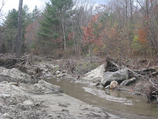
Debris along the floodplain next to the Rock River in South Newfane. The Agency of Natural Resources is working to determine which log jams will cause problems during spring flooding.

(Host) Tropical Storm Irene washed trees and other debris into rivers and streams.

With winter coming on and the spring floods that follow, the state has launched an initiative to assess the location of debris that could dam up water flow.

But as VPR’s Nancy Cohen, reports there’s no state money to remove the logjams.

(Cohen) The Agency of Natural Resources is asking regional planning commissions to work with towns to identify what clean up work on which rivers and streams should be a priority. Natural Resources Secretary Deb Markowitz says there’s a concern about log jams

(Markowitz) “The trees around streams and brooks were lifted out of the grounds and now are in the rivers and streams. The towns are concerned that if they don’t act, it’s going to  cause problems during the seasonal flood in the spring.”

(Cohen) The six regional planning commissions in the areas most affected by Irene are surveying towns, including the Windham County commission.

Chris Campany, its executive director, is in South Newfane, where the Rock River jumped across Dover Road during the flood.

He says the survey is trying to pinpoint where there are areas that are still vulnerable to flooding  during winter thaws or spring flooding. Campany says the survey asks about debris jams in streams that may act like a dam during a thaw.

(Campany) “As ice breaks up or as water flows you basically wind up with a lake forming up behind that debris jam.  And then it either finds its own course or it breaks through and suddenly you have that surge of water.”

(Cohen) Campany says big pieces of debris could cause big problems

(Campany ) “Some of the logs are going to be the battering rams that you have during the next flood event.”

(Cohen) The Agency of Natural Resources will send engineers and hydrologists to assess the debris jams that pose the highest risks. The agency can help decide how much debris should be left in a stream to protect fish habitat and how much should be removed.

But Justin Johnson, the deputy commissioner of the Department of Environmental Conservation, says there’s no state money to help towns or private property owners remove the debris.

(Johnson) “If there’s a log jam or  some kind of a debris jam that’s imminently  threatening a public assets  then we can usually get FEMA money to help remove that. But if it’s just something on private, sending water onto private land somewhere, it’s not going to affect a public asset we don’t have access to money to do anything with that .”

(Cohen) Private property owners might be able to get funding from the U.S. Department of Agriculture to remove debris that could cause a flood.

For VPR News I’m Nancy Cohen

(Host) Reporting about Vermont’s recovery from the floods of Tropical Storm Irene is supported by the VPR Journalism Fund.

See the dozens of unique artificial fish habitat models, fish attractors and fish cover used at fishiding.com, the industry leader and only science based, man made and artificial fish habitat, proven to provide all fish with cover they prefer to prosper.

Dry Creek fish habitat restoration plan approved

Nov. 21–The first stage of a habitat makeover for Dry Creek coho salmon and steelhead is one step closer to construction.
Sonoma County officials will unveil plans next summer to install side channels, boulders and logs to offer greater shelter for the endangered and threatened fish.

The work is part of a 2008 federal order to improve conditions for the two species in the Russian River watershed. On Dry Creek, which the county uses to deliver water for 600,000 customers but where fish are in need of more slow-water habitat, the efforts would cover six of the stream’s 14 miles and cost $36 to $48 million.

County supervisors last week approved the first phase of that project, on a one-mile stretch of the stream bisected by Lambert Bridge Road.

Eleven landowners in the area are working with the county to provide access to the creek for construction and future maintenance and repair. Total building cost is estimated at $6 million to $8 million, with an additional $413,000 for the purchase of short- and long-term easements.

County officials hope the work, including collaboration with an initial group of landowners, will lay the foundation for the rest of the project, which would run through 2020 if the early stages are successful.

The alternative is a costlier $150 million to $200 million fix that would lower flows in the creek through a parallel water pipeline running from Lake Sonoma to Healdsburg.

“To say the success of the first mile (of habitat improvement) is critical to the entire project is an understatement,” said Supervisor Mike McGuire, who represents the area. “Failure is not an option.”

Construction is set to begin in June and run through October, taking advantage of the dry season.

Excavators will carve out four channels off the main creek for backwater habitat, while workers in other areas embed boulder clusters and about 2,000 logs in the stream to slow water and provide holding pockets for fish.

See the dozens of unique artificial fish habitat models, fish attractors and fish cover used at fishiding.com, the industry leader and only science based, man made and artificial fish habitat, proven to provide all fish with cover they prefer to prosper.

Non-native plants will also be removed and native bushes and trees installed.

The goal is about 114,000 square feet of improved habitat, said David Manning, principal environmental specialist for the county Water Agency, which is overseeing the project.

One grape grower participating in the project said the efforts were part of a renewed focus on fish-friendly farming in the area.

“We’re looking forward to working with the agency on Dry Creek projects now and in the future,” said Ned Horton, vineyard manager at Quivira Vineyards and Winery.
By Brett Wilkison, The Press Democrat, Santa Rosa, Calif.

TVA fish hatchery fight headed to Capitol Hill regarding fish habitat

Efforts to persuade TVA to fund fish hatcheries that produce rainbow trout now depend on legislative lobbying. See the dozens of unique artificial fish habitat models, fish attractors and fish cover used at fishiding.com, the industry leader and only science based, man made and artificial fish habitat, proven to provide all fish with cover they prefer to prosper.

Earlier this year the federal budget cut funding to U.S. Fish and Wildlife hatcheries by around $6 million.  Rather than getting funds directly from the general budget, under law the hatcheries now receive money from specific federal agencies that operate dams and rivers.

“This mitigation was created because the dams and reservoirs disrupted the river flow and the natural reproduction of fish,” said George Lane with the Tennessee Council of Trout Unlimited.  “These hatcheries are incredibly important to an enormous recreational resource.  It gives one of the best returns on investment because the eggs produced help generate a 300 million dollar industry in our area.  Everything from fishing shops, bait shops, boats, and tourism is boosted by these trophy fish.”

The U.S. Army Corps of Engineers was required to help fund the mitigation in 2012.  However, TVA does not fall under the same requirements because it does not receive federal tax dollars.  Therefore, TVA has said it will not contribute any money to the hatcheries.

“TVA is self-funded through the sale of power. We have to be very careful about the burden we put on our power customers,” said Travis Brickey, TVA spokesman.  “TVA already spends $8 million annually on improving the fish habitat downstream and upstream from our dams.”

Lane said TVA’s stance means no rainbow trout will be stocked in TVA waters such as the Clinch River and the Holston River.

“The Clinch River is one of the great fly-fishing streams in the eastern United States.  People come in from all of the county to fish the South Holston and the Clinch.  “Any of the lakes or tail waters that are part of the TVA system will no longer receive the trout for stocking,” said Lane.

Lane said the financial contribution asked of TVA would amount to around $800,000 annually.

“TVA customers would pay less than a dime a year to fund hatcheries.  A dime is a dime and I know it is difficult to increase any charges on customers, but TVA spends money on all kinds of other projects that do not generate the kind of return on investment for the country that these hatcheries do,” said Lane.  “Hatcheries like the one in Erwin are also the ones that fertilize eggs that go to other hatcheries around the country.  If it shuts down, the impact is felt everywhere.”

Lane acknowledged that TVA has contributed greatly to trout fishing by creating weirs, releasing cold water, and improving oxygen levels in its waters.

“But this would be a major hit to all of those efforts if the fish are not stocked from these hatcheries.  We’ve had lawyers examine the issue and TVA is not required to do anything under the current law.  We think there is a moral requirement, but there’s no legal requirement because this will cost hundreds of jobs,” said Lane.  “Part of the original TVA mission was economic development and this definitely qualifies as that type of effort.”

In the absence of any current legal obligations to fund the hatcheries, it may truly require an act of congress to influence TVA.

“Our chapters are planning a trip to Washington in the spring to lobby our legislators to take up this cause.  TVA is up for reauthorization next year, so we believe legislators have some leverage to ask the utility to help fund the hatcheries,” said Lane.

Brickey said there is another reason TVA is unwilling to fund federal rainbow trout hatcheries.  In addition to costing customers money, the rainbow trout is not a native species in Tennessee.  Rainbow trout were introduced to Tennessee in the 1880s from the western United States.Jim Matheny

Scroll to Top