StructureSpot

Ranch improves fishing opportunities and Brush Creek

A finger in the water
Adam’s Rib Ranch has taken an active hand in water quality with Brush Creek enhancements
Adam's Rib Ranch General Manager Joe Cranston and Adam's Rib Golf Course Superintendent Brynly Marsh throw fish food pellets into an area of Brush Creek that was enhanced for trout habitat. A feeding frenzy ensued that could be seen all the way  around the bend.
See the dozens of unique artificial fish habitat models, fish attractors and fish cover used at fishiding.com, the industry leader and only science based, man made and artificial fish habitat, proven to provide all fish with cover they prefer to prosper.

Adam’s Rib Ranch General Manager Joe Cranston and Adam’s Rib Golf Course Superintendent Brynly Marsh throw fish food pellets into an area of Brush Creek that was enhanced for trout habitat. A feeding frenzy ensued that could be seen all the way around the bend.
Adam's Rib Ranch General Manager Joe Cranston and Adam's Rib Golf Course Superintendent Brynly Marsh stand by one of the 66 structures they made in Brush Creek to improve trout habitat.

Adam’s Rib Ranch General Manager Joe Cranston and Adam’s Rib Golf Course Superintendent Brynly Marsh stand by one of the 66 structures they made in Brush Creek to improve trout habitat.
Derek Franz / dfranz@eaglevalleyenterprise.com

St. Clair River fish habitat projects begin

Don Malcolm of Malcolm Marine operates an excavator to clear away broken concrete from the riverbank near Lincoln Street to rehabilitate the shoreline in Port Huron. The steel break wall is being placed to protect the riverbank with stone covering the steel.

Don Malcolm of Malcolm Marine operates an excavator to clear away broken concrete from the riverbank near Lincoln Street to rehabilitate the shoreline in Port Huron. The steel break wall is being placed to protect the riverbank with stone covering the steel. / Mark R. Rummel/Times Herald

Federally funded shoreline restoration projects are moving forward in the Blue Water Area.

About $3.68 million in grants from Continue reading “St. Clair River fish habitat projects begin”

NOAA Receives $4.8 Million to Restore Habitat in Great Lakes Area of Concern

NOAA announced today that it has awarded nearly $5 million to eight projects to support habitat restoration throughout the Great Lakes Areas of Concern. NOAA’s Restoration Center is funding Continue reading “NOAA Receives $4.8 Million to Restore Habitat in Great Lakes Area of Concern”

Ohio Division of Wildlife sinks some spools to create fish attractors

Sinking Spools for Shoreline Succes

Division’s work aims to help shore anglers

CORTLAND, OH- Northeast Ohio has some excellent fishing available to anglers, but some of the better fishing lakes are sometimes the larger lakes. For anglers without a boat, this presents a problem since some of the best fishing spots are not accessible or are heavily pressured. So where is an angler supposed to go if they want to fill their stringers without launching a boat?
            Spool being placed at Mosquito ReservoirThis past week, the Ohio Division of Wildlife placed fish attractors in a popular shore fishing spot atMosquito Reservoir (Trumbull County). “From ice out to ice up, there’s always someone fishing along that stretch of shoreline. We hope our work will improve the fishing along there,” said Matt Wolfe, Fisheries Biologist, who oversees this project for the Ohio Division of Wildlife. Plastic spools weighed down with stone were placed near the rip-rap break wall outside of the State Park Boat launch on the south side of the lake. Spools were placed along the outside and inside edges of both the Northern and Southern sections of the break wall. In total, 50 spools were placed in anywhere from seven to 14-feet of water. More importantly though, “the spools were placed within easy casting distance for anglers who fish this area,” added Wolfe.
            The goal of this project is to introduce these fish attractors into the waters of Northeastern Ohio to recruit the next generation of anglers and retain the anglers who already enjoy the sport of fishing. A downloadable Google Earth file containing all of the structure placements throughout Northeast Ohio is available by contacting the Wildlife District Three office at (330) 644-2293.Written by: ODNR Division of Wildlife.
See the dozens of unique artificial fish habitat models, fish attractors and fish cover used at fishiding.com, the industry leader and only science based, man made and artificial fish habitat, proven to provide all fish with cover they prefer to prosper.

Drink a beer, help fish in Bear Creek

http://www.outtherecolorado.com/Wildlife-nature/Drink-a-beer-help-fish-in-Bear-Creek.html#ixzz1YdCghX7s

alt

See the dozens of unique artificial fish habitat models, fish attractors and fish cover used at fishiding.com, the industry leader and only science based, man made and artificial fish habitat, proven to provide all fish with cover they prefer to prosper.

The “tree army” installs wooden spawn boxes for fish

The US Army Corps of Engineers will host National Public Lands Day events at various lakes throughout the Pittsburgh District. In 2010, more than 500 volunteers came to 15 of 16 Pittsburgh District recreation projects and provided 2,179 hours of work valued at nearly $47,000. National Public Lands Day keeps the promise of the Civilian Conservation Corps, the “tree army” that worked from 1933-1942 to preserve and protect America’s natural heritage.

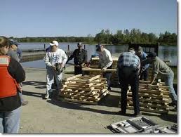
A local event at Mahoning Creek Lake will be held Sept. 24. This year the goal is to accomplish the building and placement of some fish habitat spawning boxes in the lake. If time permits, shore line clean-up will be done. Volunteers are asked to meet at 9:30 a.m. at the Milton Loop Campground pavilion, on Route 839, two miles north of Dayton.

See the dozens of unique artificial fish habitat models, fish attractors and fish cover used at fishiding.com, the industry leader and only science based, man made and artificial fish habitat, proven to provide all fish with cover they prefer to prosper.

The project will be to build wooden spawn boxes and then taking them by boat to place them in the lake. Event will take place rain or shine. Questions may be directed to Park Ranger Grover Pegg 412-719-9227.

Wyoming Game and Fish Habitat Improvement

The Bureau of Land Management, within the Department of the Interior, has announced funding of $750,000 to support the Wyoming Game and Fish Habitat Improvement Project.

See the dozens of unique artificial fish habitat models, fish attractors and fish cover used at fishiding.com, the industry leader and only science based, man made and artificial fish habitat, proven to provide all fish with cover they prefer to prosper.

This funding will aid in the understanding, enhancement and protection of fish, wildlife, and plant species. This will be done through projects, data sharing, conducting studies, and through education and information dessimination.BY MICHAEL SAUNDERS

For more information on this government grant visit:

Wyoming Game and Fish Habitat Improvement

Fish habitat plan unveiled for northwest quadrant of Kemptville

 Highlighting the natural environment with a “green corridor” and a unique approach to stormwater servicing are two features of a recently introduced concept plan for the long-term development of the northwest quadrant of Kemptville.

Forbes Symon, director of planning and development, unveiled the summary of work done on the concept plan to date to council during the Sept. 6 Committee of the Whole meeting. The idea is to create a planned community in the northwest quadrant, which are the lands located north of County Road 43 and west of County Road 44. These lands were added into the urban boundary of Kemptville during the 2009 five-year review of North Grenville’s Official Plan.

See the dozens of unique artificial fish habitat models, fish attractors and fish cover used at fishiding.com, the industry leader and only science based, man made and artificial fish habitat, proven to provide all fish with cover they prefer to prosper.

“It was intended to accommodate a large proportion of the future residential growth of the Kemptville urban area,” Symon explained, adding that the Official Plan outlined a need to develop some sort of master plan to guide the growth. “One thing the Official Plan said…was to involve all property owners in developing a master plan that all developers can follow.”

“In actual fact, it’s a planned community, which was a new experience for me and it’s a unique experience for small towns to have a relatively large area like this to plan communities in,” he continued.

The draft concept plan features protection of the more than 52.6 hectares (130 acres) of wetlands in the northwest quadrant as well as a drainage greenway, five low maintenance naturalized ponds to address stormwater servicing, as well as a link to a trails system, paths for pedestrians and cyclists and the possibility of establishing an interpretive trail and boardwalk in the future. The main entrance to this planned community would be situated across from the North Grenville Municipal Centre on County Road 44, with a secondary entrance located on County Road 43 and another further down County Road 44.

According to Symon’s report on the matter, it was important for the plan to identify environmental hazards and constraints, road networks, natural heritage features, linkages for pedestrians, water, sanitary and stormwater servicing, as well as parkland needs. “It would be anticipated that the individual development proposals would complement the agreed upon concept plan for the area,” he stated in his report.

One of those developments already in the works is the approved 480-unit Oxford Village subdivision. In the subdivision proposal, a need for a new sanitary pump station, stormwater management infrastructure and a new municipal well to accommodate the new units was highlighted.

Work on the concept plan began in spring 2010 and major property owners within the quadrant were invited to take part in what Symon calls a concept planning exercise. Engineers, landscape architects, biologists and planning professionals, as well as the Rideau Valley Conservation Authority (RVCA) were also brought to the table and last fall, an environmental review was undertaken.

“Since then over the last year we’ve been working on dealing with a number of technical issues that we faced with master planning this area,” he said, with the wetlands located in the middle of the northwest quadrant being the primary issue.

How to manage stormwater servicing was another concern, which led the group to come up with an “innovative, state-of-the-art approach of dealing with stormwater,” Symon said.

The solution, which has only been used in smaller areas previously, involves the five low maintenance naturalized ponds which will be placed throughout the planned community. Karen Dunlop, director of public works, said if all goes well, these ponds should only need to be cleaned of sediments every 20 years.

A focus has also been placed on ensuring the existing fish habitat thrives as ditch work in the community will force a relocation of the habitat. It is something the RVCA is monitoring closely.

“We will compensate and create a new fish habitat,” Symon explained.

Councillor Terry Butler questioned how many homes would be going into this planned community.

“When the Official Plan review was done, there was an estimation there could be between 2,500 and 3,000 homes go in over a 20-year period,” Symon commented. “At this point in time that number’s closer to the lower number of 2,500 because the wetland ended up being larger than it was originally mapped.”

“We haven’t had a complete analysis done on the maximum or minimum density but that will come out later. This (report) is literally hot off the presses,” he added.

While he had concerns with the primary entrance to the community being on County Road 44, which Symon said was better from a “promotional standpoint,” Butler wondered how this concept plan would fit in with the United Counties of Leeds and Grenville’s County Road 43 master plan.

“The 43 master plan anticipated this development and the volume of traffic coming from the area…we’ve worked at trying to fit the concept plan into the 43 long-term design,” Symon noted, adding that traffic impact studies would be conducted later on in the process.

Another issue was the cost associated with this planned community. Symon indicated all along the mentality of the municipality has been that growth will pay for growth.

“The previous council commented on this when the eastern quadrant was financed by the municipality to open up employment lands but the municipality is not going to finance for residential lands,” he explained. “eQuinelle set the bar with that when they paid their own costs…at least at this point in time it’s anticipated that development will pay for infrastructure needs such as the well, pump lines, station, roads, etc. So there aren’t going to be public expenditures for this development.”

Councillor Tim Sutton wanted to ensure all developers with a stake in the lands were in agreement with the plan.

“All have been well represented at the table,” Symon confirmed.

Mayor David Gordon was relieved to hear that this development would be taking place over a 20-year period. “We need to have the choice to control growth. I think this is a good concept,” he said. “It seems more like an eco-village.”

After Symon introduced the concept plan to council, Symon stressed there is also a need to go through a Class Environment Assessment (EA) for the stormwater and sanitary servicing. Once the EA has commenced, which will take four to five months to complete, the public will be introduced to the planned community through a public meeting set for sometime this fall.

“We think we’ve come up with a document that’s going to guide development in this area for the future…This is going to be one of the most attractive residential projects in the community,” Symon concluded.By Ashley Kulp

Wekepeke Brook Meeting held on fish habitat study results

CLINTON — On Monday, Aug. 29, a meeting was held at The Clinton Home, which brought together local and state officials and others to discuss the results of a fish habitat study conducted on portions of Wekepeke Brook and the former Clinton Water Works in Sterling. The meeting was hosted by Northeast Geoscience Inc of Clinton at the request of Nestlé Waters North America Inc. (NWNA).
The presentation was given by Dr. Piotr Parasiewicz, from the Rushing Rivers Institute in Amherst, the organization that conducted the study.A public meeting will be held on Sept. 15 at 6 p.m. at the Chocksett Middle School Auditorium, 40 Boutelle Road, Sterling. Continue reading “Wekepeke Brook Meeting held on fish habitat study results”

Derelict boats burying prime fish habitat.

 Derelict boats that are along the White Salmon River, as well as other garbage, could get stuck at the mouth of the Columbia River, muddying up and burying prime fish habitat.

Those abandoned boats simply <i>have</i> to go

»PLAY VIDEO

COLUMBIA RIVER GORGE – The White Salmon River is in for somewhat of an overhaul.

When the Condit Dam is dismantled, Continue reading “Derelict boats burying prime fish habitat.”

Scroll to Top