StructureSpot

Construction Starts on Two Dry Creek Fish Habitat Projects

(Healdsburg, CA) During the next week, construction will start on the first phase of a six-mile habitat enhancement project in the Dry Creek Valley. The purpose of the project, which is being conducted by the Sonoma County Water Agency (Water Agency) in cooperation with private landowners and by the U.S. Army Corps of Engineers (USACE), is to provide habitat for endangered coho salmon and threatened steelhead and Chinook. During the first phase of this multi-year project, an estimated 560 tons of boulders and 202 trees, root wads and logs will be used to create backwaters, side channels and shady habitat for the young fish that live in Dry Creek during the summer.

“This is a massive enhancement project that will provide big benefits for fish on the brink of extinction in our area,” said Sonoma County Supervisor and Water Agency Director Mike McGuire. “Dry Creek Valley farmers deserve tremendous thanks for their partnership and willingness to move this project forward.”

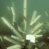
“We are excited to be starting construction on a project that should provide immediate help to the coho and steelhead raised at hatcheries at Warm Spring Dam and released into Dry Creek and its tributaries,” said Lt. Col John Baker, commander of the USACE San Francisco District. See the dozens of unique habitat models at fishiding.com

The habitat enhancement is required by National Marine Fisheries Service (NMFS) to help restore endangered and threatened fish to the watershed. The first phase of Dry Creek habitat enhancement involves two projects, as follows:

• The Water Agency Dry Creek Demonstration Project is centered on Lambert Bridge and is nearly one-mile in length. Construction in 2012 will take place at Quivira Winery and Vineyards. The Laytonville-based firm Bio-Engineering Associates is conducting the work at Quivira, which will be complete by mid-October. Work on the majority of the Dry Creek Demonstration Project will take place during 2013.

• The USACE project (known as the “Reach 15” project, for its location directly below Warm Springs Dam) is 1,400 feet long and is located on property owned by USACE. Contractor Services Group is overseeing construction which will take place through mid-October and during summer 2013.

Elements of the projects include bank stabilization to reduce erosion, boulders and anchored log jams to provide refuge and to slow the water, constructed backwaters and side channels to give the young fish places to escape summer and winter high flows, and native plants to reduce erosion and create shade.

“The habitat enhancements fit into Quivira’s holistic approach to grape growing and wine making. By improving Dry Creek, we improve the health of the land, helping both people and fish,” said Quivira Winery representative Ned Horton.

The majority of work on the Water Agency’s Dry Creek Demonstration Project will occur in 2013, and involves several landowners including Amista Vineyards, Dry Creek Vineyard, Rued Winery, Seghesio Family Vineyards and Yellow Dog Vineyards. The demonstration project also includes individual landowners Doug Lipton and Cindy Daniels, Carole and Geno Mascherini, Peter and Marian Van Alyea and Ron Wolmer.

When complete, the Dry Creek Demonstration Project and Reach 15 Project will serve as the first mile of habitat enhancement of the six miles required in NMFS’ Russian River Biological Opinion. The Biological Opinion was issued in 2008, and requires the Water Agency and the USACE to improve habitat for juvenile coho and steelhead in Dry Creek as an alternative to reducing summertime flows in the creek. (The high velocity of water flowing in Dry Creek in the summer was found by NMFS’ biologists to be detrimental to the survival of young coho and steelhead.)

“By breaking ground for this project the agency partners and landowners are reaching an important milestone on the road to conservation of our Russian River coho salmon and steelhead. This investment will not only benefit our fisheries, but is also an investment in the overall health of our watershed,” said Dick Butler, National Marine Fisheries Service.

Since nearly all of the 14-mile Dry Creek is privately owned, the required six miles of habitat enhancement is dependent on cooperative landowners. The demonstration project and the Reach 15 project will allow landowners, the Water Agency, the USACE, NMFS and California Department of Fish and Game to observe how enhancements work on a smaller scale.

“The coho broodstock program and stream enhancement projects in the Russian River watershed, including these important projects in Dry Creek, contribute greatly to coho salmon conservation. By enhancing and creating this habitat, we are improving conditions for coho and providing people more opportunities to enjoy and participate in coho habitat restoration successes,” said Scott Wilson, Acting Regional Manager, California Department of Fish and Game.

Dry Creek residents who notice any problems or who have immediate concerns regarding construction issues are urged to contact the Water Agency public information officer, Ann DuBay at (707) 524-8378, ann.dubay@scwa.ca.gov , or the USACE onsite engineer, Carlos Hernandez at (707) 431-4550 orCarlos.R.Hernandez@usace.army.mil.

Laytonville-based Bio-Engineering Associates specializes in construction of creek restoration and habitat enhancement features that also help reduce erosion. Several of the firm’s projects have been on major creeks located within vineyards.

Contractor Services Group, located in West Sacramento, is a full-service contracting company with experience in conducting large-scale restoration projects.

To learn more about NMFS’ Biological Opinion and Dry Creek requirements go to http://www.scwa.ca.gov/drycreek/. For additional details on the demonstration project, go tohttp://www.scwa.ca.gov/files/docs/projects/rrifr/DryCreek-Habitat.pdf.

Sonoma County Water Agency provides water supply, flood protection and sanitation services for portions of Sonoma and Marin counties. Visit us on the Web at www.sonomacountywater.org.

Ann DuBay

Public Information Officer
Office: (707) 524-8378
Mobile: (707) 322-8185
Email: ann.dubay@scwa.ca.gov

NOAA Joins Partners to Award $800,000 for Living Shorelines, a New Way to Combat Erosion, Build Fish Habitat

Eric Schwaab, NOAA’s Assistant Administrator for Fisheries, was in Annapolis Thursday with U.S. Senator Ben Cardin, Chesapeake Bay Trust Executive Director Jana Davis, Maryland Department of Environment Secretary Dr. Robert Summers, Maryland Department of Natural Resources Secretary John Griffin and others to announce $800,000 in federal, state and private funding to create “living shorelines” on Chesapeake Bay.

Shorelines, like those in the bay, are often stabilized with hard materials, such as bulkheads and seawalls. Ironically, these structures often increase the rate of coastal erosion, and provide little habitat for fish and wildlife. Living shorelines mimic nature by using plants, sand, and sometimes rock to stabilize banks while maintaining and improving valuable fish and wildlife habitat.

Sixteen homeowner associations, nonprofit organizations, and municipalities in Maryland and Virginia have been selected to be part of the program to develop living shorelines and increase public understanding of the technique.

“In order to fully restore our great Chesapeake Bay, we are going to have to employ a multitude of techniques, including the creation of living shorelines,” said Senator Cardin, a longtime supporter of bay restoration. See the dozens of unique habitat models at fishiding.com

“Living shorelines are a win-win solution to shoreline erosion. They replace hardened structures with more natural, vegetated shorelines that not only prevent erosion and protect shorelines, but also provide habitat for fish and wildlife,” said Schwaab.

NOAA was one of the founding partners of the living shoreline program, which to date has funded 68 projects, created 28,000 linear feet of living shoreline—the length of the Bay Bridge!—and 18 acres of wetland habitat. NOAA and the Chesapeake Bay Trust each contributed $275,000 to the $800,000 award; the Maryland Department of the Environment contributed about $200,000; and the Maryland Department of Natural Resources contributed $50,000.

Wood habitat in Table Rock rotting away after 50 years underwater

This unusual barge can deposit several tons of rock into the lake to help create new fish habitat.

This unusual barge can deposit several tons of rock into the lake to help create new fish habitat. / Missouri Department of Conservation
Written by
David Casaletto
Executive Director, Ozarks Water Watch
The Missouri Department of Conservation uses this unusual barge to dump heavy rocks or tree stumps into Table Rock Lake to help improve fish habitat. MDC also uses a different 'fish habitat barge' to deposit trees and brush piles into the lake.

The Missouri Department of Conservation uses this unusual barge to dump heavy rocks or tree stumps into Table Rock Lake to help improve fish habitat. MDC also uses a different ‘fish habitat barge’ to deposit trees and brush piles into the lake. / Missouri Department of Conservation

Table Rock Lake is more than 50 years old.

When the lake was created, much of the Ozark forest was flooded, and the trees and brush provided cover for the lake’s fish populations. But after 50 years, most of that fish habitat has disappeared.

In 2007, the Table Rock Lake National Fish Habitat Initiative (NFHI) project began with the primary objective to improve fish habitat in Table Rock Lake. Additional goals include: Improve the water quality of Table Rock Lake and its tributaries, monitor the effectiveness and longevity of habitat structures, and develop a framework for a broader national habitat program.

Project partners include the Missouri Department of Conservation, Arkansas Game and Fish Commission, the National Fish and Wildlife Foundation, Bass Pro Shops, The U.S. Fish and Wildlife Service, the U.S. Army Corps of Engineers, Southwestern Power Administration, Ozarks Water Watch, Table Rock Lake Water Quality, James River Basin Partnership and other private groups and citizens.

To improve habitat, the Initiative project places cedar trees, hardwood treetops and recycled Christmas trees in the lake to create habitat with a “fish habitat barge.” The barge was built for this purpose by Tracker Marine in Lebanon, Mo. It is a large pontoon-style boat with a hydraulic lift on the front that raises and dumps the habitat into the lake.

Another barge called the “rock barge” is contracted to place larger (and heavier) habitat structure consisting of rocks, boulders and stumps. The state conservation department gets these materials from developers, contractors and landowners who are clearing land and need to dispose of them.

To date, 1,810 brush piles, 104 rock structures, 76 stump fields, 11 stump/rock combinations and 26 rock “fence” structures have been installed for a total of 2,027 new habitat structures in Table Rock Lake. These structures were placed in areas and depths that are available for fish during most of the year.

They have been located by positioning systems and can be found (and downloaded) on the department’s website at:http://newmdcgis.mdc.mo.gov/tablerock/. In addition, the department has placed green signs on the shoreline near some structures.

The Initiative also recognizes that water quality is a critical component of fish habitat. Funding has been contributed to the James River Basin Partnership, Table Rock Lake Water Quality and Ozarks Water Watch for cost sharing to homeowners to pump out septic tanks and replace failing septic systems.

These water quality organizations have combined over the past five years to pump out more than 2 million gallons of septic effluent and replace more than 100 failing septic systems.

All participants receive a packet of water quality educational materials and septic system maintenance information. Funds are still available to share the cost for pumpouts and for replacing failing septic systems.

See the dozens of unique artificial fish habitat models, fish attractors and fish cover at fishiding.com, the leader in proven science based, fish protection.

To monitor and evaluate the Initiative structures that have been placed in Table Rock Lake, the state conservation department has designated four evaluation techniques: fish sampling, Scuba observations, an angler survey and a black bass biotelemetry study.

By monitoring fish use of the habitat structures, the department is learning what techniques and designs work best for placing habitat during the remainder of the Initiative project and in other lakes in Missouri. Information gathered from the evaluation will allow the department to share ideas and techniques with other state agencies that are working to improve fish habitat in reservoirs.

By all accounts, this is a success story, but is that area going to be loaded with fish? Will a fisherman always be able to find fish off those trees? The only way to find out is to get out there and fish those areas. And the only way for biologists to know if the project is working is if anglers let them know.

Visitthe Missouri Department of Conservation websiteand download the GPS points, print off a map and go fish.

Texas tree top habitat causes Govenor intervention.

Dear friends,

I was recently contacted by J Harmon, President of the Protect lake Dunlap association in New Braunfels,Texas. He explained to me their struggle with the Guadalupe-Blanco River Authority over existing small diameter standing timber being hazardous to recreation use. Apparently, The GBRA has denied the cutting of these stumps to protect fish habitat and recommends marking these areas off to boat use which has the residents upset.

See the dozens of unique artificial fish habitat models, fish attractors and fish cover at fishiding.com, the leader in proven science based, fish protection.

The PLDA’s plan is to draw down the reservoir and shorten the existing hazards about eight feet from normal surface elevation. I’m told there are hundreds of them and already have caused many accidents and property damage. J says the average depth is about 15 feet, so when cut, they would still stick up about 6-8 feet off the bottom, root ball intact.

After cutting, they plan to set one of our PVC habitat units on the remaining stump and fasten it there for good. This would increase the square footage of surface area approximately three times. The thinking is, with our units within six feet of the surface as water fluctuates, boats, skiers and water craft will be safe, including the fish. J and the group understand the benefits of not only keeping as much existing habitat as possible but to continue to add more habitat. The cut off tops would be kept and fastened to the remaining trunk too.

They have a full understanding of the science behind periphyton, nutrient removal and fish production and feel unwavering in their decision to work with only us in their efforts.

Senator Jeff Wentworth supports PLDA. With his intervention and the phone call from Gov. Rick Perry, GBRA’s action item #8 was tabled. The PLDA has been granted 30 days, (less now) to present their case for a final decision of what will be allowed. The General Manager and staff continue to meet with representatives of Lake Dunlap, enforcement officers, and fishery experts to evaluate the current no-wake area designation and alternative options to provide water safety and assure a balance of all uses including the preservation of fishery habitat and funding mechanisms, and to continue to review and develop alternatives that address congestion and lake boating conflict uses on Lake Dunlap and to report back to the Board at its next regularly scheduled meeting in August 2012.

What I’m asking of you once again is your opinion, hopefully your support. Can you find any adverse effects of removing these hazardous stumps as long as the habitat is replaced in other ways/forms? Can you comment on the benefits of the artificial habitat we produce and results you have seen? What can we expect to see in a 300 % increase in available cover for the fishery? With our help, the PLDA intends to present their plan for approval as a landmark decision for the state of Texas. Safety for the residents and fish is the priority of both sides, in that order. All parties involved want to save and increase fish habitat. Wood is good, just not where people get hurt. Send replies to either Jarod or myself at david@fishiding.com Thanks.

Here are some links to the information as well as Jerod Harmon’s contact information:
news story:
http://www.ksat.com/news/Lake-Dunlap-res…rz/-/index.htmlhttp://www.plda.org/index.htmlhttps://docs.google.com/viewer?url=http%3A%2F%2Fwww.plda.org%2Ffiles%2Fstump_removal_procedure.pdfhttp://www.gbra.org/
jrharmon123@yahoo.com
713-202-8870

Floating treatment wetlands mitigate lake eutrophication

By Mark Reinsel

ES&E Magaqzine’s May/June 2012 issue

An enhanced floating treatment wetland (FTW) that incorporates air diffuser technology is under evaluation in an ongoing study at Floating Island International in Montana. The latest-generation system lifts and circulates water through floating streambeds within the FTW. This combination of FTW and improved water circulation/aeration is part of a product range called BioHaven®. The primary objective of the study is to determine whether biofilm-based microbes can provide nutrient removal, while increasing fish productivity.

This system, which is a new type of
constructed wetland, has been evaluated
for treatment of agricultural effluent and
municipal wastewater. Cost-effective treatment options for end users with limited
funding will be its greatest benefit. It can
provide treatment of agricultural-impacted
waters, municipal wastewater, storm water
and polishing of tertiary waste water, along with lake restoration.

Fisheries managers will be especially interested in the productivity potential afforded by a biological system, which can reduce algae and grow more (and bigger) fish. See the dozens of unique artificial fish habitat models, fish attractors and fish cover at fishiding.com, the leader in proven science based, fish protection.

Wetland areas have been reduced worldwide, while nutrient loading has increased
with growing human populations. Mass-production agriculture, as practiced in many developed nations, can contribute to hyper-eutrophication in water bodies that were previously low in nutrient concentrations. In fresh water, partly as a result of normal seasonal stratification, nutrient loading can deplete oxygen levels within the livable temperature zone for fish species.


Over the last 11 years, Floating Island
International (FII) has developed the Bio-
Haven FTW technology, which mimics
the ability of natural peat-based wetlands
to purify water. The Leviathan™ extrapolates
this technology by maximizing surface area and circulation, which are key components of wetland effectiveness. The islands are also designed to provide
optimal perennial plant habitat.

System background:
Dissolved oxygen and temperature measurements taken on Fish Fry Lake,
FII’s 6.5-acre research lake in 2008/2009 indicated that stratified water near the
surface was too warm to sustain a trout fishery. While temperatures below the
stratified warm water layer were sufficiently cool for trout, that zone contained
low dissolved oxygen (DO) levels. During late summer, no strata of water could
consistently provide the cold-water, high- DO environment demanded by fish, such
as rainbow, brown and Yellowstone cutthroat trout.
Groundwater containing variable nutrient concentrations enters the lake at an estimated average rate of 18 m3/hr. Surface water also flows into the lake with variable nutrient concentrations and flow rates. Evaporative loss and outflow are balanced to maintain the lake level, which is approximately 9 m deep.

As the lake was filled several years
ago, a series of BioHaven floating islands
covering 5,200 square feet (480 m2) of
lake area and providing over 9.3 ha of saturated surface area was installed. Several
islands were positioned next to the inflow
to maximize exposure to the highest nutrient concentrations.

These islands were designed to maximize production of biofilm (organisms attached to underwater surfaces), and to move nutrients into and through the food web.
After addition of the last 232-m2 FTW, floating islands now cover approximately 715 m2, or 2.7% of the lake’s surface area. Active treatment system with floating streambed Leviathan is an enhanced form of constructed wetland, and is FII’s latest effort to move excess nutrients into the food chain or harvest them. It integrates high volume, low-pressure circulation with matrix surface area constructed of postconsumer (recycled) polymer fibers, for maximum wetland performance.

Air-driven directional diffusers circulate up to 2,300 m3/hr, pushing it through the Bio-
Haven matrix and plant roots. The system’s floating streambed contributes to aeration and nutrient uptake.


The FPZ-brand air diffusers require 3 hp (2.2 kW) to operate, typically with 230V
single-phase power. Leviathan is designed to provide the  complete “wetland effect,” including aerobic, anaerobic and anoxic microbial nutrient conversion. This allows it to treat large, nutrient-rich stratified bodies of water, including “dead zones,” in both freshwater and marine settings. Removal of ammonia, nitrate, phosphate and soluble organic carbon has been demonstrated.

The system can move nutrients from
any depth into and through the islands’
biologically active substrate. In the
process, these nutrients are digested by
beneficial microbes and form periphyton
(attached plant and animal organisms
embedded in a polysaccharide matrix,
similar to biofilm), which is the base of
the freshwater food chain. As these excess nutrients transition into the food chain via biofilm/periphyton, both water quality and fish growth rates can be dramatically improved.
Leviathan can de-stratify water bodies, resulting in greatly expanded habitable zones for targeted fish species. As part of this process, high DO levels can be achieved and maintained, and water temperatures homogenized.


Results:
A 232-m2 Leviathan system, incorporating floating streambeds and grid-powered water circulation, was installed in the lake in April 2009. This system circulated up to 770 m3/hr through the stream channels within the island. Each cubic meter of Leviathan’s matrix, averaging 0.64 m in thickness, provided 820 square meters of surface area.

After 17 months of operation, water clarity had improved from a low of 0.36 m of visibility to as much as 3.3 m. Clarity is now at 5.8 m. Simultaneously, the
water temperature gradient was reduced, creating a larger zone of “livable” water for fish. Two age classes of Yellowstone cutthroat trout were introduced 13 and 14 months into the test. Through the summer of 2010, a favorable temperature/dissolved oxygen strata, ranging from the water surface down to a depth of at least 3.7 m, was maintained as potential cutthroat trout habitat.


One-year-old and two-year-old black crappie were also introduced two months
into the test, and naturally-occurring northern yellow perch were present in the
lake when it was filled. All three species have flourished.

The new aeration scheme in the lake improves water quality by incorporating
dissolved phosphorus and nitrogen into the aquatic food web, in the form of periphyton,
while limiting the growth of deleterious algae. Total phosphate concentrations
are reduced from about 0.04 mg/L to 0.02 mg/L, while nitrate-nitrogen
concentrations decrease from about 0.6 mg/L to 0.01 mg/L.
Fish Fry Lake is relatively unique in that it supports fish accustomed to cold
water (Yellowstone cutthroat trout), temperate water (perch) and warm water
(crappie). Montana officials have made two unsuccessful attempts at sustaining
cutthroat populations in an adjacent stretch of the Yellowstone River.
Fish catch rates and growth rates are now being monitored at the lake. Initial
data show that experienced fishermen catch an average of one perch every two
minutes. Visual observations from diving and an underwater viewing station indicate
that perch approaching or exceeding the Montana state record of 1.0 kg now
inhabit the lake.
The perch harvest at Fish Fry Lake averaged 12 kg of fish per week from May-
November 2011. With a phosphorus content of 0.9% in perch, phosphorus removal
from the lake via fishing averaged 0.10 kg/wk, or 84% of the estimated
phosphorus input to the lake.
In summary, Fish Fry Lake was poised to become another eutrophic waterway, until a new form of applied stewardship was introduced, which reversed the process.

Mark Reinsel is with Apex Engineering.
E-mail: mark@apexengineering.us

Eat more fish to clean your lake?

A few weeks ago, my wife Renee’ and I took a trip to Shepherd Montana, headquarters of  Floating Island International Inc. We had been invited to stay on the ranch and to see for ourselves how Bruce Kania and his wife Anne, are growing huge fish fast with a woven matrix of inert substrates called BioHaven, or Floating Treatment Wetlands. I had been in contact with Bruce for some time, learning about how excessive nutrients brought in from runoff can be turned into fresh, tasty fish. Not only do the Kania’s grow fish, but frogs, minnows, pheasant, deer and all species of waterfowl prosper in their efforts. Even Yellowstone cutthroat trout flourish in this superior environment, along with crappie and perch and various minnows.

See the dozens of unique artificial fish habitat models, fish attractors and fish cover used at fishiding.com, the leader in proven science based, fish protection.

The setting was breathtaking, Mule deer and whitetail browsing on the thousands of perennial plants Bruce has planted for their benefit and soil stability. Over time these plants die off and return each spring, contributing to the rich organic soils being built up. Sprawling channels and wetlands run throughout the property, slowly beginning to filter and absorb the high levels of nutrients. When the water enters the property, it is dark and cloudy like chocolate.

Ducks of all varieties, geese, snipe, vulture, pheasant and more, have taken up residency in this oasis of prime habitat, with no intention of ever leaving. With Bruce being a veteran trapper, predators are being kept in check, protecting the desired species. With the Yellowstone River along one property line, this place is an outdoorsman’s paradise.

Stewardship of our natural resources is the core of the work being undertaken at Shepherd Ranch. We were there to catch and eat a bunch of these fish, helping them ultimately remove the phosphorus and nitrogen that causes excessive weed growth and poor water quality. Bruce and I dreamed big about someday soon, this concept of abundant, mass fish harvest to clean our Nation’s waters and beyond.

The data shows that over 50% of our Nation’s waterways are considered eutrophic and in trouble, meaning highly excessive weed growth and nutrient concentrations. Dark, stained and sometimes smelly water are all results of an unbalanced system. More information about our Nation’s waters are available on the National Fish Habitat Action Plan website, a wealth of details everyone is affected by.

When we began producing artificial fish habitat products made from reclaimed PVC siding called Fishiding, the ability to grow algae immediately on the inert surface area, appealed to the fisherman. Like myself, the average fisherman understands that habitat with good algae growth seems to hold more fish. It wasn’t until reading more and talking to Bruce that I began to understand the big picture of why this holds true.

These nutrients stick to surfaces underwater and create the beginning of the food chain called periphyton. Many forms of this wonderful natural, filter and food factory are present. Algae, bacteria, fungi, protozoa, zoo plankton and other invertebrates, function as a community highly efficient in capturing and processing nutrients. When I say processing, this means turning it into food of the highest quality found on earth. The more fish graze on it, it grows faster, decreasing bio mass and the fish grow at alarming rates, making the water clearer.

Numerous types of periphtyon are present, some require light to thrive and some do best in the dark. The more surface area available, the more periphyton can grow and work its magic. Pretend the floating island is a supermarket, the more shelves available the more food can be stocked for consumption. Small fish and fry eat this “super food” until about age one, when they begin to forage on larger minnows and bugs. Periphyton is the “mother’s milk” needed to start life full of nourishment.

This process has been perfected in second and third world countries. We are lacking in knowledge here in the states, but it’s improving with over 4400 of these floating treatment wetlands installed here and worldwide.

Think about all the ponds and lakes in your area. Golfcoarse ponds, retention ponds, private and public, there are many. Some are clear and deep with a balanced mesotrophic or oligotrophic eco system. The other 50% eutrophic waters, could be teaming with fish and every citizen is asked to help keep them clean…..by catching as many fish as you can eat, and removing them! The fish also reproduce faster than normal, so there is no worry of running out. Fish Fry Lake is living, thriving proof of this for all to see. Renee’ and I caught over 500 fish in less than eight hours of fishing. If your hook was in the water, it was being attacked by one or more gorgeous perch or crappie. From 6-8” one year olds, to 12-14” plus jumbos! Remember, this is in Montana not Lake Michigan, the only other place I have ever seen perch of this size. Perch and Crappie were abundant to say the least, with a perch containing about one percent live weight of phosphorus. The name “Fish Fry Lake” more than lives up to its name. Remember, this works with no chemicals, win,win,win…….

This natural cause and effect has other uses too. Bioswales also made by FII,  are used in ditches and swales to slow down erosion as water runs through it, similar to adding hay bales in a ditch after new construction. The difference in using the inert matrix, patented by FII, is that as the bioswales slow down the water, the periphyton forms and begins to consume the over abundant nutrients, cleaning the water as it passes through slowly. Unlike the hay bales, the matrix never breaks down, which would add to the nutrient load in the waterway. Same with weeds, as they decompose, they remove oxygen from the water and add fertile organic matter that acts like fertilizer. Inert substrates like the matrix material used in the Floating islands, never breakdown and keep working year round to feed the fish and clean the water.

One of the optimal ways that FTWs can transition nutrients from water to beneficial use is to grow bacterial biofilm rather than floating algae.  Bacterial biofilms grow faster than algae when their limiting parameters are satisfied, and when they have adequate circulation and surface area for growth.  With appropriate stewardship, they also are an improved primary food source for fish (Azim 2005).

Circulation increases bacterial efficiency by bringing nutrients such as dissolved oxygen, nitrogen and phosphorus to the biofilm.

A single 1000-square-foot BioHaven Floating Island can provide over 18 acres of strategic “concentrated wetland effect” surface area.

As demonstrated in field-scale case studies, waterways containing FTWs remove contaminants (pollutants) such as ammonia, total nitrogen, total phosphorus, Total Organic Carbon (TOC), Biochemical/Chemical Oxygen Demand (BOD/COD) and total suspended solids (TSS).  These studies have included municipal wastewater, storm water, lakes and agricultural runoff.  FTWs have demonstrated the ability to simultaneously remove all of these contaminants, due to their complex biofilms containing both aerobic and anoxic bacteria.

Dissolved oxygen (DO) levels are higher when inert substrate are used rather than organic substrates like wood, due to oxygen consumption during organic carbon uptake by biofilms.  Inert substrates like BioHaven polymer matrix, can provide a more precise ability to initiate movement of a waterway’s nutrient load up the food chain. Periphyton moves nutrients up the food chain better than does synthetic fish food.

The bottom line is this. To ultimately remove these unwanted nutrients, fish have to be harvested. Not all lakes have these issues, but in Eutrophic lakes, the fish contain these nutrients and have to be caught and eaten to keep up with the periphyton growth. A perch for example, contains about 1% live weight of phosphorus. By removing enough fish to equal one pound of this chemical which is safe for humans and needed for strong bones, about 700 pounds of aquatic vegetation never gets a chance to grow. No chemicals or weed harvesting just fishing and keeping them for the table. Would you be willing to help clean your neighborhood pond by catching and eating some fresh fish? It’s a reality and is being performed at an alarming rate at Fish Fry Lake. We flew home with only one checked bag, 50 pounds of fresh fillets.

Clean water  entering the Yellowstone River and ultimately the Mississippi, Stewardship is the lesson to be learned.

Pro’s opinion after one year…Artificial fish habitat rocks!

See what professional fishing guide, photographer and accomplished writer Brad Wiegmann, has to say about fishiding habitat products.

Adding Artificial PVC Fish Attractors with Fishiding

See the dozens of unique artificial fish habitat models, fish attractors and fish cover used at fishiding.com, the leader in proven science based, fish protection.

PVC fish habitat excels in giving fish what they require-Underwater pictures update

fishiding after four weeks

This next group of amazing shots by Engbretson Underwater Photgraphy, show biofilm and algae growth explode after less than four weeks. Fishiding Reclaimed Artificial Fish  Habitat products made from reclaimed pvc vinyl siding, act as an ideal inert substrate to grow biofilm which in turn feeds and grows fish at a far above normal or average rates. This process called biomimicry, has been perfected and installed with overwhelming success by a company called Floating Island International, which utilizes recycled plastic matrix to create massive amounts of surface area.

See the dozens of unique artificial fish habitat models, fish attractors and fish cover used at fishiding.com, the leader in proven science based, fish protection.

Area golf courses filled with fish

 Small lakes, streams, lagoons contain prime fish habitat
 
Mark Shaw of Ponte Vedra Beach shows a chunky bass he caught from a lagoon adjacent to a Northeast Florida golf course. Small boats are allowed on the lagoon.  Bob McNally/The Times-Union

Bob McNally/The Times-Union
Mark Shaw of Ponte Vedra Beach shows a chunky bass he caught from a lagoon adjacent to a Northeast Florida golf course. Small boats are allowed on the lagoon.

Most of the world’s best golfers this week gather at the TPC Sawgrass Players Stadium Course in Ponte Vedra Beach. They’re there to tackle undulating and tricky greens, tough bunkers, tight fairways, and water hazards full of gators, snakes and sometimes round white balls.

But also on the agenda of some of those elite golfers is fishing in the ponds, lakes, lagoons and famous water hazards in and around the Stadium Course. Those waters are loaded with fish, including largemouth bass the size of newborn babies. The Sawgrass complex of lagoons and other watery spots is chock full of heavyweight bass, many weighing well more than 10 pounds, and fish to 15 pounds have been caught.

artificial fish habitat by fishiding.com

Those are truly world-class fish that many anglers in many places would pay a bundle to hook.

Often before or after a practice round, or a tough day in the rough, players such as Davis Love III, Tiger Woods, Boo Weekley, Greg Norman, Mark O’Meara and many others have been known to hang up a graphite driver in favor of a graphite casting rod at The Players.

The bass fishing is so good in waters at the Stadium Course that years ago it was voted the best for big bass by elite PGA Tour fishermen. See the dozens of unique artificial fish habitat models, fish attractors and fish cover used at fishiding.com, the leader in proven science based, fish protection.

A poll was taken among the golf pros who fish different courses on Tour to learn which of the many places they visit offers the best fishing. The Stadium Course won by a wide margin.

Only players with PGA credentials, very special guests and perhaps course residents are allowed to fish Stadium Course waters, especially during the tournament. But area anglers should take a tip from the golfers that some of the best and most consistent fishing that anglers could ever hope for can be found in the water hazards and nearby ponds and lakes of golf courses.

habitat for fish installed before filling lake.

Not only do golf course waters have bass, but many are loaded with bluegills, crappies and catfish. In coastal regions, often saltwater species seep into the freshwaters or tidal waters of golf courses. Plenty of golf courses in Florida, Georgia and the Carolinas are full of fish such as red drum, flounder, baby tarpon, snook, ladyfish, black drum and other species.

While great fishing can be discovered in golf course waters, it’s probably wise not to eat fish caught from them because of the pesticides and fertilizers used on nearby turf. Nevertheless, for fun catch-and-release fishing, few places offer better action than golf course waters.

Getting permission to fish golf ponds can be challenging, particularly on private country clubs — which frequently offer the best action. But it’s worth the effort gaining access. Sometimes meeting and talking with the club pro is worthwhile. Explain you’ll not interfere with golfers on the course, and all fish will be released unharmed. Some golf courses are closed on Mondays, which is a prime time to fish their waters, and permission to fish is more easily obtained then. Dawn, dusk and night fishing is worthwhile because golfers are not on courses, and anglers don’t interfere with play.

In many golf course communities, residents and their guests are allowed to fish, so it pays to make friends with golfers. Golf resorts are popular vacation spots, and guests often have permission to fish water hazards as long as they don’t hamper golf play.

In large golf Meccas, frequently several courses are available, and many feature large, wandering connected ponds and creeks that snake around the area. Many such waters appear small, but instead might cover hundreds of acres, with many places surrounded by overgrown vegetation that’s ideal fish habitat.

Sometimes small, lightweight johnboats, canoes, kayaks and float tubes can be put in, which allows anglers to get far away from golfers and other people — to waters rarely fished. Electric fishing motors often are allowed on boats in golf course communities.

At some golf resorts, angling by visitors is encouraged on water hazards, to the point that improved boat ramps are available, and large bass boats even can be launched and used for fishing. Usually, no big outboards can be used, however, only quiet electric motors.

An important plus for golf course waters is that most are small, shallow, and have limited fishing pressure. Therefore, it takes comparatively little time for anglers to locate fish. More often than not, course ponds and lakes were dug by construction crews for use as fill when building greens, tees and bunkers.

Consequently, water hazards commonly have great structures such as holes, underwater islands, humps, bars, tapering points and drop-offs. Some golf ponds are mini-reservoirs, complete with creek channel edges, flooded timber and stumps, riprap and deep dam water.

In some shallow, natural golf course waters there is no well-defined structure to hold fish. In such waters, the outside edges of grass lines and lily pads might hold almost every fish in the lake or pond. Sometimes, ponds have deep undercut banks that harbor big bass and other species, particularly in sunny weather. Find a cool, shady bank with overhanging willows or other trees and you might have discovered the best fishing spot on an entire water hazard.

Bulkheads around greens and near fairway bunkers, and small footbridges for golf carts over water hazards, also can be outstanding fishing spots. I once stopped on such a bridge on a public Florida golf course and looked down into the shadows, hoping to see bass or bream.

Instead, I spotted a school of about a dozen catfish, none less than 10 pounds.

A little schmoozing of the club pro got permission to fish for the cats, and that afternoon friends and I worked them over using baits on bottom. We caught over a dozen hard-fighting channel cats, including one behemoth pushing nearly 20 pounds.

We released every cat, and have several times since fished the same water hazard — no doubt landing and releasing some of the same catfish over several years.

Not once have we seen another angler working the same spot, though many dozens of golfers cross the bridge daily.By Bob McNally

Law challenges woody debris

 
Vince Lovato
Editor

WASHINGTON, DC – Federal legislation now requires the Army Corps of Engineers to address the safety risks of placing dead trees in Lake Chelan to offset the environment damage allegedly caused by building a dock.

The House Appropriations Committee passed a bill April 25 that requires the Corps to address the safety risks to recreational users of woody debris placed in Lake Chelan, according to U.S. Rep. Doc Hastings (R-Wenatchee).
For about a decade, agencies issuing building permits for docks on Lake Chelan required applicants to offset the alleged damage to fish habitat by placing large woody debris in the form of dead fruit trees, bundled with steel cable and rocks, on the lake bed. See the dozens of unique artificial fish habitat models, fish attractors and fish cover used at fishiding.com, the leader in proven science based, fish protection.

“Individuals wishing to construct a residential dock must pass through an exhaustive and very expensive permit process,” wrote boating safety instructor Russ Jones in a guest column to The Mirror. “Yet any agency wishing to deposit non-native species into the lake appear to be able to do so without the simplest of review processes. This was also the case with the use of submerged fruit trees. No prior study was conducted nor has there been any follow up study.”

With the dramatic rise and fall of the water level through the different seasons, local residents have raised concerns about the possible movement of this woody debris and the safety hazards that it poses to boaters and other recreational users of the lake, Hastings said.

“Washington residents have enjoyed waterskiing, swimming, boating and fishing in Lake Chelan for generations, and it is critical that it remain a safe environment for recreation,” said Hastings, who contributed language in the bill, “I am pleased that the Appropriations Committee acknowledges the need for the Corps to address the safety hazards of woody debris in Lake Chelan and reevaluate its use in the future so Lake Chelan can remain a safe place for Washington families to enjoy recreational activities. Additionally, I question the science and lack of monitoring of large woody debris as a mitigation requirement.”

In January 2011, Chelan City Council members unanimously adopted a complicated resolution restricting the use of large woody debris as an environmental offset to construction projects such as boat docks over the lake.

“In layman’s language, it would allow large woody debris but only low enough where it won’t interfere with boaters,” said council member Wendy Isenhart at that time. “It’s our responsibility to make policy here and we need an expression of our policy.”

Chelan County Commissioners followed shortly thereafter with a similar resolution.

Hastings’ language, which was included in the report accompanying the Fiscal Year 2013 Energy and Water Appropriations bill, requires the Army Corps of Engineers to report back to Congress on their efforts to address the safety hazards posed by woody debris in Lake Chelan, the liability of the Corps and private dock owners should a person or property be injured or destroyed by the woody debris, and whether woody debris should continue to be an acceptable option offered for mitigation within Lake Chelan.

In March, Hastings, who has long questioned the need to mitigate the impact of docks on fish, submitted a request to Administrator Lubchenco of the National Oceanic and Atmospheric Administration for the science used to determine the impact of docks on fish species.

Lubchenco has yet to respond to this request.
At least six federal, state and county agencies require anyone building a dock on Lake Chelan to offset its alleged environmental detriment to fish.

One prescribed method is to anchor apple trees, referred to as large woody debris, near the shoreline to create artificial fish habitats. The Army Corps of Engineers and the State Department of Ecology created a prospectus that includes research allegedly proving this method would work in Lake Chelan.

The agencies call the trees “large woody debris” and fear that every time a portion of the lake is covered by such things as docks, it has a negative impact on the ecology of the lake.

Making up for that negative impact, by tethering dead trees near the lake shoreline to create habitat for fish, is called “mitigation.”

Scroll to Top