StructureSpot

Tweed river fish habitat in good hands

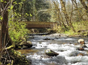
Jim Ryan, a state river scientist, surveys a restoration project on the Tweed River in Pittsfield on Friday, Dec. 2, 2011. Floods triggered by Tropical Storm Irene sent the river shooting into a new path that threatened a mill downstream. Road crews seeking gravel further altered the river, making it more unstable. To restore the Tweed, river scientists redesigned a 1,800-foot stretch of the stream, to make it more stable, protect private property and restore fish habitat. Ryan stands on gravel used to fill in the Irene flood channel. That area will be the river's new floodplain -- a relief valve during heavy rains and spring snowmelt. The river flows in its new, more stable channel farther from houses and Vermont 100.
Jim Ryan, a state river scientist, surveys a restoration project on the Tweed River in Pittsfield on Friday, Dec. 2, 2011. Floods triggered by Tropical Storm Irene sent the river shooting into a new path that threatened a mill downstream. Road crews seeking gravel further altered the river, making it more unstable. To restore the Tweed, river scientists redesigned a 1,800-foot stretch of the stream, to make it more stable, protect private property and restore fish habitat. Ryan stands on gravel used to fill in the Irene flood channel. That area will be the river’s new floodplain — a relief valve during heavy rains and spring snowmelt. The river flows in its new, more stable channel farther from houses and Vermont 100. / CANDACE PAGE, Free Press

Written by
Candace Page


PITTSFIELD — Jim Ryan stood with Ray Colton on the banks of the Tweed River on Oct. 7 and shook his head, more in resignation than disbelief. He’d seen too many places like this in the last month.

“What a mess,” he said. He made a note in his notebook: “Colton’s mill site: Site is hammered.”

The river running past Colton’s firewood mill looked more like an abandoned gravel pit than a babbling brook.

On Aug. 28, Tropical Storm Irene had ravaged this stretch of the Tweed, a scenic stream that borders Vermont 100 between Killington and Stockbridge. Highway crews compounded the damage. Desperate for gravel to repair the washed-out highway and its broken bridges, they drove excavators and dump trucks into the river and scooped out tons of stone.

The tracks of heavy equipment could still be seen as ridged indentations on gravel bars. Much of the river’s water ran in a stony ditch gouged out by the road crews, but the rest trickled in multiple threads through the gravel islands.

Just upstream, the river had jumped its bank, eating up the field behind Sarah and Gordon Gray’s house and carving a new channel that barely missed Colton’s mill. More than 100 feet of riverbank snowmobile trail had disappeared.

Colton was worried about what would happen in the next high water.

“I’m afraid the river wants to come right through the yard,” he said, referring to his millyard with its stacks of logs. He’d spent the night of Irene sleeping in a camper at the mill to keep an eye on the river.

Ryan shared Colton’s concern about damage from a future flood, but had other worries as well.

“From a water quality and fish habitat perspective, the conditions were just horrible,” he said later. “Think about fish trying to stay cool in the middle of summer. Instead of deep shaded pools, they would have this shallow, braided stream.

“Yes, the river might have healed itself, but it could have taken decades. Something needed to be done,” he said.

Irene had jerked Ryan, a stocky, soft-spoken man, from his job as a state watershed coordinator to join the state’s lightly staffed River Management Program. He had spent the weeks since criss-crossing the White River watershed to survey river damage and to provide guidance to towns about rebuilding bridges and culverts in more flood-resistant ways.

Before the arrival of Ryan and his peers, road crews had torn up river channels across central and southern Vermont. Vermonters were treated to the surreal site of excavators, backhoes and dump trucks chugging through trout streams to remove whole shoals of gravel.

Much of this post-Irene emergency work did not just destroy fish habitat. It left rivers unstable — prone to severe erosion of their banks and sudden changes in course during high water — and thus potentially dangerous.

The challenge facing Ryan at Colton’s mill and elsewhere was: What do we do now? How do we restore a river? How do we resolve the conflict between the laws of physics governing a river’s natural behavior with the need to protect homes, roads and businesses on the bank?

And how do we do all this given shortages of money, manpower and work days before winter?

‘Don’t fight the river’

The traditional Vermont response to flood damage has been to dredge out new gravel deposits and to keep water moving past private property by digging out a straight river channel with banks armored in stone.

Over the last 20 years, river scientists have learned that such “solutions” come with a cost and often do not work. At best, a channelized, armored river will need frequent maintenance. At worst, the river’s potential for damage will simply move downstream.

“The idea is you don’t want to fight to create a river channel that the forces of nature will constantly work against,” says Shayne Jaquith, the state’s river restoration scientist.

After looking at the Tweed, Ryan persuaded Colton not to insist on a quick, Band-Aid fix that would be unlikely to last. Then he won agreement from Colton, the state Transportation Agency and the town of Pittsfield to share the cost of some restoration.

Ryan hoped to resculpt 1,800 feet of river, giving it something close to the form, slope and dimensions the river would find, in time, if it were left alone.

If the design worked, the river would be stable, that is, powerful enough to move sediment downstream — one of a river’s jobs — but not so powerful it cut a deeper and deeper channel or collapsed its banks.

But “stable” in a river system doesn’t mean unchanging. Rivers naturally migrate across a valley landscape, eroding earth from the outside of bends, depositing dirt and stones on the inside of bends where water moves more slowly.

Compromise would be necessary. Here, as farther downstream, the Tweed could not be allowed to migrate willy-nilly because that would endanger the highway and buildings on its banks.

Meanwhile, across Vermont, river management engineers were facing dozens of similar situations — rivers used as gravel mines, landowners calling for new river channels to be moved away from their homes, anglers complaining about the destruction of fish habitat.

Winter loomed. Towns, already facing million-dollar road repair bills, were unable to undertake expensive river restoration projects. The state lacks sufficient staff to design and carry out multiple complicated restorations.

Compromise was required everywhere. Mike Kline, director of river management for the state, compared the dilemma to the building of a new home on a limited budget: The first priority is to get the superstructure right; interior details can wait.

“The basic work we could do was to get people to stop digging — stop digging an 80-foot-wide channel in a 30-foot-wide stream! We would redirect them to fill back in to get the dimensions of the channel right. Get that superstructure right. With that, the river can rebuild over time,” he said.

Resculpting a river

On the Tweed, Ryan had commitments for funding that he hoped would allow him to do a more complete restoration.

He and Jaquith assembled a survey crew to spend a day creating a topographical map of the river, measuring the width, depth and slope of the post-Irene channel.

They compared their measurements to what river science, and data about the Tweed watershed, indicated should be the stream’s natural dimensions. They also used U.S. Geological Survey data to determine how much “bedload” — gravel and sediment — the river should have the capacity to move downstream.

It was clear that big changes were needed.

At the point in the watershed where Colton’s mill sits, the Tweed’s channel should be about 45 feet wide and 2.5 feet deep, as measured from the top of one bank to the top of the opposite bank.

The post-Irene, post-dredging, channel was more than twice as wide and half as deep. The river had lost some of its bend, so it flowed at too steep a slope.

In the end, Jaquith designed a new path for the Tweed much like the one the river had chosen for itself in the years before Irene.

He called for the new channel cut by the river across the Grays’ field to be filled in. The ditch excavated post-Irene would disappear. Mathematical formulas determined the radius and frequency of three new bends that would send the river past the Grays’ house and Colton’s mill in a series of lazy curves.

Those meanders decreased the slope of the river, slowing down the force of the water. In one place, a bend would bring the river against immovable ledges on the far side of the narrow valley, a place where a good fishing hole might develop. Where another bend curved toward Colton’s mill, riprap would protect the bank from erosion.

The newly carved river channel would be 45 feet across. The rest of the 150-foot-wide gravel bed left after Irene would become the river’s new floodplain, a pressure relief valve to hold water during spring snowmelt and moderate floods.

At the tail end of November, the excavators went to work.

‘We’re 80 percent there’

As the heavy equipment finished its work on Dec. 2, the river landscape looked raw, as though newly scraped by a glacier. A wide expanse of gravel, the new floodplain, stretched up-river in the place of the Irene flood channel.

Out beyond the gravel plain, the river meandered gracefully back and forth across the valley within well-defined banks. Driftwood tree trunks had been anchored in the riverbank, their root systems sticking out into the water where they would absorb some of the force of the water and thus protect the banks from erosion. Rocks protected the stretch of shore beside Colton’s mill.

“In the end, I was satisfied,” the mill owner said last week, although he said it had been necessary for him to rein in the river scientists’ plans to import boulders to place in the stream to dissipate more stream energy and create fish habitat. See the dozens of unique artificial fish habitat models, fish attractors and fish cover used at fishiding.com, the leader in  science based, proven, fish protection.

“I paid my share, it got done and the river looks pretty good,” he said.

Jaquith and Ryan were satisfied they had done the best they could, within the constraints of an $11,000 budget and — ironically — a shortage of gravel to better define the channel edges at the far end of the 1,800-foot reach. Too much gravel had been dredged out of the waterway.

“What I saw there, that first day, was an ugly thing — I remember thinking, ‘How can someone do something like this to a river, even though it wasn’t done in malice?’ — but what came out of it I hope can be a model,” Ryan said last week.

“We restored a river in a collaborative way. All the parties responsible for the damage came together and did the right thing. We didn’t have to fine anybody or go through environmental enforcement. We have a better stream for stability, for protecting infrastructure, for fish.

“It wasn’t a perfect fit, but it was a good start,” he said.

Remove carp from Lake Puckaway to improve game fish habitat

area for habitat installation
habitat along shoreline

Removal of carp from Lake Puckaway to improve fish habitat got off to a good start last year after a massive game fish kill on the lake in 2009 halted the carp project for a year.

A little over one million pounds of carp were taken from the lake starting in November of last year by a commercial fishing business — the La Crosse based Monsoor Fishing Company, which sells the carp to fish distributors. See the dozens of unique artificial fish habitat models, fish attractors and fish cover used at fishiding.com, the leader in  science based, proven, fish protection.

The Wisconsin Department of Natural Resources has renewed the company’s contract for this year to continue its carp removal efforts from Lake Puckaway located west of Oshkosh in Green Lake County.

The possibility exists that upwards of four to five million pounds of carp could be removed from the lake in the next few years in continuing efforts to clean up the invasive species and provide a better habitat for game fish.

Officials from the DNR said so far they’re also pleased with the Monsoor Fishing Company and its efforts to remove carp.

“We’ve been working with them and they’re taking out a good number of carp,” said Dave Bartz, a DNR fisheries biologist in Wautoma. “They have good equipment and are experienced and professional.”

It was a much different story two years ago when an Ohio man and his crew workers committed a huge blunder while removing carp from the lake.

Ron Bruch, DNR fisheries supervisor in Oshkosh, said they didn’t properly handle the carp removal and as a result there was a pretty substantial killing of game fish, including a sizeable number of walleye.

“They killed about 10 percent of the walleye stock. It didn’t have any measurable effect on the fisheries, but we would have preferred the walleye still be in Lake Puckaway,” Bruch said.

Timothy J. Smith of Swanton, Ohio, who had the contract to remove the carp, pleaded no contest to three counts of unlawful possession of fish and two counts of possessing illegal fish in Green Lake County Circuit Court in September of 2010.

He entered into a deferred prosecution agreement on a felony charge of violating fish dealing rules. A Jan. 17 motion hearing has been scheduled to possibly revoke the agreement for failure to make payments on fines levied for the violations.

The fish kill came to light on Nov. 27, 2009 when a shoreline property owner reported seeing piles of dead fish along the shore in the town of Marquette. DNR agents went to the scene and found thousands of dead fish. The number of game fish, which included highly prized walleye, white bass and northern pike, was estimated at more than 3,300.

Their value was placed at $8.75 each, according to a criminal complaint.

The fish became stressed and many of them died when Smith failed to remove the game fish from his carp nets as required.

Carp studies underway
A major theory behind the carp removal is to improve the habitat so game fish can thrive on Lake Puckaway.

Bruch said carp mess up water clarity by rooting up vegetation beds, which destroys habitat the game fish population needs to be successful and stable.
“We’re hoping to remove some of the carp so the habitat will be less influenced by carp left there,” Bruch said.

Phil Malsack, chairman of the Lake Puckaway Protection and Rehabilitation District, said not only will game fishing improve on the lake with fewer carp, but is also a plus for water fowl, including Forster’s Tern, who nest on the lake in what he called “floating mats of vegetation.”

“With fewer carp there will be more vegetation and expand the opportunities for terns to nest,” Malsack said.

Bruch said attempts have been made to remove carp on Lake Puckaway and other area waters for about 100 years, but with no lasting results so far.

Bruch said the current carp management strategy on Lake Puckaway is much more than taking fish out of the water. He said the DNR is doing additional monitoring and studies of carp in partnership with the Lake Puckaway Protection and Rehabilitation District.

Bruch said the Lake Puckaway group provided $7,000 for sonic telemetry tags surgically embedded into 20 carp from Lake Puckaway this past November. He said the tags should help define where carp call home and how fast they grow and die.

“We’re trying to define the stock size of the carp and to figure out the home range of the carp and do they move long range,” Bruch said. “We want to know just what are the dynamics of the carp population in Lake Puckaway.”

He said the tags should also allow DNR personnel to build mathematical models to see what level carp can be removed to negatively impact their population long term.

“Understanding the fish better will provide critical insight into whether carp removal will ever be effective,” Bruch said.

Carp sold for consumption
Jedd Monsoor, who operates the Monsoor Fishing Company with his father, Tom, said carp from Lake Puckaway range from five to 35 pounds and are sold to fish distributors in the Midwest and east coast, where carp are considered a delicacy.

Monsoor said a mile of netting is placed in the lake and airboats are used to scare fish — from carp to a variety of game fish — into the nets.

“We pick out the game fish and immediately release them back into the lake,” Monsoor said.

Monsoor said the live carp are shipped to fish distributors in semi trucks with tanks of water to ensure freshness and good quality.

Malsack said he’s impressed with the work of Monsoor Fishing Company.

“Thank God, we have somebody decent in there to commercially fish the carp,” Malsack said. “I think they have been doing an exceptional job.”

Written by
Doug Zellmer
of The Northwestern

Michigan firm expanding with Fishiding Habitat products

This Michigan company has the help you need to manage your lake or pond. Get professional advice with proven results along with cost effective methods and products at Tri-county Aquatics.

Tri-County Aquatics, Inc. is a full service aquatic management company, specializing in superior waterway management programs. The friendly staff regularly controls nuisance aquatic vegetation, weeds, and algae in small backyard ponds, inland lakes, canals, marinas and other waterways. Tri-County Aquatics’ goal is to create a management program designed to control your specific aquatic need. With years of experience in the aquatics industry, These folks have the solution to your pond and lake needs.

See the dozens of unique artificial fish habitat models, fish attractors and fish cover used at fishiding.com, the leader in  science based, proven, fish protection.

Tri-County Aquatics, Inc. services include, but are not limited to:

  • Aquatic Vegetation Control
  • Aeration Systems (sales, service, and installations)
  • Floating Fountains (sales, service, and installations)
  • Water Quality Testing
  • Pond and Lake Consulting
  • Fish Stocking & Population Management
  • Equipment Sales
  • Pond & Lake Consulting

    Problems with your pond or lake? Contact Tri-County Aquatics and have one of their trained technicians meet with you to set up the best management program for your waterway. Whether you’re dealing with nuisance aquatic vegetation, high bacteria levels, or just looking for a beautiful floating fountain or some professional advice, we can help you with any of your aquatic needs.

  • Tri-County Aquatics, Inc. specializes in the control of nuisance aquatic vegetation in ponds, lakes, canals, marinas and many other waterways. 
  • Aquatic vegetation can inhibit the recreational uses of any waterway, and become very aesthetically unappealing.
  • Tri-County Aquatics, Inc. has years of experience in the aquatics industry. Controlling aquatic vegetation is our specialty. With hundreds of water bodies being managed by us annually, we have the experience, knowledge, and tried management techniques to solve your waterway problems.
  •  Full service water testing for bacteria levels, organics, and total water quality index. 
  • The products used to control nuisance aquatic vegetation, whether herbicides or algaecides, are all approved and labeled for aquatic use by the United States Environmental Protection Agency and the Michigan Department of Agriculture. All waterway treatments and applications are performed by trained, state certified, and licensed applicators. We use specialized and waterway specific management techniques to manage your waterway in the most efficient and effective manner.

New Vessels for Aquaculture Regulation in British Columbia

CAMPBELL RIVER, BRITISH COLUMBIA–(Marketwire – Jan. 9, 2012) – The Honourable Keith Ashfield, Minister of Fisheries and Oceans, welcomed six British Columbia-made vessels into the departmental fleet today.

“Our government is proud to ensure that Fisheries and Oceans Canada has the tools it needs to regulate the aquaculture industry in British Columbia and ensure that it operates in a sustainable and environmentally responsible manner,” Minister Ashfield said. “We are committed to an economically and ecologically viable fishing and aquaculture industry across Canada.”

The six vessels, of various sizes and construction, are dedicated to the B.C. Aquaculture Regulatory Program and carry out aquaculture regulatory and monitoring activities. Three of the vessels are used by aquaculture management staff for auditing and monitoring aquaculture sites, and three are used by aquaculture fishery officers for enforcement and compliance inspections.

As the majority of aquaculture operations are located along the coast of Vancouver Island and in mainland inlets, and most are inaccessible by car, ensuring DFO staff are able to move freely on the water is an important aspect of regulating the aquaculture industry in B.C. The new Conservation and Protection vessels will allow fishery officers to respond quickly to events or public reports of potential concerns at farm sites, while staff on the aquaculture management vessels can deploy tethered remote underwater vehicles for site inspections and conduct and analyze benthic (ocean bottom) sampling.

Nationally, aquaculture production has increased four-fold in the past 20 years. Approximately 70 per cent of all Canadian aquaculture products are sold to foreign markets, and the world increasingly depends on aquaculture as an essential food source. In fact, globally, half of all fish and seafood is now farmed. British Columbia contributes the most farm-raised fish and seafood to Canada’s output annually.

Backgrounders:

  • SIX DFO AQUACULTURE VESSELS FOR B.C.
  • FISHERIES AND OCEANS CANADA’S FIRST YEAR AS PRIMARY REGULATOR FOR BRITISH COLUMBIA’S AQUACULTURE INDUSTRY

SIX FISHERIES AND OCEANS CANADA AQUACULTURE VESSELS FOR BRITISH COLUMBIA

Fisheries and Oceans Canada has purchased six B.C.-made vessels to support its effective regulation of aquaculture activities in the province. As the regulator and manager of aquaculture in B.C., Fisheries and Oceans Canada is responsible for ensuring that the industry is abiding by the conditions of licence established for each aquaculture site in the province, adhering to the Pacific Aquaculture Regulations, and following strict guidelines for operations. These vessels will allow departmental staff to carry out these new duties.

Of the six vessels, three are being used by aquaculture management staff to undertake regular audit and monitoring activities at aquaculture sites, and three are tasked with aquaculture fishery officer enforcement activities.

Aquaculture Management Program

Three B.C.-made vessels, the Salmon Bay, the Sturgeon Bay, and the Oyster Bay, are being used by aquaculture management staff for audit and monitoring activities:

  • Fish health management inspections
  • Sea lice audits
  • Stream surveys
  • Benthic (ocean floor) sampling and remote-operated vehicle assessments
  • Facility inspections

The three program management vessels are named after the three sectors of the fish farming industry: marine finfish, shellfish, and freshwater aquaculture.

The Salmon Bay and the Sturgeon Bay carry departmental staff to fish farm sites for the purpose of conducting finfish facility inspections, fish health inspections, and soft-bottom benthic sampling. In addition, the vessels can deploy a remote-operated vehicle, which is used to capture video of hard-bottom benthic (ocean floor) environments for assessment purposes.

The Salmon Bay has an onboard work station that supports field testing of various benthic samples and the collection of samples for future analysis.

The Oyster Bay is used primarily to transport departmental staff to and from aquaculture facilities to conduct fish health and shellfish farm inspections.

Enforcement Program

The regional Conservation and Protection Branch is operating its three new vessels to transport fishery officers to aquaculture facilities to conduct announced and unannounced site inspections and enforce compliance with the Pacific Aquaculture Regulations and the Fisheries Act.

The MacLeod Bay is a 9.7-metre rigid-hull inflatable boat. It is named for J. Ronald MacLeod, a retired departmental employee and Officer of the Order of Canada who was recognized for his contributions to Pacific fisheries.

The Weaver Bay is a 9.7-metre rigid-hull inflatable boat. It is named after Kenneth E. Weaver, a Pacific Region fishery officer who died in an airplane accident in the line of duty on September 2, 1948.

The Max Bay is a six-metre aluminum vessel. It is named after Max Tscharre, a well-respected retired fishery officer dedicated to the protection of fish and fish habitat. This vessel is the “sister ship” to the Oyster Bay, with similar design, features and equipment.

FISHERIES AND OCEANS CANADA’S FIRST YEAR AS PRIMARY REGULATOR FOR BRITISH COLUMBIA’S AQUACULTURE INDUSTRY

In December 2010, Fisheries and Oceans Canada assumed primary responsibility for the regulation of the aquaculture industry in B.C., including the licensing of marine finfish, shellfish, and freshwater aquaculture sites, as well as enhancement facilities. Staff were hired to implement and undertake the federal B.C. Aquaculture Regulatory Program, with the majority of positions located on Vancouver Island. The program provides economic stimulus to coastal communities, as its employees work to ensure that the aquaculture industry is operating in an environmentally sustainable fashion.

After its first full year in operation, the program has achieved success in a number of areas:

  • A total of 104 inspections were conducted at marine finfish aquaculture sites by departmental field biologists and fishery officers to assess compliance with their site’s conditions of licence, and applicable acts and regulations;
  • Conditions of licence inspections were conducted at 140 shellfish and 22 freshwater aquaculture operations, and fishery officers also conducted 18 compliance inspections;
  • More than 65 marine finfish site health audits (including sea lice audits) were conducted;
  • Benthic (ocean bottom) environmental audits were conducted at 23 operational marine finfish farm sites;
  • An enhanced Atlantic Salmon Watch Program has surveyed six rivers for the potential presence of Atlantic salmon escapes;
  • Two new freshwater aquaculture licences were issued;
  • A pre-site audit was conducted for one proposed new farm site; and
  • A total of 12 marine finfish licence applications and amendments were processed.

In 2011, the Department also initiated consultations on the development of draft Integrated Management of Aquaculture Plans. These consultations will continue in 2012: http://www.pac.dfo-mpo.gc.ca/consultation/aquaculture/index-eng.htm.

As part of its commitment to transparency, the Department undertakes regular public reporting of fish health, sea lice levels, disease presence, and other data on the environmental performance of the aquaculture industry in B.C. Information is regularly posted to the Department’s website: http://www.pac.dfo-mpo.gc.ca/aquaculture/index-eng.htm.

The British Columbia aquaculture industry provides an estimated 6,000 jobs and over $224 million in wages for British Columbians. Salmon farming has grown to take its place as the province’s largest agricultural export, generating $800 million in economic output. Cultured shellfish production has reached 10,000 tonnes with a landed value of $21.7 million.

See the dozens of unique artificial fish habitat models, fish attractors and fish cover used at fishiding.com, the leader in  science based, proven, fish protection.

Contact Information

  • Fisheries and Oceans Canada
    Michelle Imbeau
    Communications Advisor, Pacific Region
    604-666-2872 or Cell: 604-219-5730

    Fisheries and Oceans Canada
    Barbara Mottram
    Press Secretary
    Office of the Minister
    613-992-3474
    http://www.dfo-mpo.gc.ca

Montana plan’s future for fish

Future fisheries panel to meet today

The 14-member Future Fisheries Improvement Program’s Citizen Review Panel will meet today at Montana Fish, Wildlife and Parks in Helena, 1420 East Sixth Ave., beginning at 8:30 a.m.

The panel will review project applications for the winter funding cycle and prepare recommendations that the FWP Commission will review in March.

The future fisheries panel is appointed by the governor and makes recommendations on funding for projects to restore or improve Montana’s wild and native fish habitat. See the dozens of unique artificial fish habitat models, fish attractors and fish cover used at fishiding.com, the leader in  science based, proven, fish protection.

The panel will review 13 applications requesting about $380,000. The public may attend this meeting, or review and comment on the grant applications on the FWP website at fwp.mt.gov, click on the Fishing page. To comment, select “Public Comment.”

Individuals or groups with opportunities to restore or improve wild and native fish habitat may apply for Future Fisheries Improvement Program funds. Landowners and other project partners usually share project costs, which extends Future Fisheries Improvement Program dollars. Applicants are encouraged to work with local area FWP fisheries biologists.  The next deadline to submit project applications is June 1.

For more information on the Future Fisheries Improvement Program, call 444-2432, or send an email tomlere@mt.gov.

Nova Scotia cares about fish habitat

Clean Nova Scotia. Inspiring environmental Change

Nova Scotia Fish Habitat Assessment Protocol (NSFHAP)

Nova Scotia Fish Habitat Assessment Protocol (NSFHAP)

Clean Nova Scotia, in collaboration with the NSLC Adopt-A-Stream, is working on the development of a standardized fish habitat assessment methodology for specific use in Nova Scotia. The methodology is intended to be used by the various groups involved in the protection, restoration, and assessment of aquatic ecosystems and will aid in the accurate assessment of fish habitat in our local rivers. This will help identify restoration needs, impacts of poor practises, and protection efforts.

See the dozens of unique artificial fish habitat models, fish attractors and fish cover used at fishiding.com, the leader in  science based, proven, fish protection.

The methodology will incorporate the use of Habitat Suitability Indices (HSI) to provide meaningful and accurate results from data collection in the field. Habitat variables are assessed in the field and are related to water quality, river morphology and hydrology, river banks and riparian vegetation, and benthic macroinvertebrates. The methodology will be modular and varying in the level of depth required so groups with different resources are able to effectively assess their rivers. The methodology will enhance our understanding of fish habitat and populations, lead to effective restoration and protection projects, and improve the health of our aquatic ecosystems.

Counties receive several grants to improve fish habitat

Cowlitz County has a $204,000 grant to remove this bridge on Abernathy Creek.

See the dozens of unique artificial fish habitat models, fish attractors and fish cover used at fishiding.com, the leader in  science based, proven, fish protection.

Several groups that work to improve habitat for endangered fish have been awarded more than $1 million for projects in Cowlitz County. Clark County projects on the Lewis River total $925,383 and money for work in Wahkiakum County totals $361,505.

The grants announced recently by the state Recreation and Conservation Office come from federal and state funds dedicated to fish recovery. The money for the grants comes from the federal Pacific Coastal Salmon Recovery Fund and from the sale of state bonds.

The level of fish funding for most parts of the state has decreased over the past few years. The statewide total of $30 million recently awarded compares to $32 million in 2010 and $42.8 million the year before, said Susan Zemek, communications manager for the RCO.

In addition, grants for fish habitat work in Puget Sound total $13.5 million this year, compared to $33 million a year ago.

Cowlitz County

• Reshaping Abernathy Creek, $486,305. The Cowlitz Indian Tribe will use this grant to remove an abandoned roadbed on the east side of the creek that inhibits full connectivity between the creek and its floodplain, and place logjams in the creek to increase habitat. The tribe will excavate channels through the former roadbed and place logjams in the main channel, allowing the river to meander. The work is on state land.

The tribe will contribute $85,819 in donations of cash, labor and materials.

• Removing an Abernathy Creek Bridge, $204,000. Cowlitz County will use this grant to remove a bridge on an abandoned portion of Abernathy Creek Road. The bridge is 6 1/2 miles up the creek, near Brentwood Road. The bridge constrains the channel and limits the creek’s ability to meander and connect with its floodplain. The county will install logs and tree root wads in the creek and replant its banks after the bridge is removed

Cowlitz County will contribute $36,000.

• Restoring Andrews Tree Farm waterways, $177,401. The Cowlitz Conservation District will use this grant to restore portions of the Coweeman River and a tributary, Turner Creek, on the Andrews Tree Farm. The district will install logs and whole trees in the streams to slow the river, encourage gravel accumulation and create places for salmon to rest and hide from predators. The district also will plant trees along stream banks to shade and cool the water.

The conservation district will contribute $40,000 from a state grant and donations of equipment, labor and materials.

• Restoring Nesbit Tree Farm stream, $89,100. The Cowlitz Conservation District will use this grant to restore a portion of the Coweeman River on the Nesbit Tree Farm, which is about 8 miles up Rose Valley Road. The conservation district will place logs and whole trees in the river to trap sediment on exposed bedrock to improve salmon habitat and cool the water.

The conservation district will contribute $20,000 from a state grant and donations of equipment, labor and materials.

• Restoring the Coweeman River, $124,000. The Conservation District will use this grant to place logs and whole trees in the Coweeman River on the Baxter and Andrews tree farms about 6 1/2 miles up Rose Valley Road to improve habitat for salmon. The logs and trees will slow the river, encourage gravel to accumulate and create places for salmon to rest and hide from predators.

The conservation district will contribute $24,500 from a state grant and donations of equipment, labor and materials.

Clark County

• East Fork of the Lewis River, $212,753. Clark County Public Works will use the money to grade the outlets of two side channels of the river, install logs and root wads that act as juvenile fish habitat, and remove invasive plants and replant with native species. The project will expand side channel habitat by 3,500 square feet. Clark County will contribute $61,891 to the project.

• North Fork of the Lewis River, $401,730. The Cowlitz Tribe will use the money to place logs and jams into two side channels of the river, remove invasive plants along the bank, and replant the area with native trees and shrubs. The tribe will contribute $91,400 from a local grant and donation of labor and materials.

• East Fork of the Lewis River at Daybreak Park, $143,900. Fish First will enhance two side channels of the river, install wood structures in the river for habitat, and replant streambanks with native trees and shrubs at the park. Fish First will contribute $26,100 in cash, labor and materials.

• Eagle Island-North Channel Restoration Project, $167,000. Lower Columbia Fish Enhancement Group will use the money to design a project to restore optimum water flows in the north channel of Eagle Island, which is located in the North Fork of the Lewis River near Woodland. Optimizing the water flow will improve 2.2 miles of high value fish spawning and rearing habitat below Lake Merwin. Pacificorp and the state departments of Natural Resources and Fish and Wildlife are partners.

Wahkiakum County

• Grays River, $226,180. The Lower Columbia Fish Enhancement Group will install wood structures on Columbia Land Trust property in the Grays River to reduce water velocity, create habitat diversity and collect sediments against the toe of eroding stream banks. The structures will create pools, collect flood debris and stabilize the river channel. Additional structures will be placed along more than a half-mile of shoreline to protect important chum salmon habitat in nearby Crazy Johnson Creek. The enhancement group also will remove non-native plants and replant the area with native trees and shrubs.

The enhancement group and Columbia Land Trust will contribute $76,300 in donations of equipment, labor and materials.

• Elochoman River, $135,325. The Wahkiakum Conservation District will use this grant to place logs and tree root wads in the Elochoman River, to slowing the river and creating places for salmon to rest and hide from predators. The logs and root wads also help stabilize the channel by reducing erosion and protecting young trees on the riverbanks. The work will improve salmon habitat along more than a half-mile of the river and create a streamside forest on 4.5 acres.

The conservation district will contribute $39,500 from federal and local grants and donations of equipment and labor.

Can I just toss my Christmas tree on the ice for fish habitat?

When the ice comes, the temptation to place fish attractors often comes to mind especially on a farm pond. If no ice, then a boat might be used. But just weighting down a couple of Christmas trees and dropping them in, may not achieve the best results.

DNR has this to say:  There are many ways to recycle Christmas trees, but tossing on a frozen lake as a way of creating fish habitat has certain requirements — and an uncertain outcome. Instead of waiting for an iced-over lake to thaw so a single Christmas tree can sink to the bottom, Bill James fisheries section chief has this to say.

“They need to be designed, sized and placed appropriately to attract and hold fish.”  He said,  “Large hardwood brush piles work well and last for many years.  Soft woods such as pin or spruce attract fish initially but deteriorate quickly. This is especially true if use Christmas tree are placed singly or just scattered about.”

State laws may apply, depending on the body of water.  Discarding a Christmas tree on a private pond is at the owner’s discretion, but doing so on a public freshwater lake is governed by the Lake Preservation Act. See the dozens of unique artificial fish habitat models, fish attractors and fish cover used at fishiding.com, the leader in  science based, proven, fish protection.

I have placed Christmas trees and have seen the results a couple of years later, both on farm ponds and Lakes  when the water is down.  Christmas trees tend to lay flat on the bottom and shortly become covered with sediment , offering little cover for fish.

On the other hand, a brush pile of hardwood limbs, wired together to maintain it’s shape will be there for years if weighted enough to stay in it’s location.  For further info Google “Fish Attractors” .  There are many home-made designs that work for years and do not deteriorate.

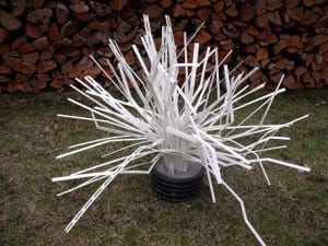
Take a look at fishiding.com. They make artificial fish habitat out of things like reclaimed pvc siding, saving landfill space and helping future generations of fish and fisherman alike.

Maryland population grows, don’t forget the fish.

About the Fisheries Habitat and Ecosystem Program:

“LAND CONSERVATION IS FISH CONSERVATION”

The Fisheries Habitat and Ecosystem Program (FHEP) is working to understand how habitat changes impact Maryland’s fisheries in the Chesapeake Bay. Our focus has been primarily on understanding how urbanization limits habitat for fish. See the dozens of unique artificial fish habitat models, fish attractors and fish cover used at fishiding.com, the leader in  science based, proven, fish protection.

Maryland’s population and land use has increased significantly. The amount of land being developed outpaces population growth. Between 1973 and 2010, developed land increased by 154 percent while population grew by only 39 percent. By 2035, 1,000,000 new residents and 500,000 new homes will be added to Maryland according to the Department of Planning.

Studies by the Fisheries Habitat and Ecosystem Program have found strong links between increased development and declining fish habitat quality in tidal tributaries of Chesapeake Bay. These links have led to creation of thresholds and targets for development to consider when managing fisheries and planning for development. These thresholds and targets use impervious cover (hard surfaces such as pavement and rooftops that are impenetrable to runoff of rain and snow melt) as a measure of development. Impervious surface thresholds describe tipping points where habitat becomes poor for fish and shellfish. This is the upper limit of impervious surface. Development beyond this limit will severely limit habitat for fish and shellfish. Impervious surface targets describe a development level that can be considered safe for fish and shellfish habitat. These targets and thresholds are being communicated to planners and the public through a simple message, “land conservation is fish conservation!” as a reminder that forests, wetlands, other natural areas, and working farms are keys to productive Chesapeake Bay fisheries.

It is clear that development is a major threat to Maryland’s natural resources and the critical ecosystem functions provided by watersheds. The impact of development on aquatic habitats is quite well documented in the scientific literature. Impervious surface increases flow extremes (lower lows and more flooding), erosion, and sediment. As trees are lost, runoff temperature of water increases. Nutrients from developed lands can be as plentiful as nutrient inputs from agriculture and cause algae blooms that deplete oxygen. In winter, more roads require more salt that pollutes streams and kills freshwater organisms, including fish. Other pollutants such as toxic metals (lead for example) and organic pollutants (oil, grease, and pesticides) enter waterways in urban runoff and wastewater. Some compounds that enter wastewater treatment facilities may not be removed. These compounds may reduce success of fish spawning and make fish less safe to eat. Fish become less abundant and less diverse in polluted waters that result from high development and impervious surface.

“Every Maryland citizen lives within at least 15 minutes of a stream or river” – Maryland StreamHealth

The Fisheries Habitat and Ecosystem Program’s Mission:

FHEP Goals and Objectives

Our goal is to develop ecosystem-based fishery management strategies that will sustain fish communities in the future. In order to do this, we are working to identify fishery and ecosystem interactions with land use and water quality stressors. We work with the public and other local, state, and federal government agencies to enable Maryland’s Fisheries Service to develop ecosystem-based fishery management strategies that sustain services by fish (including shellfish) communities into the future. The role of others in ecosystem-based management is important since Fisheries Service (and even DNR) does not have authority to manage whole watersheds.

  
The Maryland Department of Natural has developed general impervious surface guidelines based on watershed size and management concern (e.g. rare, threatened, and endangered species, sportfsh management, etc.). The FHEP has adapted these thresholds and consider them when evaluating the status of the Chesapeake Bay’s fisheries. The categories for the Chesapeake Bay fisheries are:

  • 5% or less Impervious

Watersheds with 5% or less impervious surface represent target conditions. They have healthy fisheries. Habitat within the watershed is productive. Active engagement by the public and planning officials should be taken at this stage to protect, conserve, and sustain healthy fish habitat.

  • 5% – 10% Impervious

Fish habitat in watersheds between 5% – 10% impervious surface may begin to decline. Fish reproduction may become less successful as spawning habitat becomes increasingly impaired. Habitat for juvenile and adult fish becomes increasingly compromised. The public and planning officials need to conserve remaining habitat, minimize additional impacts, and revitalize damaged areas.

  • 10% or Greater Impervious

Watersheds with 10% or greater impervious surface are facing the “point of no return” of a tidal tributary to a very different and less productive status than when the watershed was less developed. Fish habitat is impaired from a variety of stressors at this stage and could be beyond the point of no recovery as development continues. Restoring a watershed to its target condition is very unlikely, but some functions might be reconstructed with limited positive success. Ecological reconstruction projects such as stormwater retrofit, impervious surface removal, or tree planting/revegetation can help mitigate impacts by reducing sedimentation and infiltrating groundwater. However, watersheds with greater than 25% impervious surface are highly altered systems, with little chance of restoring ecological integrity. Studies of restored streams do not show successful biological restoration in highly urbanized areas. In these cases, the public and planning officials should first restructure and redevelop areas of impervious surface in a watershed before attempting restoration projects.

What Can Fishermen Do?

Understand and learn what is happening in your backyard…

As fishermen, who use and enjoy Maryland’s natural resources, it is important for you to understand and learn what development and environmental impacts are occurring “in your own backyard.” The following links provide information and facts about the areas in which you may fish and-or live.

Fishermen and the public can get engaged in the planning process…

Fishermen are familiar with Maryland’s natural resources; however, there may be times in which you, as a fisherman, feel that you have no control in what is occurring around you and to your natural resources. If you are concerned you can engage in your county and watershed planning processes. The following links provide information and contacts that can help you take part in the development and land use decisions taking place in your watershed and community.

Hopes Raised for Lake Dredging and fish habitat

test4Lake Gregory dredging tour

Photo by Mike Harris

Lake Gregory dredging tour

Phil Krause, county park planner, points to areas on a map of Lake Gregory where silt has built up over the past few years. Krause was conducting an orientation tour of the lake on Dec. 21 for representatives from California Fish and Game, Lahontan Regional Water Quality Control Board and Lake Gregory Improvement Committee.

A major step toward getting approvals to dredge Lake Gregory was achieved Dec. 21 when representatives from regional agencies visited the lake for an orientation tour.

On hand for the tour were representatives from California Department of Fish and Game, Lahontan Regional Water Quality Control Board, Lake Gregory Improvement Committee and county Regional Parks Department. A representative from the Army Corps of Engineers was scheduled to attend, but canceled at the last minute. See the dozens of unique artificial fish habitat models, fish attractors and fish cover used at fishiding.com, the leader in  science based, proven, fish protection.

“The meeting was an excellent first step in terms of our working to get Lake Gregory dredged,” said Keith Lee, county regional parks director, who was present for the tour. “The different agencies’ representatives were incredibly helpful in providing solutions.”

The group assembled in the North Shore parking lot at 1 p.m., where Phil Krause, county park planner, started the tour with a briefing on past dredging efforts. He explained how silt and debris flowing into the lake from the silt basin near the new county library building has created large sand bars in the swimming area, limiting visitor access.

Another source for the silt is storm drains, especially those near the ball field.

After the briefing, the members walked over to the silt basin to see the area, then moved on to other areas around the lake, including areas near the Leisure Shores Community Center and the ball field where silting is a major issue.

“I think we’re moving along in a good way,” Lee added. “We won’t be able to get away from doing some California Environmental Quality Act (CEQA) work, but we’re looking for ways to work together to dredge the lake and get it back to the condition that I think many in the community would like it to be in.”

Members of the Lake Gregory Improvement Committee who were on hand for the tour included Aaron Creighton, Rick Dinon (who leads the committee), Mick Hill and John Short.

“We have continually emphasized to the regulating agencies that Lake Gregory is not just a county asset, but an important asset to the Crestline and Lake Gregory community,” said Dinon. “The good news is that we’ve encountered a lot of cooperation.”

Committee member Aaron Creighton said he also was pleased with the response from the Fish and Game and Lahontan representatives who took the tour.

“We now have a vastly greater view of what needs to be done,” he said.

Creighton said that in order to get permitted by Fish and Game and Lahontan, the county has to be in compliance with CEQA.

“One of the tricky parts under CEQA is that if we remove habitat, we will have to mitigate the removal,” Creighton said. “There are two areas at Lake Gregory that need to be dredged, and the two have quite a lot of habitat.”

Part of the talk during the tour centered on creating separate habitat areas, and how it might be possible to make habitat areas protected. Other ideas included creating fish habitat areas in the deeper parts of the lake by depositing used Christmas trees weighed down by cinder blocks.

Creighton said one of the comments included that by pulling silt out of the lake, it would help improve the water quality.

“We will need an environmental impact report, and probably have to have a biological report,” he said. “We have heavy-duty problems at this lake.”

By Mike Harris, Reporter

Scroll to Top