StructureSpot

Counties receive several grants to improve fish habitat

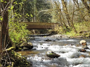
Cowlitz County has a $204,000 grant to remove this bridge on Abernathy Creek.

See the dozens of unique artificial fish habitat models, fish attractors and fish cover used at fishiding.com, the leader in  science based, proven, fish protection.

Several groups that work to improve habitat for endangered fish have been awarded more than $1 million for projects in Cowlitz County. Clark County projects on the Lewis River total $925,383 and money for work in Wahkiakum County totals $361,505.

The grants announced recently by the state Recreation and Conservation Office come from federal and state funds dedicated to fish recovery. The money for the grants comes from the federal Pacific Coastal Salmon Recovery Fund and from the sale of state bonds.

The level of fish funding for most parts of the state has decreased over the past few years. The statewide total of $30 million recently awarded compares to $32 million in 2010 and $42.8 million the year before, said Susan Zemek, communications manager for the RCO.

In addition, grants for fish habitat work in Puget Sound total $13.5 million this year, compared to $33 million a year ago.

Cowlitz County

• Reshaping Abernathy Creek, $486,305. The Cowlitz Indian Tribe will use this grant to remove an abandoned roadbed on the east side of the creek that inhibits full connectivity between the creek and its floodplain, and place logjams in the creek to increase habitat. The tribe will excavate channels through the former roadbed and place logjams in the main channel, allowing the river to meander. The work is on state land.

The tribe will contribute $85,819 in donations of cash, labor and materials.

• Removing an Abernathy Creek Bridge, $204,000. Cowlitz County will use this grant to remove a bridge on an abandoned portion of Abernathy Creek Road. The bridge is 6 1/2 miles up the creek, near Brentwood Road. The bridge constrains the channel and limits the creek’s ability to meander and connect with its floodplain. The county will install logs and tree root wads in the creek and replant its banks after the bridge is removed

Cowlitz County will contribute $36,000.

• Restoring Andrews Tree Farm waterways, $177,401. The Cowlitz Conservation District will use this grant to restore portions of the Coweeman River and a tributary, Turner Creek, on the Andrews Tree Farm. The district will install logs and whole trees in the streams to slow the river, encourage gravel accumulation and create places for salmon to rest and hide from predators. The district also will plant trees along stream banks to shade and cool the water.

The conservation district will contribute $40,000 from a state grant and donations of equipment, labor and materials.

• Restoring Nesbit Tree Farm stream, $89,100. The Cowlitz Conservation District will use this grant to restore a portion of the Coweeman River on the Nesbit Tree Farm, which is about 8 miles up Rose Valley Road. The conservation district will place logs and whole trees in the river to trap sediment on exposed bedrock to improve salmon habitat and cool the water.

The conservation district will contribute $20,000 from a state grant and donations of equipment, labor and materials.

• Restoring the Coweeman River, $124,000. The Conservation District will use this grant to place logs and whole trees in the Coweeman River on the Baxter and Andrews tree farms about 6 1/2 miles up Rose Valley Road to improve habitat for salmon. The logs and trees will slow the river, encourage gravel to accumulate and create places for salmon to rest and hide from predators.

The conservation district will contribute $24,500 from a state grant and donations of equipment, labor and materials.

Clark County

• East Fork of the Lewis River, $212,753. Clark County Public Works will use the money to grade the outlets of two side channels of the river, install logs and root wads that act as juvenile fish habitat, and remove invasive plants and replant with native species. The project will expand side channel habitat by 3,500 square feet. Clark County will contribute $61,891 to the project.

• North Fork of the Lewis River, $401,730. The Cowlitz Tribe will use the money to place logs and jams into two side channels of the river, remove invasive plants along the bank, and replant the area with native trees and shrubs. The tribe will contribute $91,400 from a local grant and donation of labor and materials.

• East Fork of the Lewis River at Daybreak Park, $143,900. Fish First will enhance two side channels of the river, install wood structures in the river for habitat, and replant streambanks with native trees and shrubs at the park. Fish First will contribute $26,100 in cash, labor and materials.

• Eagle Island-North Channel Restoration Project, $167,000. Lower Columbia Fish Enhancement Group will use the money to design a project to restore optimum water flows in the north channel of Eagle Island, which is located in the North Fork of the Lewis River near Woodland. Optimizing the water flow will improve 2.2 miles of high value fish spawning and rearing habitat below Lake Merwin. Pacificorp and the state departments of Natural Resources and Fish and Wildlife are partners.

Wahkiakum County

• Grays River, $226,180. The Lower Columbia Fish Enhancement Group will install wood structures on Columbia Land Trust property in the Grays River to reduce water velocity, create habitat diversity and collect sediments against the toe of eroding stream banks. The structures will create pools, collect flood debris and stabilize the river channel. Additional structures will be placed along more than a half-mile of shoreline to protect important chum salmon habitat in nearby Crazy Johnson Creek. The enhancement group also will remove non-native plants and replant the area with native trees and shrubs.

The enhancement group and Columbia Land Trust will contribute $76,300 in donations of equipment, labor and materials.

• Elochoman River, $135,325. The Wahkiakum Conservation District will use this grant to place logs and tree root wads in the Elochoman River, to slowing the river and creating places for salmon to rest and hide from predators. The logs and root wads also help stabilize the channel by reducing erosion and protecting young trees on the riverbanks. The work will improve salmon habitat along more than a half-mile of the river and create a streamside forest on 4.5 acres.

The conservation district will contribute $39,500 from federal and local grants and donations of equipment and labor.
Can I just toss my Christmas tree on the ice for fish habitat?

When the ice comes, the temptation to place fish attractors often comes to mind especially on a farm pond. If no ice, then a boat might be used. But just weighting down a couple of Christmas trees and dropping them in, may not achieve the best results.

DNR has this to say:  There are many ways to recycle Christmas trees, but tossing on a frozen lake as a way of creating fish habitat has certain requirements — and an uncertain outcome. Instead of waiting for an iced-over lake to thaw so a single Christmas tree can sink to the bottom, Bill James fisheries section chief has this to say.

“They need to be designed, sized and placed appropriately to attract and hold fish.”  He said,  “Large hardwood brush piles work well and last for many years.  Soft woods such as pin or spruce attract fish initially but deteriorate quickly. This is especially true if use Christmas tree are placed singly or just scattered about.”

State laws may apply, depending on the body of water.  Discarding a Christmas tree on a private pond is at the owner’s discretion, but doing so on a public freshwater lake is governed by the Lake Preservation Act. See the dozens of unique artificial fish habitat models, fish attractors and fish cover used at fishiding.com, the leader in  science based, proven, fish protection.

I have placed Christmas trees and have seen the results a couple of years later, both on farm ponds and Lakes  when the water is down.  Christmas trees tend to lay flat on the bottom and shortly become covered with sediment , offering little cover for fish.

On the other hand, a brush pile of hardwood limbs, wired together to maintain it’s shape will be there for years if weighted enough to stay in it’s location.  For further info Google “Fish Attractors” .  There are many home-made designs that work for years and do not deteriorate.

Take a look at fishiding.com. They make artificial fish habitat out of things like reclaimed pvc siding, saving landfill space and helping future generations of fish and fisherman alike.

Culverts open up new fish habitats

Swimming against the current won’t be quite as hard for fish in parts of the Siuslaw basin thanks to a project that replaced 11 culverts on creeks southwest of Eugene.

The culverts opened a passage to upstream habitat on three creeks that was effectively blocked by the old pipes. Buck, Hawley and Esmond creeks could start seeing runs of coho and chinook salmon and steelhead trout as a result of the fixes. See the dozens of unique artificial fish habitat models, fish attractors and fish cover used at fishiding.com, the leader in  science based, proven, fish protection.

The $1.5 million project took place over the summer and was funded with a federal stimulus grant. Road repairs also were done as part of the project.

The work took place on the U.S. Bureau of Land Management’s Eugene District. The creeks all feed into the Siuslaw River drainage. The new culverts replaced old pipes that were failing or that blocked fish passage because of their small size or erosion around the outlets.

Jennifer O’Leary, a BLM spokeswoman, said the new culverts are specially designed to aid fish. Not only are they larger in diameter, they also are oblong in shape to create a wider, more natural passage.

Also, rocks and sediment are placed in the culvert to simulate the natural creek and slow the water so it flows at the same speed as the rest of the creek.

“What this does is allow for more natural rates of flow while restoring the natural width of the stream channel,” she said. “It’s all about restoring more natural conditions out there in the watershed.”

Many older culverts aren’t big enough for the stream volume, causing water to speed up and jet through the pipe, clearing out any natural material and making it hard for fish to navigate upstream. And because of erosion on the downstream side where water exits, many older pipes now sit well above the stream level, blocking young fish from migrating downstream.

With the new culverts in place, fish will have an easier time. That means areas that had been off limits before will now be reachable.

“The habitat above these (new) culverts is healthy and intact,” said Leo Poole, fisheries biologist for the BLM’s Siuslaw Resource Area. “All we needed to do was open up the passage for fish and other aquatic species to get there.”

Work on the creeks only can be done during a summer window from July 1 to Sept. 15. To get all the culverts replaced in that relatively brief opening, the BLM worked with an agency of the Federal Highway Administration known as the Western Federal Lands Highway Division.

That agency contracted with area engineering and construction firms to design and build the culverts. The number of jobs created by the project wasn’t available this week, but O’Leary said it was at least a dozen and possibly more.

The BLM has done a number of other projects aimed at improving fish habitat in the area. Previous work added boulders and gravel to portions of the Siuslaw River, creating spawning beds, lowering water temperature and providing refuges where fish can rest.

BY GREG BOLT

The Register-Guard

Maryland population grows, don’t forget the fish.

About the Fisheries Habitat and Ecosystem Program:

“LAND CONSERVATION IS FISH CONSERVATION”

The Fisheries Habitat and Ecosystem Program (FHEP) is working to understand how habitat changes impact Maryland’s fisheries in the Chesapeake Bay. Our focus has been primarily on understanding how urbanization limits habitat for fish. See the dozens of unique artificial fish habitat models, fish attractors and fish cover used at fishiding.com, the leader in  science based, proven, fish protection.

Maryland’s population and land use has increased significantly. The amount of land being developed outpaces population growth. Between 1973 and 2010, developed land increased by 154 percent while population grew by only 39 percent. By 2035, 1,000,000 new residents and 500,000 new homes will be added to Maryland according to the Department of Planning.

Studies by the Fisheries Habitat and Ecosystem Program have found strong links between increased development and declining fish habitat quality in tidal tributaries of Chesapeake Bay. These links have led to creation of thresholds and targets for development to consider when managing fisheries and planning for development. These thresholds and targets use impervious cover (hard surfaces such as pavement and rooftops that are impenetrable to runoff of rain and snow melt) as a measure of development. Impervious surface thresholds describe tipping points where habitat becomes poor for fish and shellfish. This is the upper limit of impervious surface. Development beyond this limit will severely limit habitat for fish and shellfish. Impervious surface targets describe a development level that can be considered safe for fish and shellfish habitat. These targets and thresholds are being communicated to planners and the public through a simple message, “land conservation is fish conservation!” as a reminder that forests, wetlands, other natural areas, and working farms are keys to productive Chesapeake Bay fisheries.

It is clear that development is a major threat to Maryland’s natural resources and the critical ecosystem functions provided by watersheds. The impact of development on aquatic habitats is quite well documented in the scientific literature. Impervious surface increases flow extremes (lower lows and more flooding), erosion, and sediment. As trees are lost, runoff temperature of water increases. Nutrients from developed lands can be as plentiful as nutrient inputs from agriculture and cause algae blooms that deplete oxygen. In winter, more roads require more salt that pollutes streams and kills freshwater organisms, including fish. Other pollutants such as toxic metals (lead for example) and organic pollutants (oil, grease, and pesticides) enter waterways in urban runoff and wastewater. Some compounds that enter wastewater treatment facilities may not be removed. These compounds may reduce success of fish spawning and make fish less safe to eat. Fish become less abundant and less diverse in polluted waters that result from high development and impervious surface.

“Every Maryland citizen lives within at least 15 minutes of a stream or river” – Maryland StreamHealth

The Fisheries Habitat and Ecosystem Program’s Mission:

FHEP Goals and Objectives

Our goal is to develop ecosystem-based fishery management strategies that will sustain fish communities in the future. In order to do this, we are working to identify fishery and ecosystem interactions with land use and water quality stressors. We work with the public and other local, state, and federal government agencies to enable Maryland’s Fisheries Service to develop ecosystem-based fishery management strategies that sustain services by fish (including shellfish) communities into the future. The role of others in ecosystem-based management is important since Fisheries Service (and even DNR) does not have authority to manage whole watersheds.

  
The Maryland Department of Natural has developed general impervious surface guidelines based on watershed size and management concern (e.g. rare, threatened, and endangered species, sportfsh management, etc.). The FHEP has adapted these thresholds and consider them when evaluating the status of the Chesapeake Bay’s fisheries. The categories for the Chesapeake Bay fisheries are:

  • 5% or less Impervious

Watersheds with 5% or less impervious surface represent target conditions. They have healthy fisheries. Habitat within the watershed is productive. Active engagement by the public and planning officials should be taken at this stage to protect, conserve, and sustain healthy fish habitat.

  • 5% – 10% Impervious

Fish habitat in watersheds between 5% – 10% impervious surface may begin to decline. Fish reproduction may become less successful as spawning habitat becomes increasingly impaired. Habitat for juvenile and adult fish becomes increasingly compromised. The public and planning officials need to conserve remaining habitat, minimize additional impacts, and revitalize damaged areas.

  • 10% or Greater Impervious

Watersheds with 10% or greater impervious surface are facing the “point of no return” of a tidal tributary to a very different and less productive status than when the watershed was less developed. Fish habitat is impaired from a variety of stressors at this stage and could be beyond the point of no recovery as development continues. Restoring a watershed to its target condition is very unlikely, but some functions might be reconstructed with limited positive success. Ecological reconstruction projects such as stormwater retrofit, impervious surface removal, or tree planting/revegetation can help mitigate impacts by reducing sedimentation and infiltrating groundwater. However, watersheds with greater than 25% impervious surface are highly altered systems, with little chance of restoring ecological integrity. Studies of restored streams do not show successful biological restoration in highly urbanized areas. In these cases, the public and planning officials should first restructure and redevelop areas of impervious surface in a watershed before attempting restoration projects.

What Can Fishermen Do?

Understand and learn what is happening in your backyard…

As fishermen, who use and enjoy Maryland’s natural resources, it is important for you to understand and learn what development and environmental impacts are occurring “in your own backyard.” The following links provide information and facts about the areas in which you may fish and-or live.

Fishermen and the public can get engaged in the planning process…

Fishermen are familiar with Maryland’s natural resources; however, there may be times in which you, as a fisherman, feel that you have no control in what is occurring around you and to your natural resources. If you are concerned you can engage in your county and watershed planning processes. The following links provide information and contacts that can help you take part in the development and land use decisions taking place in your watershed and community.

Hopes Raised for Lake Dredging and fish habitat

test4Lake Gregory dredging tour

Photo by Mike Harris

Lake Gregory dredging tour

Phil Krause, county park planner, points to areas on a map of Lake Gregory where silt has built up over the past few years. Krause was conducting an orientation tour of the lake on Dec. 21 for representatives from California Fish and Game, Lahontan Regional Water Quality Control Board and Lake Gregory Improvement Committee.

A major step toward getting approvals to dredge Lake Gregory was achieved Dec. 21 when representatives from regional agencies visited the lake for an orientation tour.

On hand for the tour were representatives from California Department of Fish and Game, Lahontan Regional Water Quality Control Board, Lake Gregory Improvement Committee and county Regional Parks Department. A representative from the Army Corps of Engineers was scheduled to attend, but canceled at the last minute. See the dozens of unique artificial fish habitat models, fish attractors and fish cover used at fishiding.com, the leader in  science based, proven, fish protection.

“The meeting was an excellent first step in terms of our working to get Lake Gregory dredged,” said Keith Lee, county regional parks director, who was present for the tour. “The different agencies’ representatives were incredibly helpful in providing solutions.”

The group assembled in the North Shore parking lot at 1 p.m., where Phil Krause, county park planner, started the tour with a briefing on past dredging efforts. He explained how silt and debris flowing into the lake from the silt basin near the new county library building has created large sand bars in the swimming area, limiting visitor access.

Another source for the silt is storm drains, especially those near the ball field.

After the briefing, the members walked over to the silt basin to see the area, then moved on to other areas around the lake, including areas near the Leisure Shores Community Center and the ball field where silting is a major issue.

“I think we’re moving along in a good way,” Lee added. “We won’t be able to get away from doing some California Environmental Quality Act (CEQA) work, but we’re looking for ways to work together to dredge the lake and get it back to the condition that I think many in the community would like it to be in.”

Members of the Lake Gregory Improvement Committee who were on hand for the tour included Aaron Creighton, Rick Dinon (who leads the committee), Mick Hill and John Short.

“We have continually emphasized to the regulating agencies that Lake Gregory is not just a county asset, but an important asset to the Crestline and Lake Gregory community,” said Dinon. “The good news is that we’ve encountered a lot of cooperation.”

Committee member Aaron Creighton said he also was pleased with the response from the Fish and Game and Lahontan representatives who took the tour.

“We now have a vastly greater view of what needs to be done,” he said.

Creighton said that in order to get permitted by Fish and Game and Lahontan, the county has to be in compliance with CEQA.

“One of the tricky parts under CEQA is that if we remove habitat, we will have to mitigate the removal,” Creighton said. “There are two areas at Lake Gregory that need to be dredged, and the two have quite a lot of habitat.”

Part of the talk during the tour centered on creating separate habitat areas, and how it might be possible to make habitat areas protected. Other ideas included creating fish habitat areas in the deeper parts of the lake by depositing used Christmas trees weighed down by cinder blocks.

Creighton said one of the comments included that by pulling silt out of the lake, it would help improve the water quality.

“We will need an environmental impact report, and probably have to have a biological report,” he said. “We have heavy-duty problems at this lake.”

By Mike Harris, Reporter

Project aims to show crops, marshland can coexist for fish habitat and flood control

Paul Chinn / The Chronicle

A flock of birds flies over the Yolo Bypass near Woodland, where conservationists hope to restore ancient floodplains.

Woodland, Yolo County —

Five acres of mud and rice stubble doesn’t look much like fish habitat, but the rectangular patch of summertime cropland is in the process of being converted to a teeming marsh filled with young salmon.

The conversion to wetland of the rice paddy at Knaggs Ranch, north of Woodland next to the Yolo Bypass, is an experiment that conservationists hope will eventually lead to the restoration of ancient floodplains all along the Sacramento and San Joaquin River corridors.

The small piece of soon-to-be-flooded cropland is an attempt to combine agriculture with habitat restoration, flood prevention with the creation of more floodplain.

“There is a real push to just build levees higher and bigger rather than really taking into account ecosystem functions,” said Jacob Katz, a biologist with the Center for Watershed Sciences at UC Davis. “We are hoping to say, ‘Look, this is how you do it. You can protect against flooding this way, too.’ ”

Breaching levees

The experiment, which involves the breaching of levees protecting the lower 5 acres of a 1,700-acre rice farm, is one example of the kind of innovation that conservationists hope will be inspired by California’s first ever attempt to create a systemwide plan to manage floods.

The $4.9 billion FloodSAFE initiative, which was created by the Central Valley Flood Protection Act in 2006, involves an ambitious program to increase public safety, promote long-term economic stability and improve environmental stewardship in the areas that have historically flooded during winter rains.

The state Department of Water Resources will issue a draft of its flood protection plan on Dec. 30, to be followed by a public comment period and hearings. The Central Valley Flood Protection Board, a panel of experts appointed by the Legislature, will have until July 1, 2012, to adopt the plan.

Salmon and rice

The document will set guidelines for flood protection and funding along the Sacramento River and around the Yolo Bypass, which was built almost a century ago as a relief valve for Sacramento River flood water. The specific programs will be developed by local and regional governments and communities.

The Knaggs Ranch study is being conducted by UC Davis, the state Department of Water Resources and rice paddy owner John Brennan, with support from Cal Trout and Trout Unlimited.

The plan is to trap the floodwater over the next month and, on Feb. 1, introduce 10,000 to 20,000 juvenile chinook salmon captured from the Feather River. Marshland habitat, including native grasses, is being restored inside the 5-acre plot.

Biologists will study the fish, waterfowl and nutrients in the water to determine the health of the wetland and to see how well the rice straw breaks down. One concern, Katz said, is that too much rotting rice straw could suck the oxygen out of the water and kill the fish.

Testing the waters

The researchers want to determine the right biological mix and, in collaboration with the owner, expand the off-season wetlands project to cover the entire 1,700 acres.

The hope, assuming all goes well, is that access points would eventually be designed so that migrating salmon in the Sacramento River could enter restored floodplains throughout the 59,000 acres of agricultural land in the Yolo Bypass and elsewhere along the Sacramento-San Joaquin River Delta.

It is important because the delta, built to funnel water through the 1,300-square-mile confluence of the Sacramento and San Joaquin rivers, is the heart of California’s vast water network. The system of levees, dams, channels and pumps funnels snowmelt from the Sierra Nevada to 25 million people in the Bay Area, Central Valley and Southern California.

The network was designed not just to provide drinking water, but also to prevent the kind of epic flooding that once occurred regularly in the Central Valley. Flooding was so bad in the winter of 1861-62 that the entire Central Valley became a vast lake.

Flooded rice farms

The Yolo Bypass was approved in 1917 as an outlet for floodwaters every couple of years when the Sacramento River overtops what is known as the Fremont Weir. The land beneath the bypass, which is reserved for agriculture during the summer, becomes an inland sea during heavy flooding.

See the dozens of unique artificial fish habitat models, fish attractors and fish cover used at fishiding.com, the leader in  science based, proven, fish protection.

Migratory waterfowl regularly visit the flooded rice farms and a small area of restored wetlands called the Yolo Bypass Wildlife Area. Sometimes juvenile salmon spill over the weir into the bypass, but the area is not designed for fish, which often become trapped, when the water subsides, and die in evaporating pools.

Staggering fish migration

It is one of many reasons fisheries biologists believe California’s once vast population of chinook salmon has been declining despite an enormous yearly infusion of hatchery-raised fish. Only about 5 percent of the original Sacramento floodplains still exist, Katz said.

The creation of a statewide flood management plan is an opportunity to restore the floodplains where migrating fish historically rested, foraged for food and fattened up before returning to the river, Katz said. It would also stagger the migration over the course of the winter and spring season.

“Floodplains are important for foraging fish and for creating a more diverse portfolio of life histories,” Katz said. “By taking away floodplains and channeling them into rivers, we have taken that diversity away.”

The original idea behind the FloodSAFE initiative was to shore up the system of levees in the delta, which have failed 166 times over the past 100 years. The danger of flooding is now worse than ever, according to experts, who point out that the sea level is rising and land in the Central Valley is subsiding.

The state’s flood management plan, which could cost as much as $16 billion to fully implement, is expected to include a major expansion of the Yolo Bypass.

“By expanding the bypass we open the door for increased ecosystem restoration while getting the dual benefit of reducing flood risk,” said Michael Mierzwa, the supervising engineer and flood policy adviser for the Department of Water Resources. “The caveat that I put on that is that it is going to take decades to implement.”

Commitment in spotlight

The level of commitment to ecosystem restoration is the major concern among many environmentalists. Many local community leaders are vehemently opposed to converting farmland into wetlands. One big reason, Mierzwa said, is because both the agricultural land and the product grown on it are taxable. When you take a rice farm out of production, he said, you reduce the tax revenues which are, in turn, used to maintain the flood system.

The Knaggs Ranch experiment, Katz said, is designed to show how floodplain and habitat restoration can be accomplished without taking agricultural land out of production.

“We’re really talking about a paradigm shift in the way we push water around the landscape,” Katz said. “It’s going to be much cheaper to invest in a system that incorporates floodplain restoration now than it will be in the future. It will be better for ducks, better for fish and better for farms.”

E-mail Peter Fimrite at pfimrite@sfchronicle.com.

This article appeared on page A – 1 of the San Francisco Chronicle

 Peter Fimrite, Chronicle Staff Writer

Read more: http://www.sfgate.com/cgi-bin/article.cgi?f=/c/a/2011/12/25/MNDK1MEG6S.DTL&ao=2#ixzz1hxOgl0e2

 Read more: http://www.sfgate.com/cgi-bin/article.cgi?f=/c/a/2011/12/25/MNDK1MEG6S.DTL#ixzz1hxOTvmlR

Iowa…the place to find Efficient Pond Management and fish habitat

That’s right, Iowa…not the first place that comes to mind when we’re talking fishing. Usually it’s whitetail deer, farming and the like. Did you know that Iowa has tons of lakes, ponds and streams?

Fish of all species abound in the public and private waters throughout the state. When managing these waters, professionals like Ryan McCaw help achieve clients goals, be it  a small pond or large lake/waterway system. See the dozens of unique artificial fish habitat models, fish attractors and fish cover used at fishiding.com, the leader in  science based, proven, fish protection.

Weed control is a major part of any lake or pond owner’s concerns. What about swimming, fish stocking and water clarity? Can I get a fountain or one of those aerator things? These guys have the skills to enhance your property in ways most of us can only imagine. We are proud to announce the newest addition to our network of dealerships.

Logo JPEG.jpg

Rooted in Iowa, LLC
Efficient POND Management

About Efficient Pond Management

Efficient Pond Management was founded in efforts to educate and assist pond owners in how to manage the valuable resource they have. Government agencies would come out if time permitted to consult and advise, but they could only do so much for the private pond owner. Mail order and internet companies are always more than happy to consult over the phone and sell their products, but most times it takes a professional on site to really get to the heart of the matter. Efficient Pond Management was designed to fill that void for you. We provide a live person on site to assess your pond to determine #1 what condition the pond is currently in with any problems diagnosed and #2 offer solutions that can correct those underlying problems. Our level of involvement is dictated by you, the pond owner, as we devise a plan that fits into your goals and budget.

We are proudly partnered with All Things Water out of Elkhart, IN. A company with over 11 years of experience in all facets of pond and lake management including large scale aquatic plant harvesting and dredging. We have the knowledge and resources to complete any job when it comes to lake and ponds and will provide you with our best efforts and results that will please you with a beautiful pond.

We also have a network of service professionals in related fields that may be very useful in your project. Heartland Habitat from Princeton, Illinois is one such company. They specialize in land management and food plots to enhance biodiversity increasing the beauty and attracting wildlife. Typically, stable and densely vegetated land surrounding a pond leads to a more stabile and healthy pond.

An active member of the Midwest Aquatic Plant Management Society. The mission of MAPMS is to promote sound and appropriate technologies for the management of aquatic vegetation, provide opportunities for the educational advancement of its members and encourage relevant scientific research. Among others.

Please feel free to contact us at:
563-370-6608
ryan@efficientpondmanagement.com

Services:

  • Aeration
  • Aquatic Herbicides
  • Dredging
  • Enzyme Bio-augmentation
  • Fishery Management
  • Pond Assessments
  • Pond Repairs
  • Services Overview
  • Water Garden
  • Weed Harvesting

Efficient Pond Management was founded with the goal of assisting private pond owners in Eastern Iowa and Western Illinois with on site personal service. We will work with you to achieve your goals and provide you with a well managed pond for you to enjoy for years to come.

Don’t assume that your pond is to big or too small for us to handle.
We have the equipment to fit your situation.
Pond Jumper Work Boat

Our network includes a close partnership with All Things Water who has over a decade of experience in all aspects of pond management and specialize in large scale aquatic plant harvesting and dredging using the Aquamog pictured on the right. This unique dredge can reach many areas not available to long reach excavators, removes solid material with very little water and only needs one access point to complete the work while leaving 99% of the shoreline untouched.
An active member of the Midwest Aquatic Plant Management Society. The mission of MAPMS is to promote sound and appropriate technologies for the management of aquatic vegetation, provide opportunities for the educational advancement of its members and encourage relevant scientific research. Among others.

We also have a network of related businesses such as Heartland Habitat. Specializing in terrestrial land management that naturalizes an area to increase the beauty and draw in wildlife. This will make your pond even more attractive and stabilize the land surrounding the water. Dense plant growth around a pond absorbs nutrients before they even enter the water and reduces aquatic plant growth and algae blooms. Pictured below are examples of how their services tie in with ours.

Fishery Management

Ponds provide some of the best fishing opportunities but need to be maintained and managed to keep them at optimal operational level. Whether it is a new pond that needs fish introduced or a an older pond that needs evaluated and possibly adjusted, we can provide you with assistance.

Fish Habitat

A good fishery must have habitat contained within the water at various levels. The fish of North America overwhelmingly use various structures throughout their lifecycle from berth to death. Lack of structure seriously limits the ability of a body of water to produce quality fish. Young fry need a place to hide and grow so at least some have a chance to become adults to replace the aging portion of the population that will eventually die off naturally. This habitat also provides a place for the base of the food chain, the microphytes, to grow to feed the zooplankton which in turn is food for the forage fish and so on to the apex predator of that pond. So as the fish grows and matures, it will return to this structure repeatedly for foraging opportunities to grow large and strong.

We offer FisHiding fish structures. Use our special Code found on our site when ordering from the FisHiding website for our exclusive discount.
FisHiding

Fish Survey

We are permitted in the state of Iowa as Scientific Collectors which allows us to perform fish surveys on your pond to determine the overall health of the fish contained. With this knowledge we can create a plan to follow to manage the existing population to create the fishery you prefer.

Fish Stocking

We carry an aquaculture license in the state of Iowa to provide fish stocking services should that be necessary to rejuvenate an old pond or get a new pond up and running. We will tailor the mix of fish introduced to maximize your fishing enjoyment.

Nuisaance Species – Rotenone

We are licensed to apply Rotenone in Iowa to a pond should you find that an exotic or undesireable species has overrun your waters. This application will terminate all fish life in the pond removing the nuisance species and allow you to stock the pond again with desired native fish species for your enjoyment.

This should give you some idea of the types of services Ryan and his crew provide. Visit the website or contact Ryan with any questions you may have.

Iowa has been in the news for getting kids involved in the outdoors and fishing. Take a look at this story posted just a few days back:

https://structurespot.com/conservation/urban-areas-among-sites-for-new-habitats-some-lakes-get-keeper-trout-for-the-kids/


Healthy Streams for TN

Fish Habitat Restoration Initiative –


JOIN THE COUNCIL IN CREATING HEALTHY STREAMS FOR WILDLIFE AND PEOPLE

The Council’s Watershed Support Center takes challenges and turns them into opportunities for Tennessee rivers and streams and waterways and the wildlife and people who enjoy them.  Thanks to a grant from the Dan and Margaret Maddox Charitable Fund, we will continue and expand our watershed support work in Middle Tennessee.  A watershed is an area of land that drains into a specific body of water.  Our work includes:

~ Planting trees to reforest the stream banks and planting live stakes to stabilize the soil and help improve water quality.

~ Installing rain gardens.  Rain gardens add beauty to the landscape and reduce flooding by allowing storm water to be absorbed by the plants and infiltrated into the ground. 

~ Installing revetments (cedar timbers wrapped in coir mat) on to the eroded bank to prevent further deterioration of the stream bank. 

~ Fish habitat restoration initiatives in the streams

See the dozens of unique artificial fish habitat models, fish attractors and fish cover used at fishiding.com, the leader in  science based, proven, fish protection.

We schedule volunteer events each month. If you would like to join us on one of these projects visit our Events Calendar.  You may come and join our group.  We also encourage your business, youth group, or other organization to join us on one of our volunteer events.  We would be happy to schedule a special workday for your group.  Call us at 615-248-6500 or email tec(at symbol)tectn.org to schedule an outing.

Protecting the Biodiversity of Middle TN Streams
We are partnering with Harpeth River Watershed Association, municipal stormwater organizations and other non-profit organizations to complete our work and expand our reach.   The Fish Habitat Restoration initiative will take place in Middle TN including Sumner, Wilson, Davidson, Rutherford, Williamson, and Murray counties in the Duck River, Harpeth River, Stones River and Old Hickory Watershed.

National Geographic magazine recently named the Duck River in Tennessee one of the most biologically rich places in the world.  This is an important recognition bringing worldwide attention to one of our natural treasures in Tennessee, and it makes our Watershed Support work even more important.

The Duck River includes 151 different species of fish – more different types of fish than all of Europe.  The river is also home to over 50 types of mussels. The health of these amazing and diverse populations is indicative of the health of the ecosystem, and a thriving ecosystem means clean air, clean water and a healthy environment for communities.

The Harpeth River is 125 miles long with over 1,000 miles of tributaries.  The river passes through agricultural, forested and suburban areas of six counties in the greater Nashville region until it joins the Cumberland River. The Harpeth River watershed is  870 square miles.  The Harpeth is also one of the unique freshwater river systems of the Southeast which contains a greater variety of aquatic life than anywhere else in the world.

Sediment is the most common pollutant in rivers, streams, lakes and reservoirs according to the Environmental Protection Agency (EPA) and all Middle Tennessee streams and watersheds are impacted by this problem.

A Healthy Fish Habitat Means Health Drinking Water and Food Supply for People  
Urbanization and agriculture are causing degradation of fish and wildlife habitat in middle Tennessee. Our region continues attracting people and businesses who develop areas previously used for wildlife or farming. The most valuable of this habitat for fish is located in stream side areas that protect water quality and fish habitat from sediment and habitat destruction.

Roof tops and parking lots preclude the land from absorbing precipitation, and leads to increasing flooding and decreasing summertime flows by limiting groundwater recharge. Urban stormwater moves more quickly than normal because of smoother surfaces and less vegetation to capture and slow down the rain run off. This runoff also carries more trash, debris and pollutants and has a higher temperature. These traits contribute significantly to the degradation of fish and wildlife habitat in streams.  A healthy stream contributes to the health of the community through cleaner drinking water, increased biodiversity, improved recreational opportunities and more.

Success Stories
In 2009, the Duck River Opportunities Project received the Tennessee Governors Environmental Stewardship award, because of work to protect this most valuable natural resource.  Click here for more information.  In 2011 we carried out 9 volunteer restoration events, planting over 1,000 trees and stabilizing close to 1,000 feet of creek bank, reducing sedimentation, the leading cause of water pollution.

The Council also works in conjunction with Friends of Henry Horton State Park to educate 5th grade students about the Duck River Watershed training them to be stewards of the river.  Click here for more information.

The Fish Habitat Restoration Initiative is made possible through your generous donations to the Council and by a grant from the Dan and Margaret Maddox Charitable Fund and another grant from the Tennessee Department of Agriculture and the U.S. EPA.

MAKE A DONATION TODAY TO SUPPORT OUR WORK.  CLICK HERE TO DONATE.

Pictured Above:
1.  5th Grade Students from Chapel Hill Elementary plant trees as part of a watershed education project sponsored by Friends of Henry Horton State Park and presented by The Council.
2.  Kevin Burke inspects revetments designed to protect the stream bank and encourage re-vegetation and prevent further erosion.
3.  A group of volunteers from Mars Petcare at Jerry Erwin Park in Spring Hill planted hundreds of trees to improve the health of the Duck River Watershed in October 2011.
4. This crawfish is a great example of the biodiversity found in the Duck River Watershed.

Click here to see more pictures.

25% Off Fish Habitat Year End Blowout!!

Fishiding artificial fish habitats are coming to a lake or pond near you. With fish attractors, more is usually better and that is good for the fish and the fisherman alike.

With continued growth and products in over 40 states, we need to clear the shelves of remaining inventory in order to expand. Most models are still available with no limit on quantities purchased. See the dozens of unique artificial fish habitat models, fish attractors and fish cover used at fishiding.com, the leader in  science based, proven, fish protection.

The 25% off sale ends December 31st 2011 so order your habitat today!

More and more lake and pond owners and fisherman are utilizing the long term benefits of artificial fish structure like the products made by fishiding.com

Made from reclaimed PVC, all the various sizes and textures of habitat are made here in the USA. The textured surface allows exceptionally fast algae growth and the models with wide limbs create shade unlike any other self installing fish structure.

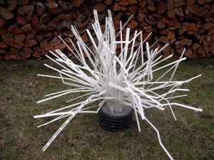
Each unit comes ready to sink in it’s own black PVC, weighted “stump” of a base. The rigid yet flexible limbs, can be bent out on any/all angles and creased to retain their shape and position.

When you like the shape of the habitat unit, simply toss it in the lake and it sinks standing upright. The habitat will cover in algae and begin the fish holding potential.

Get a group of fishiding habitat today and begin to hold fish where you want them. Provide cover to grow your forage fish fat to feed those hungry predator fish.

Lake Fork sportsmen and state work together to help create fish habitat

Members of the Lake Fork Sportsman’s Association partnered with the Texas Parks & Wildlife Department’s Inland Fisheries Division staff in making fish habitat improvements at Lake Fork last week.

They took advantage of drought-induced low water levels that have exposed shorelines and they planted 400 buttonbush plants around the lake.

Buttonbush is a native woody shrub commonly called “buckbrush,” and it was chosen to establish woody cover for fish.

When covered by water, it helps provide great bass fishing, a TP&W press release said.

Michael Rogge, president of the Lake Fork group, said approximately 15 members of the association and 15 members of the TP&W, spent approximately three hours planting 400 of the plants in two separate locations.

Rogge said the shrubs are adapted to “wet environments” like willow trees and that they will grow to about six to eight feet and be quite “bushy.”

“They will sprout new plants as seeds drop off,” in the future, and “become pretty dense,” which in turn creates fish habitat, he said.

Rogge said 200 of the plants were introduced in Glade Creek and another 200 in Big Caney.

According to a parks and wildlife spokesman, Lake Fork has had a long history of relatively stable water levels. This has been advantageous in that it has mostly translated into stable aquatic habitat and fish production. However, during the recent drought the disadvantage of this stability became evident. The lake elevation has dropped to an all-time record low, exposing shorelines and reducing cover which provides young fish shelter from predators. See the dozens of unique artificial fish habitat models, fish attractors and fish cover used at fishiding.com, the leader in  science based, proven, fish protection.

The state said Lake Fork will likely be subject to more water level fluctuations in the future as the City of Dallas increases pumping operations on the lake, especially if the current drought persists.

In lakes where there are prolonged draw-downs, plants will grow in the newly expanded shoreline.

These include aquatic plants such as smartweed, sedges and rushes, along with a variety of other plants including shrubs and trees. Woody plants such as willows will grow rapidly along the shore, and when it rains and the lake elevation rises enough, the plants can become partially or totally covered.

The plants provide shelter for fish and for the establishment of many organisms that fish eat.

Some of the woodier plants are persistent and will survive for many years and provide benefits to the ecosystem.

The first step in this habitat enhancement plan materialized in March when the association purchased 1,000 bare-root buttonbush plants from a local tree nursery and planted them at selected locations throughout the reservoir. Survival of these small plants, most less than two feet in length, was low. At some of the planting sites they were trampled by feral hogs.

The second stage in the Lake Fork organization’s habitat project began to take shape this past summer. The opportunity to purchase larger plants presented itself when a fish farmer in Columbus, Texas, approached TP&WD looking for potential customers for 400 two-year-old buttonbush plants.

The TP&W press release said these larger plants should experience better survival. The LFSA agreed to underwrite the majority of the $1,900 purchase price, and TP&WD contributed $650. Bushes were planted at different elevations to hedge against future water-level changes.

Scroll to Top