StructureSpot

Clear Lake minnow petitioned to be added to endangered species list due to lost habitat

Clear Lake hitch focus of state, federal Endangered Species Act applications

040212clearlakehitch
Clear Lake hitch during the April 2011 migration. Photo by Ed Oswalt.

LAKE COUNTY, Calif. – One of Clear Lake’s natives species is the focus of new state and federal Endangered Species Act applications submitted on Tuesday.

Estimating that the Clear Lake hitch’s numbers have plummeted from millions to, more recently, a few thousand, the Center for Biological Diversity on Tuesday petitioned to protect the hitch – a large minnow found only in Clear Lake and its tributaries – under both the federal Endangered Species Act and the state’s Endangered Species Act.

The fish, once a staple food for the region’s Pomo tribes, has been tracked closely in recent years by local tribes and the Chi Council for the Clear Lake Hitch. As the fish’s habitat has dramatically changed their numbers have seen a precipitous decline. Dozens of unique habitat models at fishiding.com

The Clear Lake hitch has long been an important part of the lake’s natural and cultural heritage of Clear Lake but, if it’s to survive for future generations, Jeff Miller of the Center for Biological Diversity said the fish needs to be put on the pathway to recovery, which means it needs to be protected and have its habitat restored.

Miller said the center has been looking at the hitch for about five years.

There is precedent for the disappearance of a local fish species – Miller pointed out that the Clear Lake hitch’s closest relative, the Clear Lake splittail, became extinct in the 1970s through habitat alterations that dried out spawning streams and barriers that prevented fish migration.

“Fisheries and biologists have been warning about the Clear Lake hitch going the same way,” he said. The fish also has been on a California Department of Fish and Game watch list for decades.

Over the last couple of years, with the continuing decline in spawning runs and the dropping number of fish, Miller said the group decided to act and give the fish “a fighting chance.”

The Center for Biological Diversity’s petition proposes recovery measures for hitch, such as removing or retrofitting barriers to fish migration, improving instream water flows, restoring fish to former spawning streams and reducing predation by invasive fish near the mouths of spawning streams.

The center also is proposing that the hitch be reintroduced into Blue Lakes after it’s determined what caused the fish population there to die. He said so far he’s not aware of studies being done on the previous Blue Lakes hitch population.

“I think it’s necessary,” said Paula Britton, environmental director of the Habematolel Pomo of Upper Lake, of the proposed Endangered Species listing.

Britton’s work for the tribe includes study of the hitch. One of their projects includes tagging the fish,  – she said they’re still tabulating results from last year’s tagging work – and they hope to initiate habitat surveys.

At Big Valley Rancheria, Environmental Director Sarah Ryan said the tribe has given input on the application, and has provided Miller and the Center for Biological Diversity information over the past few years, as has the Chi Council.

“I think it’s probably a positive step because the hitch are declining pretty badly at this point,” she said.

Peter Windrem, president of the Chi Council, said the group was unaware that the Center for Biological Diversity was planning to file the petitions for protection.

He said the group was meeting Wednesday afternoon, and he deferred further comment until he had a chance to discuss the matter with the rest of the council.

Tom Smythe, an engineer with Lake County Water Resources who also sits on the Chi Council, said the petitions weren’t a complete surprise. “There’s been discussion of this for a couple of years.”

He said there are pluses and minuses to a potential Endangered Species listing for the Clear Lake hitch.

On the plus side, it could provide funding for habitat restoration for the hitch, which isn’t a game fish and so doesn’t have much of that funding available. Miller also believes projects like the Middle Creek restoration would likely gain funding as a result of the listing.

Among the minuses, said Smythe, is the potential for the permitting process to become much worse, “even if you’re trying to help the habitat.”

Theoretically, the listing shouldn’t add complications to the Middle Creek restoration project, although there is the possibility, Smythe said, adding that a listing would potentially affect any project that impacts local streams.

Miller said that any projects under way currently, whether beneficial or harmful, would likely be unaffected due to the time it will take for a listing decision to be made.

He said restoration projects, scientific monitoring and tribal harvests of fish “are usually permitted within the framework of listings” as long as there is a conservation component to them.
Changes in habitat threaten fish

“The Clear Lake basin and its tributaries have been dramatically altered by urban development and agriculture,” the Center for Biological Diversity states in its petitions. “Much of the former stream and wetlands habitat suitable for hitch has been destroyed or degraded, and barriers that impede hitch migration have been built in many streams which formerly had spawning.”

The petitions continue, “Hitch can no longer reach the majority of former spawning areas, and are forced to spawn opportunistically in ditches and wet meadows during high flows. In recent years, hitch have been able to spawn in significant numbers in only two streams, Kelsey Creek and Adobe Creek, both located in the Big Valley drainage.”

The hitch spawn has become “sensitive to very localized events,” and, as such, “a toxic spill or water use issues of limited size could results in spawn failure for the entire population,” according to the petitions.

The petitions found no local ordinances or regulations to protect the fish.

While the 2008 Lake County General Plan’s goals and policies seek to ensure the protection of sensitive species, limit encroachment into sensitive habitats and protect riparian corridors, the petitions suggested it didn’t go far enough.

The center said the general plan “only superficially mentions the Clear Lake hitch as a state species of concern. The plan contain goals and policies aimed at protecting water quality and biological resources, but some of the policies are couched in qualifiers such as ‘should’ or ‘shall consider’ and ‘whenever possible.’”

Historically, the hitch spawned in all of Clear Lake’s tributaries. Now, however, due to a variety of impacts – changes in creek habitat, migration barriers, water pumping, in-channel mining, pollution and predation by non-native fish – they’re found spawning only in Kelsey and Adobe creeks.

The Endangered Species Act petitions also raise another future concern. “Increased drought and rapid climate change due to global warming will likely accelerate this trend, causing further spawning failures.”

In the last spring hitch run, Ryan said they found that while the hitch were spawning, there was not enough water in the creeks, such as Adobe Creek, for them to make it back to Clear Lake.

Ryan said that an Endangered Species listing could lead to changed water usage in the creeks, making sure that the fish have the water they need.

“The intent is not to stop projects and not to stop progress and things that are already being planned,” said Ryan, pointing to the Endangered Species Act’s goal of preserving heritage species populations.

If there are actions or activities that are affecting hitch being able to survive and thrive, Ryan said they will have to be modified in conjunction with the act.

Smythe said he’s noted a decline in hitch populations over the past 25 years.

During the spring spawn in 2011, which was a wet year, Smythe said the hitch were seen in streams where their presence hadn’t been noted in years.

However, this year, with late rain – and less rain overall – the hitch were harder to find, he said.

“We don’t really have good data this year because it’s hard to see them in a muddy stream,” Smythe said, adding that, overall, the hitch spawn “looked pretty poor.”

The Endangered Species listing process “takes a lot longer than it should,” said Miller.

There will be a 90 day finding, but Miller said that step rarely is as quick as three months. After that, there is a yearlong status review that’s similar in both the state and federal process.

During the status review, Miller said the government will collect information from stakeholders, hold public hearings and take public comment, followed by a Federal Register notice if the listing is granted.

“Optimistically, you’re looking at a couple of years,” Miller said.

Email Elizabeth Larson at elarson@lakeconews.com .

ELIZABETH LARSON

Nature’s water purifiers help clean up lakes

Nature’s water purifiers help clean up lakes
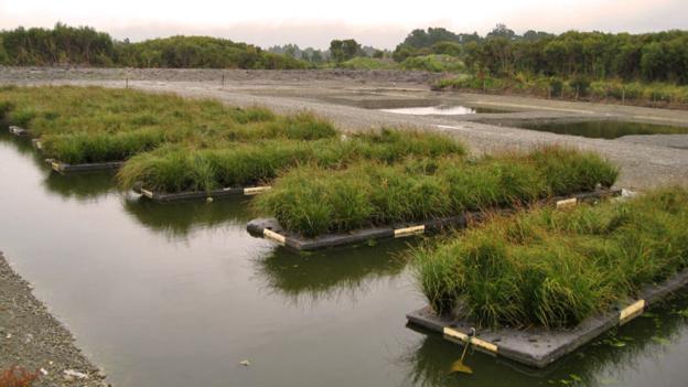
(Copyright: Floating Islands International)

More and more of our waterways are being starved of life through pollution. One simple, yet improbable, solution? Cover rafts in plants.

The solution was as simple as it was improbable: cover rafts with plants, and set them afloat in the lake. Within a year-and-a-half, the algal blooms were gone. Water clarity improved. Oxygen levels rose. Today, the lake is home to a thriving community of fish, including black crappieyellow perchand Yellowstone cutthroat trout.

The story of Fish Fry Lake demonstrates the power of mimicking wetlands to clean up dirty waterways. Wetlands are sometimes called nature’s own water purifiers: as dirty water moves through a sprawling marsh, the bacteria that cling to wetland plants, timber, rocks, and other debris consume and process some common water pollutants. Other contaminants get trapped in the mud and muck. As result of these and other processes, the water that eventually flows out of a wetland is much cleaner than the stream that came trickling in.  Dozens of unique habitat models at fishiding.com

By creating floating treatment wetlands out of small, human-engineered rafts of vegetation, researchers and entrepreneurs hope to provide these same ecological services to small, polluted bodies of water that may be far from a natural marsh. “BioHaven floating islands are concentrated wetland systems that are essentially biomimicking nature’s wetland effect,” says Bruce Kania, the founder and research director of Floating Island International, the company behind the Fish Fry Lake rafts.

Cleansing power

To construct a BioHaven island, the company starts with layers of mesh made from recycled plastic. They assemble this mesh into a floating raft – which can be as small as a home aquarium or nearly as large as a football field – and top it with soil and plants. They launch the island into a lake, pond, stream, or lagoon, anchoring it in place. Over time, the plants’ roots grow into and through the raft’s porous matrix, descending into the water below. At the same time, bacteria colonise the island, assembling into sticky, slimy sheets called biofilm that coat the floating matrix and the suspended plant roots.

This bacterial biofilm is the secret to a floating island’s cleansing power. Overgrowth of algae from nitrogen and phosphorus pollution can cause several problems, preventing sunlight from reaching subaquatic plants and starving a body of water of the oxygen needed to sustain fish populations and other animal life. A dead zone, like the one is Fish Fry Lake, is often the ultimate result. The biofilm bacteria consume nitrogen and phosphorous, however, and as polluted water flows through and around a floating island, the bacteria converts these contaminants into less harmful substances. Though the bacteria do the brunt of the work, the plant roots suspended from the floating island also play their part, absorbing some of the nitrogen and phosphorous through their roots.

In Fish Fry Lake, for instance, Floating Island International deployed several islands, which together covered almost 2% of the lake’s 6.5-acre (2.6-hectare) surface area. Over the course of four years, the islands helped reduce nitrogen concentrations by 95% and phosphorus concentrations by nearly 40%. Today, levels of dissolved oxygen are sixty times what they once were.

Clearer, cleaner, healthier

The system also mechanically filters out other pollutants, like metals and particulates. “The sticky biofilm essentially keeps the water clear because all the suspended solids tend to bond to it,” says Kania. Floating Island International, which has deployed more than 4,400 of their artificial wetland systems worldwide, has documented this effect in multiple case studies. For example, the concentrations of suspended solids, copper, lead, zinc, and oil and grease fell dramatically after a floating island was installed in a stormwater pond in Montana. Controlled laboratory studies and research by scientists not affiliated with the company have also  foundthat floating treatment wetlands can reduce the levels of many common water pollutants.

Some scientists are now exploring how to optimise the design of floating islands – probing, for instance, which plants do the best job of removing pollutants. Gary Burtle, an aquaculture specialist at the University of Georgia, thinks we can get even more out of these artificial wetlands by seeding the rafts with plants that are of commercial value, such as lettuces and herbs. Burtle is screening a number of potential plant candidates – if he finds one that grows well on a floating island, we may soon see constructed wetland systems that “give us a little bit more return”, he says, producing saleable crops while purifying the water.

Meanwhile, the removal of contaminants not only improves the water itself, but also helps to foster a healthier ecosystem. Clearer water allows light to penetrate deeper, encouraging the growth of various aquatic plants, which produce oxygen and become part of the food chain, supporting larger populations of fish and other animals. “You end up with a waterway that can be abundant,” Kania says, “that can be verdant even at depth.” The organic debris that attaches itself to the underside of a floating island also becomes a source of food for fish and other aquatic organisms, and the island itself provides new habitat for birds.

“The concept of how to get back to a healthy waterway,” Kania says, “is very simple: nature’s wetland effect.” All we have to do is simulate it.

By: Emily Anthes bbc.com

If you would like to comment on this article or anything else you have seen on Future, head over to our Facebook page or message us onTwitter.

More money for the fish and wildlife over 11 projects

Restoration Effort Moving Forward on 11 Projects as Part of
$3.7 Million Nyanza Natural Resource Damages Settlement

BOSTON – State and federal environmental officials announced today that 11 projects benefitting the wildlife, people and landscape of the Sudbury River Watershed will be funded by the $3.7 million settlement reached in 1998 by parties for natural resources harmed by mercury and other contaminants from the Nyanza Chemical Superfund site in Ashland, Mass.

The funds are allocated as part of the final restoration plan and environmental assessment for the Sudbury River Watershed. Dozens of unique habitat models at fishiding.com

“Together, these projects will restore, replace, or acquire harmed natural resources and natural resource services,” said Massachusetts Energy and Environmental Affairs Secretary Rick Sullivan. “Undoing the damage done to this area has been a hard-fought legal battle, but the residents will soon bear witness that the work going forward is more about restoration and less about litigation.”

The projects will restore migratory and cold water fish habitat; protect land to conserve wildlife habitat; create public access to the river in Ashland and Sudbury; create a nature preserve in Framingham and Ashland; and control invasive aquatic weeds to improve recreation and wildlife habitats and diversity.

“In terms of wildlife, public access and recreational amenities, this is welcome news for residents and everyone in the Commonwealth, but it further restores environmental habitat that is essential to wildlife and bringing vitality back to the region,” said Massachusetts Department of Environmental Protection Commissioner Kenneth Kimmell.

The Nyanza Natural Resource Damages Trustee Council – comprised of the Massachusetts Executive Office of Energy and Environmental Affairs, represented by the Massachusetts Department of Environmental Protection (MassDEP), the U.S. Fish and Wildlife Service (Service), and the National Oceanic and Atmospheric Administration (NOAA) – worked with citizen, community and environmental groups, local and regional officials, and state and federal agencies to identify restoration project ideas. The final plan also incorporates public comments on an earlier draft.

“The Nyanza natural resource settlement will support projects with wide-ranging benefits to wildlife, including healthier wetlands for waterfowl, enhanced streams for brook trout, and restored habitat for songbirds not only in the Sudbury River watershed, but also in their Belize wintering grounds,” said Service Regional Director Wendi Weber. “In addition, several projects will improve access to the river for exploring the Service’s popular Great Meadows National Wildlife Refuge.”

“NOAA is delighted that these projects will have a positive impact on the important wetland and river habitat in the Sudbury River Watershed,” said NOAA Fisheries Northeast Regional Administrator John Bullard. “Restoring access to upstream habitat will help to improve fish populations, including river herring, American eel, and American shad.”

Restoration projects will:

  • Improve wetlands and river habitat through the control of aquatic weeds in the main-stem of the Sudbury River;
  • Restore coldwater fish habitat through riparian channel and stream-bank improvements;
  • Assess migratory fish passage in the Concord River that will provide access to habitat in the Concord, Assabet and Sudbury rivers;
  • Promote future river conservation through education and the Sudbury RiverSchools Program;
  • Restore riparian grasslands in the Greenways North Field in Wayland;
  • Benefit migratory songbirds through the restoration and protection of the Sudbury River habitat and their overwintering habitat in Belize;
  • Transform the Stearns and Brackett reservoirs in Ashland and Framingham into a wildlife preserve that will protect and enhance ecological values and create appropriate public access and recreation;
  • Conserve habitat by the acquisition of land along the Sudbury River;
  • Increase public access to the Sudbury River by the addition of canoe and car-top boat access sites on Aikens Road in Southborough and by having canoes/kayaks for visitor use at the Great Meadows National Wildlife Refuge Headquarters in Sudbury; and
  • Improve trails and pathways at the Great Meadows National Wildlife Refuge Headquarters in Sudbury to increase accessibility for visitors.

The trustees will use a range of administrative mechanisms to implement approved restoration projects, including competitive procurement through Requests for Responses, intergovernmental agreements, directed grants such as Cooperative Agreements, and use of existing statewide or nationwide contracts.

In 1998, the Nyanza Trustee Council recovered approximately $3 million in damages from the Nyanza chemical company as compensation for natural resources injured, destroyed, or lost by the release of hazardous substances and materials at the site. Since that time, interest earned on the settlement funds has increased the total amount of funding available for restoration activities to approximately $3.7 million.

A copy of the Final Restoration Plan and Environmental Assessment will be available at the Ashland Public Library, 66 Front Street, Ashland, and online at:http://www.mass.gov/dep/cleanup/sites/nrd/nrdny.htm

The Nyanza NRD Trustee Council representatives are: Rose Knox and Karen I. Pelto – MassDEP; Molly B. Sperduto – U.S. Fish and Wildlife Service; and Eric W. Hutchins – NOAA Restoration Center.


MassDEP is responsible for ensuring clean air and water, safe management and recycling of solid and hazardous wastes, timely cleanup of hazardous waste sites and spills, and the preservation of wetlands and coastal resources.


Artificial reefs to boost fish supply

ARTIFICIAL reefs are to be built in local waters to boost fish supplies which have been depleted by over-fishing, pollution, dredging and dumping.

The Agriculture and Fisheries Department yesterday announced it was investigating sites for the reefs and had received $1.6 million from the Royal Hong Kong Jockey Club to start the project.
Reefs provide nursing and feeding grounds for all sorts of marine life including larger fish sold in local markets.
Fisheries officer David Cook said it was hoped local stocks would be boosted and the diversity of marine life in Hong Kong would increase with the reefs.
”We see that there’s a need to provide some level of redress for the perceived damage that’s occurring to the marine environment,” he said.
Fishermen and environmentalists have stepped up campaigns in the past year to call attention to the destruction caused by dredging and dumping for the airport projects. Silt is stirred up that can smother corals and drive away fish.
But overfishing is also a concern and Mr Cook said fishing around the reefs would be restricted.
He said fishermen in Malaysia and Thailand had abided by fishing restrictions around artificial reefs in their waters because they increased fish production by up to 400 times in some cases.
It was impossible to say how much impact the scheme would have on Hong Kong fisheries as this would be proportional to the scale of the project, he said.
But fish stocks are expected to increase when the first reefs are set up in soon-to-be-established marine parks where legislation already restricts fishing, he said. The first park is expected to be declared later this year, probably in the eastern waters.
But the declaration of the parks is likely to be slow and cover only a limited area, and any large-scale setting up of artificial reefs will require about $65 million.
The Jockey Club’s $1.6 million contribution will be used towards setting set up the first few reefs and determine the best reef sites.
The programme is separate from trials being carried out on an artificial reef made from coal ash in Hoi Ha Wan, which is still underway. Until results are available on its safety, the reefs will be made from more expensive reinforced concrete.
It is also hoped to use sunken ships, possibly some of the hundreds of vessels destroyed by the Marine Department each year, as these can provide the solid surface and nooks and crannies needed for a successful reef.
Hong Kong’s natural coral reefs are in the eastern waters and many have been damaged by dredging and pollution and by a mysterious water current last month that killed everything in a 40-square-kilometre area.
Most of the rest of the sea bottom is flat and soft, and the reefs will provide a place for marine organisms to grow, providing food for larger animals.By KATHY GRIFFIN
Mr Cook said. Dozens of unique habitat models at fishiding.com

Last chance to secure funds for fish habitat

Time is running out to apply for more than half a million dollars worth of grants for projects to enhance recreational fishing throughout NSW. Dozens of unique habitat models at fishiding.com

Department of Primary Industries (DPI) Conservation Manager, David Cordina, said applications for the NSW Government’s Habitat Action Grant program close at 5pm on Friday 28 September 2012.

“Habitat Action Grant program grants of up to $40,000 are available for individuals or groups interested in rehabilitating fish habitat,” he said.

“These grants are open to fishing clubs, Landcare, Rivercare and other community groups, individuals, local councils and Catchment Management Authorities wanting to improve habitat for recreational fish in their local area.

“This program supports local communities in protecting good habitat, and rehabilitating degraded habitat for more productive recreational fisheries.”

Mr Cordina said projects that will be considered include bank stabilisation works, removal of barriers to fish passage, rehabilitation of riparian lands, re-snagging waterways, weed control works and reinstatement of natural flow regimes.

“Applications must relate to the improvement of fish habitat that provides direct benefit to recreational fishing,” Mr Cordina said.

“Projects that involve recreational fishers will be given preference.

“Previous community projects have provided fantastic outcomes for our native fish and are great examples of how recreational fishing fees are helping to support recreational fishing and boosting fish numbers, naturally.”

“So hurry, you have only weeks left to apply.”

The Habitat Action Grant program is funded from the NSW Recreational Fishing Trusts and is administered by DPI.

For more information about the program, examples of past Habitat Action Grant projects and application forms visit the DPI Habitat Action Grants web page, or call (02) 6881 1277 or (02) 4916 3817.

Media contact: Tom Braz 02 6391 3686 or 0428 256 596

Project aims to bring more fish to Smith Mountain Lake

Shallow cover for fry.
Standing on a bank at Smith Mountain Lake, Michael Forte watched as Appalachian Power workers on a barge lowered what looked like a wooden pyramid the size of a small refrigerator into the lake.

Forte, of Franklin County, designed it himself, and now the invention is part of an assortment of habitat devices that will be used to determine how to entice more fish into coves at the lake.

With the help of Internet research, Forte built a similar pyramid habitat and installed it under his boathouse a few years ago. He said it caused a “dramatic difference” in the number of fish swimming in his cove; today, there are dozens and dozens as opposed to very few.

“I just wanted to see if I could attract some fish,” he said. “And it worked.” See the dozens of unique habitat models at fishiding.com

The power company, which uses Smith Mountain and Leesville lakes to produce electricity through a two-reservoir hydroelectric generation dam, hopes to duplicate that kind of success in drawing fish to shallow water areas, said Liz Parcell, a plant manager.

Last week, workers lowered about a dozen similar fish habitat devices in areas shallower than 20 feet in the cove below the Discovery Center at Smith Mountain Lake State Park in Bedford County.

"The Cradle"
“Fine, dense cover for the smallest of fish.

Some of the habitat designs were natural collections of brush and twigs; others were man-made and included cinder blocks, wood pallets and various pipes.

“It’s kind of like a scientific project,” Parcell said.

Some designs resembled objects that might be seen in art galleries, but that will change over time, she said. (possibly the fishiding structures)“They’ll get covered in algae; they won’t look like this for long,” Parcell said. 

The goal is to study what designs work and then share that information with lake homeowners, who in turn could use it to create fish habitats of their own.

Next year, the Virginia Department of Game and Inland Fisheries will send scuba divers near the habitats placed in the water to gauge their effectiveness in drawing more fish, Parcell said.

The work is tied to the 30-year license renewal that the Federal Energy Regulatory Commission granted APCo in 2010, she said. The license, which the commission renewed after years of planning and debate among lake-area stakeholders, calls for a habitat-management plan and improved habitat along the shoreline.

Lake-area residents and landowners will have to obtain permits from the company before installing the habitats, Parcell said. APCo is working to have that process online, she said, and hopes to have it up and running soon.

“Hopefully, no one gets too excited too quickly,” she said.

By: JUSTIN FAULCONER | The News & Advance
LYNCHBURG, Va. —

Funding for Namoi River fish habitat, water improvements

fishiding after four weeks

FUNDING has been announced for fish habitat improvement on the Namoi River between Gunnedah and downstream Narrabri.

The improvements are aimed at enhancing river health and increasing the fish population, says the State Department of primary Industries (DPI).

Applications for funding, under the federal Government’s Clean Energy Future Biodiversity Fund, are invited from landholders adjacent to the Namoi River and associated tributaries, local councils, community groups and fishing clubs, along the 150km stretch from Gunnedah to of Narrabri. See the dozens of unique habitat models at fishiding.com

Project co-ordinator and DPI fisheries conservation manager, Milly Hobson, has encouraged landholders to apply for fish habitat funding and become involved in the project.

“Funding is available for a range of on-ground works including fencing and revegetation, control of woody weeds, establishment of off-stream stock watering points and the planting of windbreaks and wildlife corridors that connect areas to the river,” Ms Hobson says in a statement.

“Activities undertaken by the local community will help protect and enhance native fish habitat, water quality and overall river health.

“At the same time the increased the carbon held in trees and native vegetation will help to tackle climate change.

“This stretch of the river forms the Namoi demonstration reach, an ongoing project that showcases river health improvement activities landholders can use to increase biodiversity and protect the local environment.

“A considerable amount of on-ground work has already been completed throughout the reach over the last five years, and this new partnership will add value to those successful river and wetland rehabilitation activities,” says Ms Hobson.

Habitat degradation along waterways has placed extreme pressure on native fish, with some important species such as Murray cod, silver perch and the freshwater catfish now listed as threatened species, she says.

“Our aim with this project is to turn the situation around, by providing landholders with funding to undertake works that deliver on-farm benefits as well,” says Ms Hobson.

“Landholders and community groups can find out more about this program and receive assistance in developing ideas or project plans by getting in touch with me.”

Ms Hobson can be contacted by email at milly.hobson@dpi.nsw.gov.au or by phone on (02) 6763 1206.

Expression of interest forms and additional project information are available at the DPI website.

National Fish Habitat Partnership Releases Updated Action Plan to Conserve America’s Aquatic Resources

Bass habitat

The new, second edition of the National Fish Habitat Action Plan advances science-based conservation mission and incorporates new objectives focused on locally driven efforts to reverse deteriorating fish habitats.

National Fish Habitat Action Plan, Second Edition

Quote startThe revised Action Plan is built on the success and experience of our Partners.Quote end

Washington, DC (PRWEB) August 29, 2012

The National Fish Habitat Board today released the second edition of the National Fish Habitat Action Plan (Action Plan), setting forth a mission-critical approach to conserving the nation’s aquatic resources for the future. The original National Fish Habitat Action Plan, created in 2006, carried a great vision forward to protect, restore and enhance aquatic habitats through partnerships. While the original Plan met its objectives set forth in 2010, the mission and goals of the plan remain the same and are the foundation of the second edition of the Plan for 2012 and beyond.

The second edition of the National Fish Habitat Action Plan is built on the foundation of advancing the conservation practices of the individual National Fish Habitat Partnerships, the working units of the National Fish Habitat Partnership. The five new objectives in the Plan include:

    • Achieve measurable habitat conservation results through strategic actions of Fish Habitat Partnerships that improve ecological condition, restore natural processes, or prevent the decline of intact and healthy systems leading to better fish habitat conditions and increased fishing opportunities.
    • Establish a consensus set of national conservation strategies as a framework to guide future actions and investment by the Fish Habitat Partnerships by 2013.
    • Broaden the community of support for fish habitat conservation by increasing fishing opportunities, fostering the participation of local communities – especially young people – in conservation activities, and raising public awareness of the role healthy fish habitats play in the quality of life and economic well-being of local communities.
    • Fill gaps in the National Fish Habitat Assessment and its associated database to empower strategic conservation action supported by broadly available scientific information, and integrate socio-economic data in the analysis to improve people’s lives in a manner consistent with fish habitat conservation goals.
  • Communicate the conservation outcomes produced collectively by Fish Habitat Partnerships as well as new opportunities and voluntary approaches for conserving fish habitat to the public and conservation partners.

The second edition of the Action Plan details how the new objectives will be implemented. The Plan also highlights conservation “Partnership in Action” stories from Fish Habitat Partnerships to provide insight into their work on the ground. Other sections explain the functions of the National Fish Habitat Board and Partnerships and the critical role of science and data and effective communications to guide activities. Interesting facts and figures related to the National Fish Habitat Partnership, recreational and commercial fishing fill out the rest of the Plan. See the dozens of unique habitat models at fishiding.com

“The revised Action Plan is built on the success and experiences of our Partners,” said Kelly Hepler, Chairman of the National Fish Habitat Board and Assistant Commissioner, Alaska Department of Fish and Game. “Creating and maintaining these Partnerships is the foundation of the Action Plan and will be the primary focus as we address conservation needs for our nation’s waterways now and into the future.”

The National Fish Habitat Board, Fish Habitat Partnerships, federal and state natural resource agencies, conservation organizations and the National Fish Habitat Partner Coalition participated in the selection process of the revised Plan objectives. The release of the revised Action Plan coincides with the launch of the updated National Fish Habitat Partnership website at http://www.fishhabitat.org.

To view and download a PDF of the revised Action Plan, visit http://www.fishhabitat.org/images/nfhp_ap_final.pdf.

About the National Fish Habitat Partnership
The National Fish Habitat Partnership (http://www.fishhabitat.org) works to conserve fish habitat nationwide—leveraging federal, state and private funding sources to achieve the greatest impact on fish populations through priority conservation projects. The national partnership implements the National Fish Habitat Action Plan and supports 18 regional grassroots partner organizations.

Construction Starts on Two Dry Creek Fish Habitat Projects

(Healdsburg, CA) During the next week, construction will start on the first phase of a six-mile habitat enhancement project in the Dry Creek Valley. The purpose of the project, which is being conducted by the Sonoma County Water Agency (Water Agency) in cooperation with private landowners and by the U.S. Army Corps of Engineers (USACE), is to provide habitat for endangered coho salmon and threatened steelhead and Chinook. During the first phase of this multi-year project, an estimated 560 tons of boulders and 202 trees, root wads and logs will be used to create backwaters, side channels and shady habitat for the young fish that live in Dry Creek during the summer.

“This is a massive enhancement project that will provide big benefits for fish on the brink of extinction in our area,” said Sonoma County Supervisor and Water Agency Director Mike McGuire. “Dry Creek Valley farmers deserve tremendous thanks for their partnership and willingness to move this project forward.”

“We are excited to be starting construction on a project that should provide immediate help to the coho and steelhead raised at hatcheries at Warm Spring Dam and released into Dry Creek and its tributaries,” said Lt. Col John Baker, commander of the USACE San Francisco District. See the dozens of unique habitat models at fishiding.com

The habitat enhancement is required by National Marine Fisheries Service (NMFS) to help restore endangered and threatened fish to the watershed. The first phase of Dry Creek habitat enhancement involves two projects, as follows:

• The Water Agency Dry Creek Demonstration Project is centered on Lambert Bridge and is nearly one-mile in length. Construction in 2012 will take place at Quivira Winery and Vineyards. The Laytonville-based firm Bio-Engineering Associates is conducting the work at Quivira, which will be complete by mid-October. Work on the majority of the Dry Creek Demonstration Project will take place during 2013.

• The USACE project (known as the “Reach 15” project, for its location directly below Warm Springs Dam) is 1,400 feet long and is located on property owned by USACE. Contractor Services Group is overseeing construction which will take place through mid-October and during summer 2013.

Elements of the projects include bank stabilization to reduce erosion, boulders and anchored log jams to provide refuge and to slow the water, constructed backwaters and side channels to give the young fish places to escape summer and winter high flows, and native plants to reduce erosion and create shade.

“The habitat enhancements fit into Quivira’s holistic approach to grape growing and wine making. By improving Dry Creek, we improve the health of the land, helping both people and fish,” said Quivira Winery representative Ned Horton.

The majority of work on the Water Agency’s Dry Creek Demonstration Project will occur in 2013, and involves several landowners including Amista Vineyards, Dry Creek Vineyard, Rued Winery, Seghesio Family Vineyards and Yellow Dog Vineyards. The demonstration project also includes individual landowners Doug Lipton and Cindy Daniels, Carole and Geno Mascherini, Peter and Marian Van Alyea and Ron Wolmer.

When complete, the Dry Creek Demonstration Project and Reach 15 Project will serve as the first mile of habitat enhancement of the six miles required in NMFS’ Russian River Biological Opinion. The Biological Opinion was issued in 2008, and requires the Water Agency and the USACE to improve habitat for juvenile coho and steelhead in Dry Creek as an alternative to reducing summertime flows in the creek. (The high velocity of water flowing in Dry Creek in the summer was found by NMFS’ biologists to be detrimental to the survival of young coho and steelhead.)

“By breaking ground for this project the agency partners and landowners are reaching an important milestone on the road to conservation of our Russian River coho salmon and steelhead. This investment will not only benefit our fisheries, but is also an investment in the overall health of our watershed,” said Dick Butler, National Marine Fisheries Service.

Since nearly all of the 14-mile Dry Creek is privately owned, the required six miles of habitat enhancement is dependent on cooperative landowners. The demonstration project and the Reach 15 project will allow landowners, the Water Agency, the USACE, NMFS and California Department of Fish and Game to observe how enhancements work on a smaller scale.

“The coho broodstock program and stream enhancement projects in the Russian River watershed, including these important projects in Dry Creek, contribute greatly to coho salmon conservation. By enhancing and creating this habitat, we are improving conditions for coho and providing people more opportunities to enjoy and participate in coho habitat restoration successes,” said Scott Wilson, Acting Regional Manager, California Department of Fish and Game.

Dry Creek residents who notice any problems or who have immediate concerns regarding construction issues are urged to contact the Water Agency public information officer, Ann DuBay at (707) 524-8378, ann.dubay@scwa.ca.gov , or the USACE onsite engineer, Carlos Hernandez at (707) 431-4550 orCarlos.R.Hernandez@usace.army.mil.

Laytonville-based Bio-Engineering Associates specializes in construction of creek restoration and habitat enhancement features that also help reduce erosion. Several of the firm’s projects have been on major creeks located within vineyards.

Contractor Services Group, located in West Sacramento, is a full-service contracting company with experience in conducting large-scale restoration projects.

To learn more about NMFS’ Biological Opinion and Dry Creek requirements go to http://www.scwa.ca.gov/drycreek/. For additional details on the demonstration project, go tohttp://www.scwa.ca.gov/files/docs/projects/rrifr/DryCreek-Habitat.pdf.

Sonoma County Water Agency provides water supply, flood protection and sanitation services for portions of Sonoma and Marin counties. Visit us on the Web at www.sonomacountywater.org.

Ann DuBay

Public Information Officer
Office: (707) 524-8378
Mobile: (707) 322-8185
Email: ann.dubay@scwa.ca.gov

Ausable River Restoration Project reaches completion

KEENE VALLEY – At last. The Rivermede Project – officially known as the East Branch Ausable River Restoration Project at Rivermede – is essentially done.

For a long time, this half-mile stretch of river in Keene Valley was growing broader and shallower, filling with sediment and gravel as its banks eroded and fell in, eating the land of Rivermede Farm at a rate of several feet a year and losing habitat for fish, amphibians and reptiles.

Beginning in July, 2012, large trees were dug out of the ground nearby and imbedded in the riverbank, root wads facing into the stream as fish habitat, the trunks buried side by side to stabilize the bank.

Photo/Martha Allen/Lake Placid News

Carl Schwartz, of U.S. Fish & Wildlife Service, leads a tour of the recently completed Rivermede riverbank stabilization and restoration project on the east branch of the Ausable River in Keene Valley Thursday, Aug. 16.

“Fish, llittle minnows and bigger fish, appeared immediately, as soon as the habitat was restored,” said Corrie Miller, director of the Ausable River Association.

At the toe of the bank, underwater, where they will not decay, logs are buried, covered with a layer of woody debris and fill, live cuttings, and then a sod mat of jute or similar material, for the cuttings to grow through. This constitutes a bench, which deflects water currents, preventing scouring of the bank.

As plant life grows, it will stabilize the bank further. Every boulder, natural as it looks, was scientifically placed to maneuver the current just so, preventing scouring of the bank and moving the water, and sediment, in a way that benefits the river and its environs.

Riverbank stabilization experts used to think it was all about water dynamics.

“Now we know it’s also about sediment being moved and deposited,” Miller said.

Flood plain room is allowed for seasonal overflow of water and sediment; floods cannot be prevented, nor can they be contained or controlled with straight channeling.

“We want to make it look as if we were never here,” Schwartz said.

Miller said that willow shoots were planted to stabilize the bank, and started sprouting leaves right away. Willows root easily and quickly along a riverbank. More plantings will be made next spring, she said.

According to Braico and Schwartz, this design has a better chance of holding than older, less natural methods. Everyone concerned seemed to be crossing fingers that another major weather event will not take place before this restoration settles in and takes hold.

Thursday, Aug. 16, two days after completion, tours were held at the site to explain what had been done to restore natural riparian (riverbank) equilibrium. About 80 people attended the tours.

Rob Hastings, Rivermede farmer, who has contributed time and money to the effort over the years, was present. He expressed his happiness that the project is done and that the river looks so beautiful, as well as his hope that it will hold.

Instruction was given by John Braico of Trout Unlimited and Carl Schwartz of F&W. Corrie Miller, Director of the Ausable River Association, Tonnie Sauca, standing in for David Reckahn of Essex County Soil and Water Conservation District, and Martha Naley, of F&W, were also helpful in explaining the project and the science behind it to participants.

The Keene Town Board, represented by Councilman Paul Martin, presented Braico with a plaque in recognition of his years of service and extensive volunteer work on this project.

Former Keene Supervisor Tom Both, who presided over the early planning days of the “Rivermede Project,” praised Braico at the August town board meeting, stating that Braico has “devoted thousands of hours to this project over 15 years.”

In 1998, Trout Unlimited began initial studies of the problem.

The Army Corps of Engineers became involved with the project in 2005, then finally withdrew in 2012 because the town could not come up with sufficient funding for the Army Corps plan. That same month, Trout Unlimited approached U.s. Fish & Wildlife Service, asking to partner with them to do a different version of the stalled 15-year project within a modest budget.

Between July 14 and August 14, 2012, inside 23 work days, under the direction of US Fish & Wildlife Service and Trout Unlimited, Ward logging LLC, under Michael Ward, harvested and staged whole trees, logs and boulders from the Rivermede area and performed active construction. Seeding and mulching was done by TU, F&W and Essex County Soil and Water Conservation District.

There is no riprap at this site. All materials are from the neighborhood, following a healthy, natural river model. According to Trout Unlimited information, extreme floods are increasing in frequency, and methods including dredging, straightening, laterally confining, vertically entrenching and overwidening stream beds are unstable and can cause destruction to roads, bridges and buildings in major floods.

As an example, containment of the Ausable’s East Branch at its present width of 176′ would entail dredging to 19.4,’ according to TU statistics.

With unpredictable weather patterns that have been bringing frequent “100-year storms,” probably everyone in town is, like Rob Hastings of Rivermede, thankful and at the same time hoping it will work.

Funding for the project was provided primarily by The Adirondack Chapter of trout Unlimited, U. S. Fish & Wildlife Service and Essex County. Additional financial support was provided by Trout Unlimited of Tri Lakes, Lake Champlain and New York City, as well as Rivermede Farm, the town of Keene and the Ausable River Association.MARTHA ALLEN , Lake Placid News

See the dozens of unique habitat models at fishiding.com

Scroll to Top