StructureSpot

Tweed river fish habitat in good hands

Jim Ryan, a state river scientist, surveys a restoration project on the Tweed River in Pittsfield on Friday, Dec. 2, 2011. Floods triggered by Tropical Storm Irene sent the river shooting into a new path that threatened a mill downstream. Road crews seeking gravel further altered the river, making it more unstable. To restore the Tweed, river scientists redesigned a 1,800-foot stretch of the stream, to make it more stable, protect private property and restore fish habitat. Ryan stands on gravel used to fill in the Irene flood channel. That area will be the river's new floodplain -- a relief valve during heavy rains and spring snowmelt. The river flows in its new, more stable channel farther from houses and Vermont 100.
Jim Ryan, a state river scientist, surveys a restoration project on the Tweed River in Pittsfield on Friday, Dec. 2, 2011. Floods triggered by Tropical Storm Irene sent the river shooting into a new path that threatened a mill downstream. Road crews seeking gravel further altered the river, making it more unstable. To restore the Tweed, river scientists redesigned a 1,800-foot stretch of the stream, to make it more stable, protect private property and restore fish habitat. Ryan stands on gravel used to fill in the Irene flood channel. That area will be the river’s new floodplain — a relief valve during heavy rains and spring snowmelt. The river flows in its new, more stable channel farther from houses and Vermont 100. / CANDACE PAGE, Free Press

Written by
Candace Page


PITTSFIELD — Jim Ryan stood with Ray Colton on the banks of the Tweed River on Oct. 7 and shook his head, more in resignation than disbelief. He’d seen too many places like this in the last month.

“What a mess,” he said. He made a note in his notebook: “Colton’s mill site: Site is hammered.”

The river running past Colton’s firewood mill looked more like an abandoned gravel pit than a babbling brook.

On Aug. 28, Tropical Storm Irene had ravaged this stretch of the Tweed, a scenic stream that borders Vermont 100 between Killington and Stockbridge. Highway crews compounded the damage. Desperate for gravel to repair the washed-out highway and its broken bridges, they drove excavators and dump trucks into the river and scooped out tons of stone.

The tracks of heavy equipment could still be seen as ridged indentations on gravel bars. Much of the river’s water ran in a stony ditch gouged out by the road crews, but the rest trickled in multiple threads through the gravel islands.

Just upstream, the river had jumped its bank, eating up the field behind Sarah and Gordon Gray’s house and carving a new channel that barely missed Colton’s mill. More than 100 feet of riverbank snowmobile trail had disappeared.

Colton was worried about what would happen in the next high water.

“I’m afraid the river wants to come right through the yard,” he said, referring to his millyard with its stacks of logs. He’d spent the night of Irene sleeping in a camper at the mill to keep an eye on the river.

Ryan shared Colton’s concern about damage from a future flood, but had other worries as well.

“From a water quality and fish habitat perspective, the conditions were just horrible,” he said later. “Think about fish trying to stay cool in the middle of summer. Instead of deep shaded pools, they would have this shallow, braided stream.

“Yes, the river might have healed itself, but it could have taken decades. Something needed to be done,” he said.

Irene had jerked Ryan, a stocky, soft-spoken man, from his job as a state watershed coordinator to join the state’s lightly staffed River Management Program. He had spent the weeks since criss-crossing the White River watershed to survey river damage and to provide guidance to towns about rebuilding bridges and culverts in more flood-resistant ways.

Before the arrival of Ryan and his peers, road crews had torn up river channels across central and southern Vermont. Vermonters were treated to the surreal site of excavators, backhoes and dump trucks chugging through trout streams to remove whole shoals of gravel.

Much of this post-Irene emergency work did not just destroy fish habitat. It left rivers unstable — prone to severe erosion of their banks and sudden changes in course during high water — and thus potentially dangerous.

The challenge facing Ryan at Colton’s mill and elsewhere was: What do we do now? How do we restore a river? How do we resolve the conflict between the laws of physics governing a river’s natural behavior with the need to protect homes, roads and businesses on the bank?

And how do we do all this given shortages of money, manpower and work days before winter?

‘Don’t fight the river’

The traditional Vermont response to flood damage has been to dredge out new gravel deposits and to keep water moving past private property by digging out a straight river channel with banks armored in stone.

Over the last 20 years, river scientists have learned that such “solutions” come with a cost and often do not work. At best, a channelized, armored river will need frequent maintenance. At worst, the river’s potential for damage will simply move downstream.

“The idea is you don’t want to fight to create a river channel that the forces of nature will constantly work against,” says Shayne Jaquith, the state’s river restoration scientist.

After looking at the Tweed, Ryan persuaded Colton not to insist on a quick, Band-Aid fix that would be unlikely to last. Then he won agreement from Colton, the state Transportation Agency and the town of Pittsfield to share the cost of some restoration.

Ryan hoped to resculpt 1,800 feet of river, giving it something close to the form, slope and dimensions the river would find, in time, if it were left alone.

If the design worked, the river would be stable, that is, powerful enough to move sediment downstream — one of a river’s jobs — but not so powerful it cut a deeper and deeper channel or collapsed its banks.

But “stable” in a river system doesn’t mean unchanging. Rivers naturally migrate across a valley landscape, eroding earth from the outside of bends, depositing dirt and stones on the inside of bends where water moves more slowly.

Compromise would be necessary. Here, as farther downstream, the Tweed could not be allowed to migrate willy-nilly because that would endanger the highway and buildings on its banks.

Meanwhile, across Vermont, river management engineers were facing dozens of similar situations — rivers used as gravel mines, landowners calling for new river channels to be moved away from their homes, anglers complaining about the destruction of fish habitat.

Winter loomed. Towns, already facing million-dollar road repair bills, were unable to undertake expensive river restoration projects. The state lacks sufficient staff to design and carry out multiple complicated restorations.

Compromise was required everywhere. Mike Kline, director of river management for the state, compared the dilemma to the building of a new home on a limited budget: The first priority is to get the superstructure right; interior details can wait.

“The basic work we could do was to get people to stop digging — stop digging an 80-foot-wide channel in a 30-foot-wide stream! We would redirect them to fill back in to get the dimensions of the channel right. Get that superstructure right. With that, the river can rebuild over time,” he said.

Resculpting a river

On the Tweed, Ryan had commitments for funding that he hoped would allow him to do a more complete restoration.

He and Jaquith assembled a survey crew to spend a day creating a topographical map of the river, measuring the width, depth and slope of the post-Irene channel.

They compared their measurements to what river science, and data about the Tweed watershed, indicated should be the stream’s natural dimensions. They also used U.S. Geological Survey data to determine how much “bedload” — gravel and sediment — the river should have the capacity to move downstream.

It was clear that big changes were needed.

At the point in the watershed where Colton’s mill sits, the Tweed’s channel should be about 45 feet wide and 2.5 feet deep, as measured from the top of one bank to the top of the opposite bank.

The post-Irene, post-dredging, channel was more than twice as wide and half as deep. The river had lost some of its bend, so it flowed at too steep a slope.

In the end, Jaquith designed a new path for the Tweed much like the one the river had chosen for itself in the years before Irene.

He called for the new channel cut by the river across the Grays’ field to be filled in. The ditch excavated post-Irene would disappear. Mathematical formulas determined the radius and frequency of three new bends that would send the river past the Grays’ house and Colton’s mill in a series of lazy curves.

Those meanders decreased the slope of the river, slowing down the force of the water. In one place, a bend would bring the river against immovable ledges on the far side of the narrow valley, a place where a good fishing hole might develop. Where another bend curved toward Colton’s mill, riprap would protect the bank from erosion.

The newly carved river channel would be 45 feet across. The rest of the 150-foot-wide gravel bed left after Irene would become the river’s new floodplain, a pressure relief valve to hold water during spring snowmelt and moderate floods.

At the tail end of November, the excavators went to work.

‘We’re 80 percent there’

As the heavy equipment finished its work on Dec. 2, the river landscape looked raw, as though newly scraped by a glacier. A wide expanse of gravel, the new floodplain, stretched up-river in the place of the Irene flood channel.

Out beyond the gravel plain, the river meandered gracefully back and forth across the valley within well-defined banks. Driftwood tree trunks had been anchored in the riverbank, their root systems sticking out into the water where they would absorb some of the force of the water and thus protect the banks from erosion. Rocks protected the stretch of shore beside Colton’s mill.

“In the end, I was satisfied,” the mill owner said last week, although he said it had been necessary for him to rein in the river scientists’ plans to import boulders to place in the stream to dissipate more stream energy and create fish habitat. See the dozens of unique artificial fish habitat models, fish attractors and fish cover used at fishiding.com, the leader in  science based, proven, fish protection.

“I paid my share, it got done and the river looks pretty good,” he said.

Jaquith and Ryan were satisfied they had done the best they could, within the constraints of an $11,000 budget and — ironically — a shortage of gravel to better define the channel edges at the far end of the 1,800-foot reach. Too much gravel had been dredged out of the waterway.

“What I saw there, that first day, was an ugly thing — I remember thinking, ‘How can someone do something like this to a river, even though it wasn’t done in malice?’ — but what came out of it I hope can be a model,” Ryan said last week.

“We restored a river in a collaborative way. All the parties responsible for the damage came together and did the right thing. We didn’t have to fine anybody or go through environmental enforcement. We have a better stream for stability, for protecting infrastructure, for fish.

“It wasn’t a perfect fit, but it was a good start,” he said.

Montana plan’s future for fish

Future fisheries panel to meet today

The 14-member Future Fisheries Improvement Program’s Citizen Review Panel will meet today at Montana Fish, Wildlife and Parks in Helena, 1420 East Sixth Ave., beginning at 8:30 a.m.

The panel will review project applications for the winter funding cycle and prepare recommendations that the FWP Commission will review in March.

The future fisheries panel is appointed by the governor and makes recommendations on funding for projects to restore or improve Montana’s wild and native fish habitat. See the dozens of unique artificial fish habitat models, fish attractors and fish cover used at fishiding.com, the leader in  science based, proven, fish protection.

The panel will review 13 applications requesting about $380,000. The public may attend this meeting, or review and comment on the grant applications on the FWP website at fwp.mt.gov, click on the Fishing page. To comment, select “Public Comment.”

Individuals or groups with opportunities to restore or improve wild and native fish habitat may apply for Future Fisheries Improvement Program funds. Landowners and other project partners usually share project costs, which extends Future Fisheries Improvement Program dollars. Applicants are encouraged to work with local area FWP fisheries biologists.  The next deadline to submit project applications is June 1.

For more information on the Future Fisheries Improvement Program, call 444-2432, or send an email tomlere@mt.gov.

Nova Scotia cares about fish habitat

Clean Nova Scotia. Inspiring environmental Change

Nova Scotia Fish Habitat Assessment Protocol (NSFHAP)

Nova Scotia Fish Habitat Assessment Protocol (NSFHAP)

Clean Nova Scotia, in collaboration with the NSLC Adopt-A-Stream, is working on the development of a standardized fish habitat assessment methodology for specific use in Nova Scotia. The methodology is intended to be used by the various groups involved in the protection, restoration, and assessment of aquatic ecosystems and will aid in the accurate assessment of fish habitat in our local rivers. This will help identify restoration needs, impacts of poor practises, and protection efforts.

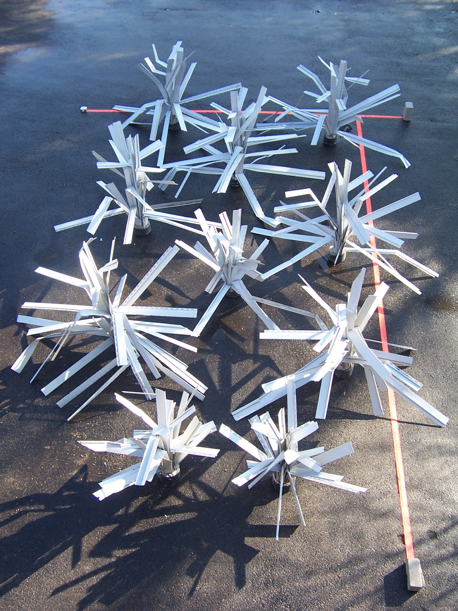
See the dozens of unique artificial fish habitat models, fish attractors and fish cover used at fishiding.com, the leader in  science based, proven, fish protection.

The methodology will incorporate the use of Habitat Suitability Indices (HSI) to provide meaningful and accurate results from data collection in the field. Habitat variables are assessed in the field and are related to water quality, river morphology and hydrology, river banks and riparian vegetation, and benthic macroinvertebrates. The methodology will be modular and varying in the level of depth required so groups with different resources are able to effectively assess their rivers. The methodology will enhance our understanding of fish habitat and populations, lead to effective restoration and protection projects, and improve the health of our aquatic ecosystems.

Counties receive several grants to improve fish habitat

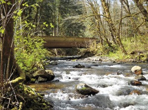
Cowlitz County has a $204,000 grant to remove this bridge on Abernathy Creek.

See the dozens of unique artificial fish habitat models, fish attractors and fish cover used at fishiding.com, the leader in  science based, proven, fish protection.

Several groups that work to improve habitat for endangered fish have been awarded more than $1 million for projects in Cowlitz County. Clark County projects on the Lewis River total $925,383 and money for work in Wahkiakum County totals $361,505.

The grants announced recently by the state Recreation and Conservation Office come from federal and state funds dedicated to fish recovery. The money for the grants comes from the federal Pacific Coastal Salmon Recovery Fund and from the sale of state bonds.

The level of fish funding for most parts of the state has decreased over the past few years. The statewide total of $30 million recently awarded compares to $32 million in 2010 and $42.8 million the year before, said Susan Zemek, communications manager for the RCO.

In addition, grants for fish habitat work in Puget Sound total $13.5 million this year, compared to $33 million a year ago.

Cowlitz County

• Reshaping Abernathy Creek, $486,305. The Cowlitz Indian Tribe will use this grant to remove an abandoned roadbed on the east side of the creek that inhibits full connectivity between the creek and its floodplain, and place logjams in the creek to increase habitat. The tribe will excavate channels through the former roadbed and place logjams in the main channel, allowing the river to meander. The work is on state land.

The tribe will contribute $85,819 in donations of cash, labor and materials.

• Removing an Abernathy Creek Bridge, $204,000. Cowlitz County will use this grant to remove a bridge on an abandoned portion of Abernathy Creek Road. The bridge is 6 1/2 miles up the creek, near Brentwood Road. The bridge constrains the channel and limits the creek’s ability to meander and connect with its floodplain. The county will install logs and tree root wads in the creek and replant its banks after the bridge is removed

Cowlitz County will contribute $36,000.

• Restoring Andrews Tree Farm waterways, $177,401. The Cowlitz Conservation District will use this grant to restore portions of the Coweeman River and a tributary, Turner Creek, on the Andrews Tree Farm. The district will install logs and whole trees in the streams to slow the river, encourage gravel accumulation and create places for salmon to rest and hide from predators. The district also will plant trees along stream banks to shade and cool the water.

The conservation district will contribute $40,000 from a state grant and donations of equipment, labor and materials.

• Restoring Nesbit Tree Farm stream, $89,100. The Cowlitz Conservation District will use this grant to restore a portion of the Coweeman River on the Nesbit Tree Farm, which is about 8 miles up Rose Valley Road. The conservation district will place logs and whole trees in the river to trap sediment on exposed bedrock to improve salmon habitat and cool the water.

The conservation district will contribute $20,000 from a state grant and donations of equipment, labor and materials.

• Restoring the Coweeman River, $124,000. The Conservation District will use this grant to place logs and whole trees in the Coweeman River on the Baxter and Andrews tree farms about 6 1/2 miles up Rose Valley Road to improve habitat for salmon. The logs and trees will slow the river, encourage gravel to accumulate and create places for salmon to rest and hide from predators.

The conservation district will contribute $24,500 from a state grant and donations of equipment, labor and materials.

Clark County

• East Fork of the Lewis River, $212,753. Clark County Public Works will use the money to grade the outlets of two side channels of the river, install logs and root wads that act as juvenile fish habitat, and remove invasive plants and replant with native species. The project will expand side channel habitat by 3,500 square feet. Clark County will contribute $61,891 to the project.

• North Fork of the Lewis River, $401,730. The Cowlitz Tribe will use the money to place logs and jams into two side channels of the river, remove invasive plants along the bank, and replant the area with native trees and shrubs. The tribe will contribute $91,400 from a local grant and donation of labor and materials.

• East Fork of the Lewis River at Daybreak Park, $143,900. Fish First will enhance two side channels of the river, install wood structures in the river for habitat, and replant streambanks with native trees and shrubs at the park. Fish First will contribute $26,100 in cash, labor and materials.

• Eagle Island-North Channel Restoration Project, $167,000. Lower Columbia Fish Enhancement Group will use the money to design a project to restore optimum water flows in the north channel of Eagle Island, which is located in the North Fork of the Lewis River near Woodland. Optimizing the water flow will improve 2.2 miles of high value fish spawning and rearing habitat below Lake Merwin. Pacificorp and the state departments of Natural Resources and Fish and Wildlife are partners.

Wahkiakum County

• Grays River, $226,180. The Lower Columbia Fish Enhancement Group will install wood structures on Columbia Land Trust property in the Grays River to reduce water velocity, create habitat diversity and collect sediments against the toe of eroding stream banks. The structures will create pools, collect flood debris and stabilize the river channel. Additional structures will be placed along more than a half-mile of shoreline to protect important chum salmon habitat in nearby Crazy Johnson Creek. The enhancement group also will remove non-native plants and replant the area with native trees and shrubs.

The enhancement group and Columbia Land Trust will contribute $76,300 in donations of equipment, labor and materials.

• Elochoman River, $135,325. The Wahkiakum Conservation District will use this grant to place logs and tree root wads in the Elochoman River, to slowing the river and creating places for salmon to rest and hide from predators. The logs and root wads also help stabilize the channel by reducing erosion and protecting young trees on the riverbanks. The work will improve salmon habitat along more than a half-mile of the river and create a streamside forest on 4.5 acres.

The conservation district will contribute $39,500 from federal and local grants and donations of equipment and labor.

Culverts open up new fish habitats

Swimming against the current won’t be quite as hard for fish in parts of the Siuslaw basin thanks to a project that replaced 11 culverts on creeks southwest of Eugene.

The culverts opened a passage to upstream habitat on three creeks that was effectively blocked by the old pipes. Buck, Hawley and Esmond creeks could start seeing runs of coho and chinook salmon and steelhead trout as a result of the fixes. See the dozens of unique artificial fish habitat models, fish attractors and fish cover used at fishiding.com, the leader in  science based, proven, fish protection.

The $1.5 million project took place over the summer and was funded with a federal stimulus grant. Road repairs also were done as part of the project.

The work took place on the U.S. Bureau of Land Management’s Eugene District. The creeks all feed into the Siuslaw River drainage. The new culverts replaced old pipes that were failing or that blocked fish passage because of their small size or erosion around the outlets.

Jennifer O’Leary, a BLM spokeswoman, said the new culverts are specially designed to aid fish. Not only are they larger in diameter, they also are oblong in shape to create a wider, more natural passage.

Also, rocks and sediment are placed in the culvert to simulate the natural creek and slow the water so it flows at the same speed as the rest of the creek.

“What this does is allow for more natural rates of flow while restoring the natural width of the stream channel,” she said. “It’s all about restoring more natural conditions out there in the watershed.”

Many older culverts aren’t big enough for the stream volume, causing water to speed up and jet through the pipe, clearing out any natural material and making it hard for fish to navigate upstream. And because of erosion on the downstream side where water exits, many older pipes now sit well above the stream level, blocking young fish from migrating downstream.

With the new culverts in place, fish will have an easier time. That means areas that had been off limits before will now be reachable.

“The habitat above these (new) culverts is healthy and intact,” said Leo Poole, fisheries biologist for the BLM’s Siuslaw Resource Area. “All we needed to do was open up the passage for fish and other aquatic species to get there.”

Work on the creeks only can be done during a summer window from July 1 to Sept. 15. To get all the culverts replaced in that relatively brief opening, the BLM worked with an agency of the Federal Highway Administration known as the Western Federal Lands Highway Division.

That agency contracted with area engineering and construction firms to design and build the culverts. The number of jobs created by the project wasn’t available this week, but O’Leary said it was at least a dozen and possibly more.

The BLM has done a number of other projects aimed at improving fish habitat in the area. Previous work added boulders and gravel to portions of the Siuslaw River, creating spawning beds, lowering water temperature and providing refuges where fish can rest.

BY GREG BOLT

The Register-Guard

Project aims to show crops, marshland can coexist for fish habitat and flood control

Paul Chinn / The Chronicle

A flock of birds flies over the Yolo Bypass near Woodland, where conservationists hope to restore ancient floodplains.

Woodland, Yolo County —

Five acres of mud and rice stubble doesn’t look much like fish habitat, but the rectangular patch of summertime cropland is in the process of being converted to a teeming marsh filled with young salmon.

The conversion to wetland of the rice paddy at Knaggs Ranch, north of Woodland next to the Yolo Bypass, is an experiment that conservationists hope will eventually lead to the restoration of ancient floodplains all along the Sacramento and San Joaquin River corridors.

The small piece of soon-to-be-flooded cropland is an attempt to combine agriculture with habitat restoration, flood prevention with the creation of more floodplain.

“There is a real push to just build levees higher and bigger rather than really taking into account ecosystem functions,” said Jacob Katz, a biologist with the Center for Watershed Sciences at UC Davis. “We are hoping to say, ‘Look, this is how you do it. You can protect against flooding this way, too.’ ”

Breaching levees

The experiment, which involves the breaching of levees protecting the lower 5 acres of a 1,700-acre rice farm, is one example of the kind of innovation that conservationists hope will be inspired by California’s first ever attempt to create a systemwide plan to manage floods.

The $4.9 billion FloodSAFE initiative, which was created by the Central Valley Flood Protection Act in 2006, involves an ambitious program to increase public safety, promote long-term economic stability and improve environmental stewardship in the areas that have historically flooded during winter rains.

The state Department of Water Resources will issue a draft of its flood protection plan on Dec. 30, to be followed by a public comment period and hearings. The Central Valley Flood Protection Board, a panel of experts appointed by the Legislature, will have until July 1, 2012, to adopt the plan.

Salmon and rice

The document will set guidelines for flood protection and funding along the Sacramento River and around the Yolo Bypass, which was built almost a century ago as a relief valve for Sacramento River flood water. The specific programs will be developed by local and regional governments and communities.

The Knaggs Ranch study is being conducted by UC Davis, the state Department of Water Resources and rice paddy owner John Brennan, with support from Cal Trout and Trout Unlimited.

The plan is to trap the floodwater over the next month and, on Feb. 1, introduce 10,000 to 20,000 juvenile chinook salmon captured from the Feather River. Marshland habitat, including native grasses, is being restored inside the 5-acre plot.

Biologists will study the fish, waterfowl and nutrients in the water to determine the health of the wetland and to see how well the rice straw breaks down. One concern, Katz said, is that too much rotting rice straw could suck the oxygen out of the water and kill the fish.

Testing the waters

The researchers want to determine the right biological mix and, in collaboration with the owner, expand the off-season wetlands project to cover the entire 1,700 acres.

The hope, assuming all goes well, is that access points would eventually be designed so that migrating salmon in the Sacramento River could enter restored floodplains throughout the 59,000 acres of agricultural land in the Yolo Bypass and elsewhere along the Sacramento-San Joaquin River Delta.

It is important because the delta, built to funnel water through the 1,300-square-mile confluence of the Sacramento and San Joaquin rivers, is the heart of California’s vast water network. The system of levees, dams, channels and pumps funnels snowmelt from the Sierra Nevada to 25 million people in the Bay Area, Central Valley and Southern California.

The network was designed not just to provide drinking water, but also to prevent the kind of epic flooding that once occurred regularly in the Central Valley. Flooding was so bad in the winter of 1861-62 that the entire Central Valley became a vast lake.

Flooded rice farms

The Yolo Bypass was approved in 1917 as an outlet for floodwaters every couple of years when the Sacramento River overtops what is known as the Fremont Weir. The land beneath the bypass, which is reserved for agriculture during the summer, becomes an inland sea during heavy flooding.

See the dozens of unique artificial fish habitat models, fish attractors and fish cover used at fishiding.com, the leader in  science based, proven, fish protection.

Migratory waterfowl regularly visit the flooded rice farms and a small area of restored wetlands called the Yolo Bypass Wildlife Area. Sometimes juvenile salmon spill over the weir into the bypass, but the area is not designed for fish, which often become trapped, when the water subsides, and die in evaporating pools.

Staggering fish migration

It is one of many reasons fisheries biologists believe California’s once vast population of chinook salmon has been declining despite an enormous yearly infusion of hatchery-raised fish. Only about 5 percent of the original Sacramento floodplains still exist, Katz said.

The creation of a statewide flood management plan is an opportunity to restore the floodplains where migrating fish historically rested, foraged for food and fattened up before returning to the river, Katz said. It would also stagger the migration over the course of the winter and spring season.

“Floodplains are important for foraging fish and for creating a more diverse portfolio of life histories,” Katz said. “By taking away floodplains and channeling them into rivers, we have taken that diversity away.”

The original idea behind the FloodSAFE initiative was to shore up the system of levees in the delta, which have failed 166 times over the past 100 years. The danger of flooding is now worse than ever, according to experts, who point out that the sea level is rising and land in the Central Valley is subsiding.

The state’s flood management plan, which could cost as much as $16 billion to fully implement, is expected to include a major expansion of the Yolo Bypass.

“By expanding the bypass we open the door for increased ecosystem restoration while getting the dual benefit of reducing flood risk,” said Michael Mierzwa, the supervising engineer and flood policy adviser for the Department of Water Resources. “The caveat that I put on that is that it is going to take decades to implement.”

Commitment in spotlight

The level of commitment to ecosystem restoration is the major concern among many environmentalists. Many local community leaders are vehemently opposed to converting farmland into wetlands. One big reason, Mierzwa said, is because both the agricultural land and the product grown on it are taxable. When you take a rice farm out of production, he said, you reduce the tax revenues which are, in turn, used to maintain the flood system.

The Knaggs Ranch experiment, Katz said, is designed to show how floodplain and habitat restoration can be accomplished without taking agricultural land out of production.

“We’re really talking about a paradigm shift in the way we push water around the landscape,” Katz said. “It’s going to be much cheaper to invest in a system that incorporates floodplain restoration now than it will be in the future. It will be better for ducks, better for fish and better for farms.”

E-mail Peter Fimrite at pfimrite@sfchronicle.com.

This article appeared on page A – 1 of the San Francisco Chronicle

 Peter Fimrite, Chronicle Staff Writer

Read more: http://www.sfgate.com/cgi-bin/article.cgi?f=/c/a/2011/12/25/MNDK1MEG6S.DTL&ao=2#ixzz1hxOgl0e2

 Read more: http://www.sfgate.com/cgi-bin/article.cgi?f=/c/a/2011/12/25/MNDK1MEG6S.DTL#ixzz1hxOTvmlR

Fish passage boasts jobs, increases fish habitat

The News-Review
If the fish only knew all of the work taking place on their behalf, they’d likely be amazed. They also might be pleased to know that their needs have put people to work at a time when jobs are tough to come by.

Nearly 60 miles up the North Umpqua River from Roseburg, a huge effort is under way to increase and improve the habitat for the steelhead, spring chinook, coho salmon and Pacific lamprey that make their way up the Wild and Scenic River to spawn.

A fish ladder is being built at Soda Springs Dam so the fish will be able to swim beyond the dam for the first time in more than 50 years, exploring another four miles of the North Umpqua River and returning to the spawning beds of their ancestors in three miles of Fish Creek.

See the dozens of unique artificial fish habitat models, fish attractors and fish cover used at fishiding.com, the leader in  science based, proven, fish protection.

Every aspect of the project takes the fish into account, whether it’s sealing the concrete or rounding out the inside corners of the fish ladder to ensure a safe and appealing passage past the 77-foot-high dam.

Of course, if the dam weren’t there, the native fish already would be swimming unimpeded through the narrow canyon of the North Umpqua. But since the North Umpqua Hydroelectric Project, which includes eight dams, has been in place since the 1950s and provides a substantial amount of electricity, the fish ladder is a compromise.

PacifiCorp expects to spend about $60 million on the fish passage at Soda Springs before it’s completed at the end of 2012. The fish passage is uniquely engineered for the geological features of the river canyon. The company estimated the cost of removing the dam, a solution sought by conservation groups, would have been about the same, but electricity rates would have increased because of the lost hydropower.

Soda Springs generates enough electricity each year to power about 40,000 homes — that’s just short of the number of households in Douglas County. More importantly, company officials say it’s a regeneration dam that produces electricity that can be stored and used during peak demand times.

Despite its steep price tag, the fish passage is small compared to the many massive projects PacifiCorp is involved in throughout the Northwest. Rates are expected to creep by less than 1 percent to pay for the construction project.

That makes it like a stimulus strategy that came along at the right time. While the construction business has been slow elsewhere, the tiny village of Toketee has been bustling with heavy equipment, trucks and workers since the project began in 2010. General contractor is Todd Construction of Tualatin, which was previously located in Roseburg.

The largest subcontractor, Weekly Bros. Inc. of Idleyld Park, hired extra employees to work on the fish ladder. As many as 80 people were on the job this past summer for the company.

Even with winter setting in, anywhere from 50 to 100 people are working on the project daily, making the site appear as if it’s crawling with workers in reflective vests and hard hats.

Between the additional jobs, the promise of clean hydropower well into the future and the re-opening of historic fish habitat, this is a project that’s worth the effort and expense.

Stillwaters Environmental Center for fish habitat enhancement gets it done

Olympic Fly Fishers of Edmonds plan Dec. 14 fund-raising auction

The Olympic Fly Fishers of Edmonds are hosting their annual dinner/auction Wednesday, Dec. 14th, to raise funds for a variety of conservation programs. The event begins at 6 p.m. at the Edmonds Senior Center. See the dozens of unique artificial fish habitat models, fish attractors and fish cover used at fishiding.com, the industry leader in science based, man made and artificial fish habitat, proven to provide all fish with cover they prefer to prosper.

Last year’s dinner raised more than $4,000 that was used to support the Western Rivers Conservancy, an organization that focuses on the purchase of critical stream and estuary habitat; the Coastal Conservation Association of Washington, a grassroots organization that advocates for fish and fish habitat; and Long Live the Kings, which works toward restoring wild salmon to Pacific Northwest waters.

Last year the club also donated funds to the Stillwaters Environmental Center for fish habitat enhancement and is currently working with the Edmonds School District to encourage teachers to incorporate fish conservation into elementary school science projects.

This year’s auction will include a traditional live auction for a number of guided fishing trips, fishing equipment and an estate planning and will development session with a local attorney. The silent auction portion of the event will feature a large assortment of fishing-related equipment, outdoor clothing and gear, and raffle tickets will be sold for a chance to win gift baskets, books, wines, a barbecue grill and other items.

Tickets for the dinner are $50 per person. For more information and ticket-reservations for the dinner auction, contact Dave Gross at 425-582-7290 or by email: gross1@illinois.edu.

BUREAU SLAMMED FOR ‘NEEDLESS’ LOSS OF SALMON EGGS AND FISH HABITAT


Three irrigation districts are blaming the federal Bureau of Reclamation for failing to adjust water releases from New Melones Reservoir to protect spawning Chinook salmon in the Stanislaus River.

The districts contend the federal agency failed to heed their repeated warnings to more aggressively reduce reservoir storage throughout the year. As a result of high flows during the fall spawning season, more than 10 percent of the salmon eggs appear to have been wiped out between the Knights Ferry and Orange Blossom (Honolulu Bar) area on the Stanislaus River based on work conducted by a team of fishery research scientists with the Oakdale-based FISHBIO firm.

Nearly continuous high water flows during October resulted in salmon spawning in side channels and other areas of high flow. The lowering of the flows led to the eggs of the “species of concern” under the federal Endangered Species Act being wiped out. The eggs were destroyed in at least 23 redds, where salmon nest and spawn, in the Knights Ferry to Orange Blossom area alone.

“We have been warning the Bureau since mid-summer,” noted Steve Knell, general manager of the Oakdale Irrigation District. “We told the (Bureau) this would happen if they didn’t manage their water releases. We didn’t want the salmon to nest in the floodplain during high flows, only to get stranded if the flows were reduced. For whatever reason, the (Bureau) ignored our concerns and the result was a significant and needless loss of salmon.”

Joining OID in criticizing the Bureau were the South San Joaquin Irrigation District and the Stockton East Water District. The OID and SSJID have spent over $1 million in the past decade working to improve fish habitat and survival on the Stanislaus River.

Fall-run Chinook salmon represent the only race of salmon that spawn in the Stanislaus River. Fall-run Chinook salmon need flow rates of approximately 300 to 500 cubic feet per second of water flow beginning in early October each year, to maximize spawning success.

“This year, the (Bureau) maintained flows in excess of 2,000 (cubic feet per second) until Nov. 2,” according to Jeff Shields, SSJID general manager.

“These salmon spawned in areas where the high flows covered the redds,” he added. “When the (Bureau) reduced the river flows, the redds became dewatered.”

Earlier this year the SSJID and OID succeeded in convincing the federal district court judge that a proposed federal operating plan to send massive amounts of water down the Stanislaus in a bid to protect salmon would ultimately be counterproductive. That’s because the pool of water behind New Melones would be so low in some years that the temperature of the “cold water storage” on the bottom of the reservoir would raise water temperatures sufficiently to kill fish.

Fish biologist Doug Demko said there had been an increase in the number of fall-run salmon returning to spawn in the Stanislaus River this year. The OID invested heavily in creating new spawning areas for the salmon as well. Demko said the Bureau’s management of New Melones releases means the number of juvenile fish heading to the Pacific Ocean this year will be reduced, which in turn will further cut the amount of adults that return in subsequent years to spawn.

Demko said the Bureau was sent a memorandum in July warning of the danger of heavy release in the spawning season but got no response.

The Bureau has not responded to requests for an explanation of why releases were allowed to jeopardize the survival of the Chinook salmon.

See the dozens of unique artificial fish habitat models, fish attractors and fish cover used at fishiding.com, the industry leader in science based, man made and artificial fish habitat, proven to provide all fish with cover they prefer to prosper.

Manteca Bulletin Managing Editor Dennis Wyatt contributed to this report.


Instream and adjacent habitat improvements will be completed for the Manistee River,Michigan

2011 10 “Waters to Watch” Project Updates
THURSDAY, 06 OCTOBER 2011 15:00
Manistee River, MI (Great Lakes Basin FHP)
Staudinger’s and Scoy Ponds, NY (Atlantic Coastal FHP)
Llano River, TX (Southeast Aquatic Resources Partnership)
Barataria Bay, LA (Southeast Aquatic Resources Partnership) 

Purpose of the project
The Conservation Resource Alliance will coordinate the replacement of a degraded road crossing with a timber bridge and the complete restoration of the Flowing Wells Trout Farm for fish passage and habitat improvement.  Implementing this project will open up approximately 31 miles of tributary for fish passage and improve approximately 4 miles of instream habitat on the North Branch of the Manistee River.

The stream will no longer be impounded, sand and sediment will be transported naturally, stream temperatures will recover, stream habitat will improve, and wild brook trout will be able to return to a reach that has been segmented by 12 dams and two dredged channels for approximately 40 years. This project will also improve the overall ecological health of the riparian corridor by improving uplands and wetlands adjacent to the instream restoration work.

Project Timeline
Major earth moving and dam removal at the Flowing Well property will be complete by the fall of 2011.  Additional reptile and amphibian monitoring as well as instream and adjacent habitat improvements will be completed during the summer and fall of 2012.  The bridge at Mecum Road is scheduled to be completed by late 2011.

Partners
The Conservation Resource Alliance is spearheading this project and closely working with the following partners:  National Fish and Wildlife Foundation; U.S. Fish and Wildlife Service; Michigan Department of Natural Resources; Michigan Department of Environmental Quality; Kalkaska County Road Commission; Kalkaska County Conservation District; Upper Manistee River Restoration Committee, Trout Unlimited, USDA-Natural Resources Conservation Service; and Huron Pines.

Updates/Changes
At the Flowing Well Property the following items have been completed.

1st. Quarter, 2011
* Established project timeline for 2011 field season.
* Removed an abandoned beaver dam on upper portion of Flowing Well Creek, blocked adjacent dredged channel, diverted flow back into natural channel.
* Received all required permits including NEPA, SHPO, MDNR, MDEQ, SESC, and Natural Rivers.
* Conducted 2 meetings for potential contractors to begin the bidding process.

2nd Quarter, 2011
* Subcontractor conducted the second season of reptile, amphibian, and macroinvertebrate monitoring, a final report is pending.
* Two volunteer workdays were conducted to clear debris from the N. Branch of the Manistee with project partners (USFWS, MDNR, Trout Unlimited)
* Cleared both Flowing Well Creek and the North Branch of the Manistee River of excess woody debris and blockages including 7 large beaver dams.
* Removed the earthen berm and a buried culvert on Flowing Well Creek using CRA staff and a locally hired work crew. Water is now flowing in its natural banks.
* Performed gradual drawdowns by removing boards at dams #3, #7, and #8, all boards have now been removed.

See the dozens of unique artificial fish habitat models, fish attractors and fish cover used at fishiding.com, the industry leader and only science based, man made and artificial fish habitat, proven to provide all fish with cover they prefer to prosper.

At the Mecum Road site the following has been completed.
* Seven project partner meetings were held to discuss project progress (2 on-site, 2 at road commission office, and 3 committee meetings).
* Contracting, bidding, and legal review of documents.
* County, State and Federal permits obtained: SESC, SHPO, NEPA, MDEQ, and MDNR Natural Rivers.
* Property owner outreach and easement – State of Michigan use permit and permission for easement from 1 private parcel on southwest corner of road crossing.
* Survey, hydraulic analysis, soil borings/analysis, and bridge design completed.

Media coverage updates

http://www.michiganrivernews.com/2011/06/river-rehab-projects-put-michigan-in-national-spotlight/

http://environmentreport.org/show.php?showID=544

Scroll to Top