StructureSpot

Project aims to show crops, marshland can coexist for fish habitat and flood control

Paul Chinn / The Chronicle

A flock of birds flies over the Yolo Bypass near Woodland, where conservationists hope to restore ancient floodplains.

Woodland, Yolo County —

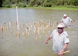
Five acres of mud and rice stubble doesn’t look much like fish habitat, but the rectangular patch of summertime cropland is in the process of being converted to a teeming marsh filled with young salmon.

The conversion to wetland of the rice paddy at Knaggs Ranch, north of Woodland next to the Yolo Bypass, is an experiment that conservationists hope will eventually lead to the restoration of ancient floodplains all along the Sacramento and San Joaquin River corridors.

The small piece of soon-to-be-flooded cropland is an attempt to combine agriculture with habitat restoration, flood prevention with the creation of more floodplain.

“There is a real push to just build levees higher and bigger rather than really taking into account ecosystem functions,” said Jacob Katz, a biologist with the Center for Watershed Sciences at UC Davis. “We are hoping to say, ‘Look, this is how you do it. You can protect against flooding this way, too.’ ”

Breaching levees

The experiment, which involves the breaching of levees protecting the lower 5 acres of a 1,700-acre rice farm, is one example of the kind of innovation that conservationists hope will be inspired by California’s first ever attempt to create a systemwide plan to manage floods.

The $4.9 billion FloodSAFE initiative, which was created by the Central Valley Flood Protection Act in 2006, involves an ambitious program to increase public safety, promote long-term economic stability and improve environmental stewardship in the areas that have historically flooded during winter rains.

The state Department of Water Resources will issue a draft of its flood protection plan on Dec. 30, to be followed by a public comment period and hearings. The Central Valley Flood Protection Board, a panel of experts appointed by the Legislature, will have until July 1, 2012, to adopt the plan.

Salmon and rice

The document will set guidelines for flood protection and funding along the Sacramento River and around the Yolo Bypass, which was built almost a century ago as a relief valve for Sacramento River flood water. The specific programs will be developed by local and regional governments and communities.

The Knaggs Ranch study is being conducted by UC Davis, the state Department of Water Resources and rice paddy owner John Brennan, with support from Cal Trout and Trout Unlimited.

The plan is to trap the floodwater over the next month and, on Feb. 1, introduce 10,000 to 20,000 juvenile chinook salmon captured from the Feather River. Marshland habitat, including native grasses, is being restored inside the 5-acre plot.

Biologists will study the fish, waterfowl and nutrients in the water to determine the health of the wetland and to see how well the rice straw breaks down. One concern, Katz said, is that too much rotting rice straw could suck the oxygen out of the water and kill the fish.

Testing the waters

The researchers want to determine the right biological mix and, in collaboration with the owner, expand the off-season wetlands project to cover the entire 1,700 acres.

The hope, assuming all goes well, is that access points would eventually be designed so that migrating salmon in the Sacramento River could enter restored floodplains throughout the 59,000 acres of agricultural land in the Yolo Bypass and elsewhere along the Sacramento-San Joaquin River Delta.

It is important because the delta, built to funnel water through the 1,300-square-mile confluence of the Sacramento and San Joaquin rivers, is the heart of California’s vast water network. The system of levees, dams, channels and pumps funnels snowmelt from the Sierra Nevada to 25 million people in the Bay Area, Central Valley and Southern California.

The network was designed not just to provide drinking water, but also to prevent the kind of epic flooding that once occurred regularly in the Central Valley. Flooding was so bad in the winter of 1861-62 that the entire Central Valley became a vast lake.

Flooded rice farms

The Yolo Bypass was approved in 1917 as an outlet for floodwaters every couple of years when the Sacramento River overtops what is known as the Fremont Weir. The land beneath the bypass, which is reserved for agriculture during the summer, becomes an inland sea during heavy flooding.

See the dozens of unique artificial fish habitat models, fish attractors and fish cover used at fishiding.com, the leader in  science based, proven, fish protection.

Migratory waterfowl regularly visit the flooded rice farms and a small area of restored wetlands called the Yolo Bypass Wildlife Area. Sometimes juvenile salmon spill over the weir into the bypass, but the area is not designed for fish, which often become trapped, when the water subsides, and die in evaporating pools.

Staggering fish migration

It is one of many reasons fisheries biologists believe California’s once vast population of chinook salmon has been declining despite an enormous yearly infusion of hatchery-raised fish. Only about 5 percent of the original Sacramento floodplains still exist, Katz said.

The creation of a statewide flood management plan is an opportunity to restore the floodplains where migrating fish historically rested, foraged for food and fattened up before returning to the river, Katz said. It would also stagger the migration over the course of the winter and spring season.

“Floodplains are important for foraging fish and for creating a more diverse portfolio of life histories,” Katz said. “By taking away floodplains and channeling them into rivers, we have taken that diversity away.”

The original idea behind the FloodSAFE initiative was to shore up the system of levees in the delta, which have failed 166 times over the past 100 years. The danger of flooding is now worse than ever, according to experts, who point out that the sea level is rising and land in the Central Valley is subsiding.

The state’s flood management plan, which could cost as much as $16 billion to fully implement, is expected to include a major expansion of the Yolo Bypass.

“By expanding the bypass we open the door for increased ecosystem restoration while getting the dual benefit of reducing flood risk,” said Michael Mierzwa, the supervising engineer and flood policy adviser for the Department of Water Resources. “The caveat that I put on that is that it is going to take decades to implement.”

Commitment in spotlight

The level of commitment to ecosystem restoration is the major concern among many environmentalists. Many local community leaders are vehemently opposed to converting farmland into wetlands. One big reason, Mierzwa said, is because both the agricultural land and the product grown on it are taxable. When you take a rice farm out of production, he said, you reduce the tax revenues which are, in turn, used to maintain the flood system.

The Knaggs Ranch experiment, Katz said, is designed to show how floodplain and habitat restoration can be accomplished without taking agricultural land out of production.

“We’re really talking about a paradigm shift in the way we push water around the landscape,” Katz said. “It’s going to be much cheaper to invest in a system that incorporates floodplain restoration now than it will be in the future. It will be better for ducks, better for fish and better for farms.”

E-mail Peter Fimrite at pfimrite@sfchronicle.com.

This article appeared on page A – 1 of the San Francisco Chronicle

 Peter Fimrite, Chronicle Staff Writer

Read more: http://www.sfgate.com/cgi-bin/article.cgi?f=/c/a/2011/12/25/MNDK1MEG6S.DTL&ao=2#ixzz1hxOgl0e2

 Read more: http://www.sfgate.com/cgi-bin/article.cgi?f=/c/a/2011/12/25/MNDK1MEG6S.DTL#ixzz1hxOTvmlR

Catastrophe strikes Coho-laden creek

Oil spill stains urban miracle in Colquitz Creek

ColquitzSalmon1PNov3011.jpg

Three-year-olds Anabelle Irvine Topping, left, and Cyrus Lessard, from Playtime Preschool, get a close look at a spawned out male Coho salmon, held by volunteer Dorothy Chambers, during a visit to the fish counting fence in Cuthbert Holmes Park last Thursday.

Don Denton/News staff

“This is a teenager, a Jack” he says, referring to the youthful age of the three-year-old salmon. “He’s protecting the genetics of this river.”

A group of wide-eyed preschoolers listening to his presentation are unfazed by the explanation – their attention is focused on the fish dangling in the net in front of them.

“A salmon!” one girl exclaims excitedly.

Unbeknownst to her and her schoolmates, seeing a good stock of grown salmon in Colquitz Creek is something Bos and two other passionate volunteers have had to work extremely hard to achieve.

At the far end of the short metal footbridge that traverses the creek, a large wooden box partially submerged underwater is the best tool of the trade for the trio of volunteers protecting the natural habitat that thrives in Cuthbert Holmes Park, behind Tillicum Centre.

The box itself is a counting fence. The fish heading back upstream from the ocean via the Gorge waterway are funnelled inside so the volunteers can collect numerical data on the fish returning to spawn.

So far this year 252 fish have turned up in the counting fence. That includes 162 counted last Tuesday alone.

The numbers this year are indicative of a stable habitat. See the dozens of unique artificial fish habitat models, fish attractors and fish cover used at fishiding.com, the industry leader in science based, fish habitat, proven to provide all fish with cover they prefer to prosper.

Last year, only 52 fish returned to spawn, but there have been years where nearly 700 have come back. The volunteers will continue counting fish until mid-December.

“We’re getting one-third adult males return, one-third adult females and one-third Jacks – that’s a good sign for the future population,” Bos says.

“If you don’t know how the health of the creek is, you have no idea if you have to do mitigation (to improve spawning numbers). … Right now you can say it’s a healthy creek.”

Catastrophe strikes Coho-laden creek

But that health is now in jeopardy, as an estimated 1,000 litres of home heating oil leaked into the river last week, killing dozens of fish over the weekend.

“The sight of the salmon at the surface gasping for air and swimming erratically was sickening,” said Dorothy Chambers, who volunteers alongside Bos.

The source of the leak has been tracked to a home on Kenneth Street, said Mike Ippen, Saanich’s director of public works. Crews installed booms at five locations downstream of the spill on Friday to minimize any further environmental impact.

Chambers said the counting fence was covered in oil Sunday, despite assurances from Saanich that steps had been taken to ensure the booms were working.

“The oil was rapidly free-flowing over the band-aids,” she said.

A sixth boom was added Sunday and Ippen is hopeful the worst is over.

“The leak has been found, the (homeowner’s) connection has been isolated from the drainage system, so it could very well be that most of the product is already through the Colquitz. Now it’s dealing with the residue that’s stuck on plants and things like that,” he said.

Adriane Polland, manager of environmental services for Saanich, says the municipality is “a little bit scattered” as to the timeline of events late last week, but says there’s optimism now, as live fish have been spotted between the spill and counting fence.

“It’s our most important watershed, it’s our biggest watershed, and keeping the salmon run going in this system is very important for the salmon, and also as an indicator species of the health of the creek,” she said.

The Ministry of Environment and Department of Fisheries and Oceans (DFO) are also looking into the oil spill.

Though leaking heating tanks don’t always come with such environmentally dire consequences, Pollard said Saanich needs to improve its messaging to homeowners to ensure they have their tanks inspected and maintained on a more regular basis.

“The public living in town get a chance to see fish in their natural habitat (in this creek) and this provides an understanding of the impact that urbanization has on our water systems, our watersheds,” she said.

Chambers isn’t sure just how badly the salmon spawn will be affected yet.

Oil’s long-term effect unknown

The salmon, in ideal conditions, would continue swimming up Colquitz Creek, well past Tillicum Centre, and will lay between 3,000 and 5,000 eggs in the waterway near Quick’s Bottom Park and the Royal Oak neighbourhood. The adult fish then reach the end of their life cycle and their carcasses provide the creek with nutrients.

Bos, Chambers and fellow volunteer Barrie Goodwin don’t just count the number of fish, they also identify the species and sex, measure each one, and inspect its visual health (looking for such things as bite marks or net and hook marks).

All that information is then provided to the DFO to help with monitoring of the national fish stock.

“What they do for us is huge,” says Tom Rutherford, acting sector head for community involvement and resource restoration with DFO. “We have a mandate to protect fish and fish habitat, and it’s easy for us to protect it if we know the fact that there’s a vibrant run in that system. It gives our regulatory folks a leg up to make sure we protect the habitat that’s there.

“The Colquitz project is a highly urban system. It goes past Tillicum Mall, under the Trans-Canada – it’s not pristine wilderness. These small runs of urban salmon are important to us,” Rutherford adds.

Bos calls their contribution just “one piece of the jigsaw” to ensure enhancements are made – both streamside and oceanside – so the fish have a better chance at survival now and in the future.

If it weren’t for the trio of volunteers who are creekside daily counting the fish, the gravity of the oil spill may not have been known for some time and the environmental impact could have been even more severe.

“The counting fence has been removed so the Coho can try to escape back out to the ocean.  They will die, they will not spawn, but we cannot keep them heading upstream into such a toxic environment,” Chambers said. “We are very worried that it will kill this year’s salmon run.”

kslavin@saanichnews.com

Stillwaters Environmental Center for fish habitat enhancement gets it done

Olympic Fly Fishers of Edmonds plan Dec. 14 fund-raising auction

The Olympic Fly Fishers of Edmonds are hosting their annual dinner/auction Wednesday, Dec. 14th, to raise funds for a variety of conservation programs. The event begins at 6 p.m. at the Edmonds Senior Center. See the dozens of unique artificial fish habitat models, fish attractors and fish cover used at fishiding.com, the industry leader in science based, man made and artificial fish habitat, proven to provide all fish with cover they prefer to prosper.

Last year’s dinner raised more than $4,000 that was used to support the Western Rivers Conservancy, an organization that focuses on the purchase of critical stream and estuary habitat; the Coastal Conservation Association of Washington, a grassroots organization that advocates for fish and fish habitat; and Long Live the Kings, which works toward restoring wild salmon to Pacific Northwest waters.

Last year the club also donated funds to the Stillwaters Environmental Center for fish habitat enhancement and is currently working with the Edmonds School District to encourage teachers to incorporate fish conservation into elementary school science projects.

This year’s auction will include a traditional live auction for a number of guided fishing trips, fishing equipment and an estate planning and will development session with a local attorney. The silent auction portion of the event will feature a large assortment of fishing-related equipment, outdoor clothing and gear, and raffle tickets will be sold for a chance to win gift baskets, books, wines, a barbecue grill and other items.

Tickets for the dinner are $50 per person. For more information and ticket-reservations for the dinner auction, contact Dave Gross at 425-582-7290 or by email: gross1@illinois.edu.

BUREAU SLAMMED FOR ‘NEEDLESS’ LOSS OF SALMON EGGS AND FISH HABITAT


Three irrigation districts are blaming the federal Bureau of Reclamation for failing to adjust water releases from New Melones Reservoir to protect spawning Chinook salmon in the Stanislaus River.

The districts contend the federal agency failed to heed their repeated warnings to more aggressively reduce reservoir storage throughout the year. As a result of high flows during the fall spawning season, more than 10 percent of the salmon eggs appear to have been wiped out between the Knights Ferry and Orange Blossom (Honolulu Bar) area on the Stanislaus River based on work conducted by a team of fishery research scientists with the Oakdale-based FISHBIO firm.

Nearly continuous high water flows during October resulted in salmon spawning in side channels and other areas of high flow. The lowering of the flows led to the eggs of the “species of concern” under the federal Endangered Species Act being wiped out. The eggs were destroyed in at least 23 redds, where salmon nest and spawn, in the Knights Ferry to Orange Blossom area alone.

“We have been warning the Bureau since mid-summer,” noted Steve Knell, general manager of the Oakdale Irrigation District. “We told the (Bureau) this would happen if they didn’t manage their water releases. We didn’t want the salmon to nest in the floodplain during high flows, only to get stranded if the flows were reduced. For whatever reason, the (Bureau) ignored our concerns and the result was a significant and needless loss of salmon.”

Joining OID in criticizing the Bureau were the South San Joaquin Irrigation District and the Stockton East Water District. The OID and SSJID have spent over $1 million in the past decade working to improve fish habitat and survival on the Stanislaus River.

Fall-run Chinook salmon represent the only race of salmon that spawn in the Stanislaus River. Fall-run Chinook salmon need flow rates of approximately 300 to 500 cubic feet per second of water flow beginning in early October each year, to maximize spawning success.

“This year, the (Bureau) maintained flows in excess of 2,000 (cubic feet per second) until Nov. 2,” according to Jeff Shields, SSJID general manager.

“These salmon spawned in areas where the high flows covered the redds,” he added. “When the (Bureau) reduced the river flows, the redds became dewatered.”

Earlier this year the SSJID and OID succeeded in convincing the federal district court judge that a proposed federal operating plan to send massive amounts of water down the Stanislaus in a bid to protect salmon would ultimately be counterproductive. That’s because the pool of water behind New Melones would be so low in some years that the temperature of the “cold water storage” on the bottom of the reservoir would raise water temperatures sufficiently to kill fish.

Fish biologist Doug Demko said there had been an increase in the number of fall-run salmon returning to spawn in the Stanislaus River this year. The OID invested heavily in creating new spawning areas for the salmon as well. Demko said the Bureau’s management of New Melones releases means the number of juvenile fish heading to the Pacific Ocean this year will be reduced, which in turn will further cut the amount of adults that return in subsequent years to spawn.

Demko said the Bureau was sent a memorandum in July warning of the danger of heavy release in the spawning season but got no response.

The Bureau has not responded to requests for an explanation of why releases were allowed to jeopardize the survival of the Chinook salmon.

See the dozens of unique artificial fish habitat models, fish attractors and fish cover used at fishiding.com, the industry leader in science based, man made and artificial fish habitat, proven to provide all fish with cover they prefer to prosper.

Manteca Bulletin Managing Editor Dennis Wyatt contributed to this report.


Derelict boats burying prime fish habitat.

 Derelict boats that are along the White Salmon River, as well as other garbage, could get stuck at the mouth of the Columbia River, muddying up and burying prime fish habitat.

Those abandoned boats simply <i>have</i> to go

»PLAY VIDEO

COLUMBIA RIVER GORGE – The White Salmon River is in for somewhat of an overhaul.

When the Condit Dam is dismantled, Continue reading “Derelict boats burying prime fish habitat.”

Anglers to be honoured for support for salmon renewal

Larry Peterson and Nick Strussi met through their shared love of fishing.

When they came together in the late 1990s to help protect fish habitat during construction of the Island Highway through the Comox Valley, they became a formidable force Continue reading “Anglers to be honoured for support for salmon renewal”

Reclaiming trees for fish habitat

Like ostriches with their heads in the sand, tall redwood trees have burrowed into the creek’s north bank, leaving their bushy root balls sticking out in the stream bed.

Never have Napa redwood trees behaved so strangely Continue reading “Reclaiming trees for fish habitat”

Stream restoration hurts fish more than grazing

Some ranchers in eastern Oregon are crying foul over a stream restoration project they believe has caused more harm to threatened fish than cattle grazing. See the dozens of unique artificial fish habitat models, fish attractors and fish cover used at fishiding.com, the industry leader and only science based, man made and artificial fish habitat, proven to provide all fish with cover they prefer to prosper.

“To see the devastation that occurred in the name of fish habitat is just mind-boggling,” Curtis Martin, incoming president of the Oregon Cattlemen’s Association, said.

Ranchers who rely on numerous allotments in the Malheur National Forest for cattle grazing must comply with strict standards to prevent damage to stream banks and fish habitat.

Grazing in the national forest is the subject of litigation by environmental groups, and the practice has long been contentious along Camp Creek, part of the John Day River watershed where the restoration work is taking place.

Ken Holliday, a rancher in the area, said the U.S. Forest Service restoration project has involved heavy machinery tearing out vegetation and moving logs along more than 6 miles of stream.

Compared to such activity, grazing is much less disturbing to the habitat of steelhead and salmon that are federally protected under the Endangered Species Act, Holliday said.

“The double standard between logging, grazing and what they can do is off the chart,” he said. “You can run cows forever and not do what they did.”

Apart from restrictions on grazing cattle in the national forest, regulations often prevent ranchers from conducting similar activities involving heavy equipment within streams on their private land, Holliday said.

“Does anybody see the irony here?” he said.

Martin said ranchers aren’t trying to be abusive of the Forest Service, but the level of disruption to Camp Creek seems bizarre in light of the concerns about impacts to fish from stream bank alteration.

The group plans to file a Freedom of Information Act request to determine what standards the Forest Service had to meet and what environmental analysis the project had undergone, he said.

“We’re trying to get a level playing field where everybody plays by the same rules,” Martin said.

John Gubel, a Forest Service district ranger overseeing the project, said he could see why the project would raise the ire of ranchers.

“I understand their concern because the pressure is on them to meet these standards,” he said.

However, the restoration work is necessary for two reasons, said Gubel.

First of all, Camp Creek and its tributaries contained several elevated culverts that were barriers to fish passage, he said. Those were replaced with “bottomless arches” that allow unimpeded migration.

Secondly, the agency sought to correct previous restoration work that was overseen by Forest Service managers in the 1980s and 1990s, he said. At that time, logs were placed across the stream to create pools for fish.

As the Forest Service monitored the effects of this project, it turned out the “log weirs” had inadvertently led to new problems in the creek, Gubel said.

“They were put in to create pools, but instead they made the stream shallower and wider,” thereby increasing temperatures to the detriment of fish, he said.

The current restoration work sought to remove, cut or reorient those logs to restore a sinuous “snakelike” movement to the creek, he said.

Heavy machinery was used from mid-July to mid-August, a time when such activity is less damaging to fish, and now the agency plans to re-vegetate the affected areas, Gubel said.

The culvert replacement cost about $345,000 and the weir alteration cost about $70,000 to $100,000, paid for with funding from the Forest Service, the Ecotrust nonprofit group and the Confederated Tribes of the Warm Springs Reservation, he said.

The project will work to boost fish populations, which would allow for continued or elevated grazing over the long term, he said.

The impacts on habitat will only be for the short term, since such activities only rarely occur within the stream, Gubel said.By MATEUSZ PERKOWSKI

“The last time we messed around in the creek was 20 to 30 years ago.”

Oregon Governor’s Fund Awards More Than $480,000 For 2012 Restoration Projects

Oregon Governor’s Fund for the Environment Awards More Than $480,000 in Grants, Announces New Grants Available For 2012 Restoration Projects

PORTLAND, Ore. – On Thursday, August 25th in Portland, Oregon, Governor John Kitzhaber will award $481,690 in thirteen grants to aid farmers, landowners, and local governments for being stewards of our natural resources.

The grants are funded by the Oregon Governor’s Fund for the Environment Continue reading “Oregon Governor’s Fund Awards More Than $480,000 For 2012 Restoration Projects”

River Maine is getting a makeover under The Environmental River Enhancement Programme


As a boy, I often listened to old anglers’ stories about the might of the River Maine and its yield of catches before my time.

They’d tell of how it used to burst its banks and flood half the town and how salmon used to go tearing upstream Continue reading “River Maine is getting a makeover under The Environmental River Enhancement Programme”

Scroll to Top