StructureSpot

Project aims to show crops, marshland can coexist for fish habitat and flood control

Paul Chinn / The Chronicle

A flock of birds flies over the Yolo Bypass near Woodland, where conservationists hope to restore ancient floodplains.

Woodland, Yolo County —

Five acres of mud and rice stubble doesn’t look much like fish habitat, but the rectangular patch of summertime cropland is in the process of being converted to a teeming marsh filled with young salmon.

The conversion to wetland of the rice paddy at Knaggs Ranch, north of Woodland next to the Yolo Bypass, is an experiment that conservationists hope will eventually lead to the restoration of ancient floodplains all along the Sacramento and San Joaquin River corridors.

The small piece of soon-to-be-flooded cropland is an attempt to combine agriculture with habitat restoration, flood prevention with the creation of more floodplain.

“There is a real push to just build levees higher and bigger rather than really taking into account ecosystem functions,” said Jacob Katz, a biologist with the Center for Watershed Sciences at UC Davis. “We are hoping to say, ‘Look, this is how you do it. You can protect against flooding this way, too.’ ”

Breaching levees

The experiment, which involves the breaching of levees protecting the lower 5 acres of a 1,700-acre rice farm, is one example of the kind of innovation that conservationists hope will be inspired by California’s first ever attempt to create a systemwide plan to manage floods.

The $4.9 billion FloodSAFE initiative, which was created by the Central Valley Flood Protection Act in 2006, involves an ambitious program to increase public safety, promote long-term economic stability and improve environmental stewardship in the areas that have historically flooded during winter rains.

The state Department of Water Resources will issue a draft of its flood protection plan on Dec. 30, to be followed by a public comment period and hearings. The Central Valley Flood Protection Board, a panel of experts appointed by the Legislature, will have until July 1, 2012, to adopt the plan.

Salmon and rice

The document will set guidelines for flood protection and funding along the Sacramento River and around the Yolo Bypass, which was built almost a century ago as a relief valve for Sacramento River flood water. The specific programs will be developed by local and regional governments and communities.

The Knaggs Ranch study is being conducted by UC Davis, the state Department of Water Resources and rice paddy owner John Brennan, with support from Cal Trout and Trout Unlimited.

The plan is to trap the floodwater over the next month and, on Feb. 1, introduce 10,000 to 20,000 juvenile chinook salmon captured from the Feather River. Marshland habitat, including native grasses, is being restored inside the 5-acre plot.

Biologists will study the fish, waterfowl and nutrients in the water to determine the health of the wetland and to see how well the rice straw breaks down. One concern, Katz said, is that too much rotting rice straw could suck the oxygen out of the water and kill the fish.

Testing the waters

The researchers want to determine the right biological mix and, in collaboration with the owner, expand the off-season wetlands project to cover the entire 1,700 acres.

The hope, assuming all goes well, is that access points would eventually be designed so that migrating salmon in the Sacramento River could enter restored floodplains throughout the 59,000 acres of agricultural land in the Yolo Bypass and elsewhere along the Sacramento-San Joaquin River Delta.

It is important because the delta, built to funnel water through the 1,300-square-mile confluence of the Sacramento and San Joaquin rivers, is the heart of California’s vast water network. The system of levees, dams, channels and pumps funnels snowmelt from the Sierra Nevada to 25 million people in the Bay Area, Central Valley and Southern California.

The network was designed not just to provide drinking water, but also to prevent the kind of epic flooding that once occurred regularly in the Central Valley. Flooding was so bad in the winter of 1861-62 that the entire Central Valley became a vast lake.

Flooded rice farms

The Yolo Bypass was approved in 1917 as an outlet for floodwaters every couple of years when the Sacramento River overtops what is known as the Fremont Weir. The land beneath the bypass, which is reserved for agriculture during the summer, becomes an inland sea during heavy flooding.

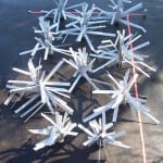
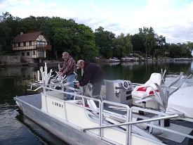
See the dozens of unique artificial fish habitat models, fish attractors and fish cover used at fishiding.com, the leader in  science based, proven, fish protection.

Migratory waterfowl regularly visit the flooded rice farms and a small area of restored wetlands called the Yolo Bypass Wildlife Area. Sometimes juvenile salmon spill over the weir into the bypass, but the area is not designed for fish, which often become trapped, when the water subsides, and die in evaporating pools.

Staggering fish migration

It is one of many reasons fisheries biologists believe California’s once vast population of chinook salmon has been declining despite an enormous yearly infusion of hatchery-raised fish. Only about 5 percent of the original Sacramento floodplains still exist, Katz said.

The creation of a statewide flood management plan is an opportunity to restore the floodplains where migrating fish historically rested, foraged for food and fattened up before returning to the river, Katz said. It would also stagger the migration over the course of the winter and spring season.

“Floodplains are important for foraging fish and for creating a more diverse portfolio of life histories,” Katz said. “By taking away floodplains and channeling them into rivers, we have taken that diversity away.”

The original idea behind the FloodSAFE initiative was to shore up the system of levees in the delta, which have failed 166 times over the past 100 years. The danger of flooding is now worse than ever, according to experts, who point out that the sea level is rising and land in the Central Valley is subsiding.

The state’s flood management plan, which could cost as much as $16 billion to fully implement, is expected to include a major expansion of the Yolo Bypass.

“By expanding the bypass we open the door for increased ecosystem restoration while getting the dual benefit of reducing flood risk,” said Michael Mierzwa, the supervising engineer and flood policy adviser for the Department of Water Resources. “The caveat that I put on that is that it is going to take decades to implement.”

Commitment in spotlight

The level of commitment to ecosystem restoration is the major concern among many environmentalists. Many local community leaders are vehemently opposed to converting farmland into wetlands. One big reason, Mierzwa said, is because both the agricultural land and the product grown on it are taxable. When you take a rice farm out of production, he said, you reduce the tax revenues which are, in turn, used to maintain the flood system.

The Knaggs Ranch experiment, Katz said, is designed to show how floodplain and habitat restoration can be accomplished without taking agricultural land out of production.

“We’re really talking about a paradigm shift in the way we push water around the landscape,” Katz said. “It’s going to be much cheaper to invest in a system that incorporates floodplain restoration now than it will be in the future. It will be better for ducks, better for fish and better for farms.”

E-mail Peter Fimrite at pfimrite@sfchronicle.com.

This article appeared on page A – 1 of the San Francisco Chronicle

 Peter Fimrite, Chronicle Staff Writer

Read more: http://www.sfgate.com/cgi-bin/article.cgi?f=/c/a/2011/12/25/MNDK1MEG6S.DTL&ao=2#ixzz1hxOgl0e2

 Read more: http://www.sfgate.com/cgi-bin/article.cgi?f=/c/a/2011/12/25/MNDK1MEG6S.DTL#ixzz1hxOTvmlR

Oregon habitat long term deal for fish and wildlife

Willamette River OR Conservation Easement Paves Way For Long-Term Fish & Wildlife Conservation

Oregon Department of Fish and WildlifeOregon Department of Fish and Wildlife

Corvallis, Ore. –-(Ammoland.com)- Greenbelt Land Trust announced today the acquisition of conservation easements on more than 300 acres of Willamette River frontage property in Benton County that will benefit a number of species including chinook salmon, cutthroat trout, Oregon chub, Pacific lampreys, western pond turtles and red-legged frogs.

This project will permanently protect important habitat for fish and wildlife identified in the Oregon Conservation Strategy.

These purchases were made possible through a strong partnership with the existing landowners, the land trust, the Oregon Department of Fish and Wildlife and funding from the Oregon Watershed Enhancement Board, the Bonneville Power Administration and the Meyer Memorial Trust.

Conservation easements allow for some traditional uses of the land, such as farming, by the landowner but permanently protect important wildlife habitat. They also allow conversion of farmland to restoration and conservation purposes as this project does.

They are particularly effective in the Willamette Valley where 96 percent of the land is privately owned. The 319-acre parcel includes Harkens Lake, a significant historic side-channel of the Willamette River that is critical habitat for native fish populations.

“This project is an integral part of creating opportunities for broad-scale floodplain habitat restoration on the Willamette River,” states Ken Bierly, Deputy Director of Oregon Watershed Enhancement Board.

The conservation of Harkens Lake is made possible through a partnership with landowners Gary, Jenny and Steve Horning and Mark and Sherie Adams, a collaboration that will continue as the partners prepare to restore the property’s floodplain forests and riparian areas to their historic conditions. Restoration of these forests decreases erosion and flood damage from seasonal inundation throughout the 100-year floodplain. See the dozens of unique artificial fish habitat models, fish attractors and fish cover used at fishiding.com, the leader in  science based, proven, fish protection.

“Our family has worked and lived on the Willamette River for five generations, which is why we take such pride in showing we can work around the river sustainably. We know the health of our crops depends on the health of the river system. Our goal for restoration is to utilize important floodplain areas to improve water quality and protect the valuable farm land that our family farm depends on,” said landowner Gary Horning.

“This important work can only be accomplished through partnerships with private landowners, non-profits, foundations and state and federal agencies,” said Michael Pope, GLT Executive Director. “We’re facing a monumental task in fish recovery and riparian restoration in the Willamette Valley, and we must all work together. We are extremely pleased to be able to complete this transaction, and grateful to all our partners who work with us to protect and restore environmentally sensitive lands.”

Funding from this project was dedicated through:

  • Oregon Watershed Enhancement Board through its Willamette Special Investment Partnership (SIP). The goal of the Willamette SIP is to identify and implement high-priority land conservation, fish passage, and habitat flow restoration projects that contribute to the enhancement of resident and migratory fish populations in the mainstem and tributaries of the Willamette River.
  • The Oregon Department of Fish and Wildlife Willamette Wildlife Mitigation Program which was created to manage the funds dedicated to the State of Oregon by the Bonneville Power Administration for wildlife habitat mitigation in the Willamette Valley. The agreement requires a substantial investment in wildlife and fish habitat restoration over the next 15 years.
  • Bonneville Power Administration funding helps fulfill an agreement that the State of Oregon made in 2010 to protect nearly 20,000 acres of Willamette Basin wildlife habitat. The agreement dedicates stable funding from electric ratepayers for 15 years to safeguard Willamette habitat for native species, supporting state efforts to protect the Willamette Basin and fulfilling BPA’s responsibility under the Northwest Power Act to offset the impacts of federal flood control and hydropower dams.

Healthy Streams for TN

Fish Habitat Restoration Initiative –


JOIN THE COUNCIL IN CREATING HEALTHY STREAMS FOR WILDLIFE AND PEOPLE

The Council’s Watershed Support Center takes challenges and turns them into opportunities for Tennessee rivers and streams and waterways and the wildlife and people who enjoy them.  Thanks to a grant from the Dan and Margaret Maddox Charitable Fund, we will continue and expand our watershed support work in Middle Tennessee.  A watershed is an area of land that drains into a specific body of water.  Our work includes:

~ Planting trees to reforest the stream banks and planting live stakes to stabilize the soil and help improve water quality.

~ Installing rain gardens.  Rain gardens add beauty to the landscape and reduce flooding by allowing storm water to be absorbed by the plants and infiltrated into the ground. 

~ Installing revetments (cedar timbers wrapped in coir mat) on to the eroded bank to prevent further deterioration of the stream bank. 

~ Fish habitat restoration initiatives in the streams

See the dozens of unique artificial fish habitat models, fish attractors and fish cover used at fishiding.com, the leader in  science based, proven, fish protection.

We schedule volunteer events each month. If you would like to join us on one of these projects visit our Events Calendar.  You may come and join our group.  We also encourage your business, youth group, or other organization to join us on one of our volunteer events.  We would be happy to schedule a special workday for your group.  Call us at 615-248-6500 or email tec(at symbol)tectn.org to schedule an outing.

Protecting the Biodiversity of Middle TN Streams
We are partnering with Harpeth River Watershed Association, municipal stormwater organizations and other non-profit organizations to complete our work and expand our reach.   The Fish Habitat Restoration initiative will take place in Middle TN including Sumner, Wilson, Davidson, Rutherford, Williamson, and Murray counties in the Duck River, Harpeth River, Stones River and Old Hickory Watershed.

National Geographic magazine recently named the Duck River in Tennessee one of the most biologically rich places in the world.  This is an important recognition bringing worldwide attention to one of our natural treasures in Tennessee, and it makes our Watershed Support work even more important.

The Duck River includes 151 different species of fish – more different types of fish than all of Europe.  The river is also home to over 50 types of mussels. The health of these amazing and diverse populations is indicative of the health of the ecosystem, and a thriving ecosystem means clean air, clean water and a healthy environment for communities.

The Harpeth River is 125 miles long with over 1,000 miles of tributaries.  The river passes through agricultural, forested and suburban areas of six counties in the greater Nashville region until it joins the Cumberland River. The Harpeth River watershed is  870 square miles.  The Harpeth is also one of the unique freshwater river systems of the Southeast which contains a greater variety of aquatic life than anywhere else in the world.

Sediment is the most common pollutant in rivers, streams, lakes and reservoirs according to the Environmental Protection Agency (EPA) and all Middle Tennessee streams and watersheds are impacted by this problem.

A Healthy Fish Habitat Means Health Drinking Water and Food Supply for People  
Urbanization and agriculture are causing degradation of fish and wildlife habitat in middle Tennessee. Our region continues attracting people and businesses who develop areas previously used for wildlife or farming. The most valuable of this habitat for fish is located in stream side areas that protect water quality and fish habitat from sediment and habitat destruction.

Roof tops and parking lots preclude the land from absorbing precipitation, and leads to increasing flooding and decreasing summertime flows by limiting groundwater recharge. Urban stormwater moves more quickly than normal because of smoother surfaces and less vegetation to capture and slow down the rain run off. This runoff also carries more trash, debris and pollutants and has a higher temperature. These traits contribute significantly to the degradation of fish and wildlife habitat in streams.  A healthy stream contributes to the health of the community through cleaner drinking water, increased biodiversity, improved recreational opportunities and more.

Success Stories
In 2009, the Duck River Opportunities Project received the Tennessee Governors Environmental Stewardship award, because of work to protect this most valuable natural resource.  Click here for more information.  In 2011 we carried out 9 volunteer restoration events, planting over 1,000 trees and stabilizing close to 1,000 feet of creek bank, reducing sedimentation, the leading cause of water pollution.

The Council also works in conjunction with Friends of Henry Horton State Park to educate 5th grade students about the Duck River Watershed training them to be stewards of the river.  Click here for more information.

The Fish Habitat Restoration Initiative is made possible through your generous donations to the Council and by a grant from the Dan and Margaret Maddox Charitable Fund and another grant from the Tennessee Department of Agriculture and the U.S. EPA.

MAKE A DONATION TODAY TO SUPPORT OUR WORK.  CLICK HERE TO DONATE.

Pictured Above:
1.  5th Grade Students from Chapel Hill Elementary plant trees as part of a watershed education project sponsored by Friends of Henry Horton State Park and presented by The Council.
2.  Kevin Burke inspects revetments designed to protect the stream bank and encourage re-vegetation and prevent further erosion.
3.  A group of volunteers from Mars Petcare at Jerry Erwin Park in Spring Hill planted hundreds of trees to improve the health of the Duck River Watershed in October 2011.
4. This crawfish is a great example of the biodiversity found in the Duck River Watershed.

Click here to see more pictures.

Lake Fork sportsmen and state work together to help create fish habitat

Members of the Lake Fork Sportsman’s Association partnered with the Texas Parks & Wildlife Department’s Inland Fisheries Division staff in making fish habitat improvements at Lake Fork last week.

They took advantage of drought-induced low water levels that have exposed shorelines and they planted 400 buttonbush plants around the lake.

Buttonbush is a native woody shrub commonly called “buckbrush,” and it was chosen to establish woody cover for fish.

When covered by water, it helps provide great bass fishing, a TP&W press release said.

Michael Rogge, president of the Lake Fork group, said approximately 15 members of the association and 15 members of the TP&W, spent approximately three hours planting 400 of the plants in two separate locations.

Rogge said the shrubs are adapted to “wet environments” like willow trees and that they will grow to about six to eight feet and be quite “bushy.”

“They will sprout new plants as seeds drop off,” in the future, and “become pretty dense,” which in turn creates fish habitat, he said.

Rogge said 200 of the plants were introduced in Glade Creek and another 200 in Big Caney.

According to a parks and wildlife spokesman, Lake Fork has had a long history of relatively stable water levels. This has been advantageous in that it has mostly translated into stable aquatic habitat and fish production. However, during the recent drought the disadvantage of this stability became evident. The lake elevation has dropped to an all-time record low, exposing shorelines and reducing cover which provides young fish shelter from predators. See the dozens of unique artificial fish habitat models, fish attractors and fish cover used at fishiding.com, the leader in  science based, proven, fish protection.

The state said Lake Fork will likely be subject to more water level fluctuations in the future as the City of Dallas increases pumping operations on the lake, especially if the current drought persists.

In lakes where there are prolonged draw-downs, plants will grow in the newly expanded shoreline.

These include aquatic plants such as smartweed, sedges and rushes, along with a variety of other plants including shrubs and trees. Woody plants such as willows will grow rapidly along the shore, and when it rains and the lake elevation rises enough, the plants can become partially or totally covered.

The plants provide shelter for fish and for the establishment of many organisms that fish eat.

Some of the woodier plants are persistent and will survive for many years and provide benefits to the ecosystem.

The first step in this habitat enhancement plan materialized in March when the association purchased 1,000 bare-root buttonbush plants from a local tree nursery and planted them at selected locations throughout the reservoir. Survival of these small plants, most less than two feet in length, was low. At some of the planting sites they were trampled by feral hogs.

The second stage in the Lake Fork organization’s habitat project began to take shape this past summer. The opportunity to purchase larger plants presented itself when a fish farmer in Columbus, Texas, approached TP&WD looking for potential customers for 400 two-year-old buttonbush plants.

The TP&W press release said these larger plants should experience better survival. The LFSA agreed to underwrite the majority of the $1,900 purchase price, and TP&WD contributed $650. Bushes were planted at different elevations to hedge against future water-level changes.

The Radford Becomes a Reef Creating fish habitat

What was once a 553-foot Navy destroyer has become the East Coast’s largest artificial reef. This summer, as tourism and natural resources officials from Delaware, New Jersey and Maryland looked on, the new “reef,” slowly sunk to the bottom of the Atlantic Ocean. The Del-Jersey- Land reef, (named for the three states involved in the project) took about four hours to make its 138-foot descent.

The USS Arthur W. Radford’s final resting place is roughly 28 miles northeast of the Ocean City inlet, midway between the Indian River and Cape May. The Del-Jersey-Land reef is a cooperative venture between the three states to enhance fisheries habitat through decommissioned and retired ships, and railway and subway cars. See the dozens of unique artificial fish habitat models, fish attractors and fish cover used at fishiding.com, the leader in  science based, proven, fish protection.

“It’s going to be a huge economic boost for Ocean City,” says Erik Zlokovitz, the artificial reef coordinator for DNR. “It is expected to attract bluefish, sea bass, weakfish, sharks and tuna, and that will attract charter fleets.”

The Radford was commissioned in 1977 and held a crew of more than 300. It patrolled Venezuela, Panama, Argentina, Brazil, Senegal, Oman, Bahrain, the Azores, Nova Scotia, Italy and Turkey. One of its final missions was deployment during Operation Enduring Freedom. The Radford’s homeport was Norfolk, Va.

The ship was named for Admiral Arthur Radford who served in three wars. He was onboard the USS South Carolina during World War I, in the Office of the Chief of Naval Operations during World War II and was Commander in Chief of the U.S. Pacific Fleet at the outbreak of Korean hostilities.

Taking nearly four hours to sink, the USS Radford is the largest ship to become a reef.

Jill Zarend-Kubatko is the Publication Manager in DNR’s Office of Communication.

Montana gets $131,000 for fish habitat projects

Montana is among the states receiving funding for improving fish habitat. The U.S. Fish and Wildlife Service will provide more than $3.3 million to support 68 fish habitat projects in 36 states. An additional $9.9 million in partner contributions will go toward restoring and enhancing stream, lake and coastal habitat, as well as to improving recreational fishing and helping endangered species. The funding is provided by 15 Fish Habitat Partnerships. In Montana under the Western Native Trout Initiative, the state will receive $61,000 in Service funds and $70,000 in partner funds to restore 9 in stream miles in Four Mile Creek to benefit Yellowstone cutthroat trout. See the dozens of unique artificial fish habitat models, fish attractors and fish cover used at fishiding.com, the leader in  science based, proven, fish protection.

Conservation Commission hosts discussion on Irene

BRATTLEBORO — On Tuesday, Dec. 13, representatives from Windham Regional Commission and the Connecticut River Watershed Council will join with the State Watershed Coordinator, who will give a presentation on understanding the effects of Tropical Storm Irene on Brattleboro and the surrounding communities.

Presenters include Chris Campany, executive director of WRC, David Deen, the CRWC’s River Steward, and Marie Caduto, State Watershed Coordinator.

The meeting is being hosted by the Brattleboro Conservation Commission, from 6 to 7:30 p.m. at the Marlboro Graduate Center, Room 2E, at 10 Vernon Street.

Aling with understanding the effects of the storm on the region, topics will include how river systems in Vermont function and the effects of flooding on fish habitat and populations.

See the dozens of unique artificial fish habitat models, fish attractors and fish cover used at fishiding.com, the leader in  science based, proven, fish protection.

“In late August, we experienced the worst flooding in Vermont since 1927,” Drew Adam, chair of the Brattleboro Conservation Commission, stated in a release. “People have noticed a change in the streams — their location and the size. We felt that it was a natural role for the Conservation Commission to help people understand the science and social impacts behind what happened to our rivers and streams. Marie Caduto and David Deen have done similar presentations in other parts of the state and Chris Campany adds a boots on the ground prospective of how the flooding unfolded.”

Partnership Preserves Livelihoods and Fish Stocks

HALF MOON BAY, Calif. — Stevie Fitz, a commercial fisherman, was pulling up his catch in one of his favorite spots off of Point Reyes in June when he saw something terrifying — in his nets were nearly 300 bocaccio, a dwindling species of rockfish protected by the government. Continue reading “Partnership Preserves Livelihoods and Fish Stocks”

BUREAU SLAMMED FOR ‘NEEDLESS’ LOSS OF SALMON EGGS AND FISH HABITAT


Three irrigation districts are blaming the federal Bureau of Reclamation for failing to adjust water releases from New Melones Reservoir to protect spawning Chinook salmon in the Stanislaus River.

The districts contend the federal agency failed to heed their repeated warnings to more aggressively reduce reservoir storage throughout the year. As a result of high flows during the fall spawning season, more than 10 percent of the salmon eggs appear to have been wiped out between the Knights Ferry and Orange Blossom (Honolulu Bar) area on the Stanislaus River based on work conducted by a team of fishery research scientists with the Oakdale-based FISHBIO firm.

Nearly continuous high water flows during October resulted in salmon spawning in side channels and other areas of high flow. The lowering of the flows led to the eggs of the “species of concern” under the federal Endangered Species Act being wiped out. The eggs were destroyed in at least 23 redds, where salmon nest and spawn, in the Knights Ferry to Orange Blossom area alone.

“We have been warning the Bureau since mid-summer,” noted Steve Knell, general manager of the Oakdale Irrigation District. “We told the (Bureau) this would happen if they didn’t manage their water releases. We didn’t want the salmon to nest in the floodplain during high flows, only to get stranded if the flows were reduced. For whatever reason, the (Bureau) ignored our concerns and the result was a significant and needless loss of salmon.”

Joining OID in criticizing the Bureau were the South San Joaquin Irrigation District and the Stockton East Water District. The OID and SSJID have spent over $1 million in the past decade working to improve fish habitat and survival on the Stanislaus River.

Fall-run Chinook salmon represent the only race of salmon that spawn in the Stanislaus River. Fall-run Chinook salmon need flow rates of approximately 300 to 500 cubic feet per second of water flow beginning in early October each year, to maximize spawning success.

“This year, the (Bureau) maintained flows in excess of 2,000 (cubic feet per second) until Nov. 2,” according to Jeff Shields, SSJID general manager.

“These salmon spawned in areas where the high flows covered the redds,” he added. “When the (Bureau) reduced the river flows, the redds became dewatered.”

Earlier this year the SSJID and OID succeeded in convincing the federal district court judge that a proposed federal operating plan to send massive amounts of water down the Stanislaus in a bid to protect salmon would ultimately be counterproductive. That’s because the pool of water behind New Melones would be so low in some years that the temperature of the “cold water storage” on the bottom of the reservoir would raise water temperatures sufficiently to kill fish.

Fish biologist Doug Demko said there had been an increase in the number of fall-run salmon returning to spawn in the Stanislaus River this year. The OID invested heavily in creating new spawning areas for the salmon as well. Demko said the Bureau’s management of New Melones releases means the number of juvenile fish heading to the Pacific Ocean this year will be reduced, which in turn will further cut the amount of adults that return in subsequent years to spawn.

Demko said the Bureau was sent a memorandum in July warning of the danger of heavy release in the spawning season but got no response.

The Bureau has not responded to requests for an explanation of why releases were allowed to jeopardize the survival of the Chinook salmon.

See the dozens of unique artificial fish habitat models, fish attractors and fish cover used at fishiding.com, the industry leader in science based, man made and artificial fish habitat, proven to provide all fish with cover they prefer to prosper.

Manteca Bulletin Managing Editor Dennis Wyatt contributed to this report.


Dry Creek fish habitat restoration plan approved

Nov. 21–The first stage of a habitat makeover for Dry Creek coho salmon and steelhead is one step closer to construction.
Sonoma County officials will unveil plans next summer to install side channels, boulders and logs to offer greater shelter for the endangered and threatened fish.

The work is part of a 2008 federal order to improve conditions for the two species in the Russian River watershed. On Dry Creek, which the county uses to deliver water for 600,000 customers but where fish are in need of more slow-water habitat, the efforts would cover six of the stream’s 14 miles and cost $36 to $48 million.

County supervisors last week approved the first phase of that project, on a one-mile stretch of the stream bisected by Lambert Bridge Road.

Eleven landowners in the area are working with the county to provide access to the creek for construction and future maintenance and repair. Total building cost is estimated at $6 million to $8 million, with an additional $413,000 for the purchase of short- and long-term easements.

County officials hope the work, including collaboration with an initial group of landowners, will lay the foundation for the rest of the project, which would run through 2020 if the early stages are successful.

The alternative is a costlier $150 million to $200 million fix that would lower flows in the creek through a parallel water pipeline running from Lake Sonoma to Healdsburg.

“To say the success of the first mile (of habitat improvement) is critical to the entire project is an understatement,” said Supervisor Mike McGuire, who represents the area. “Failure is not an option.”

Construction is set to begin in June and run through October, taking advantage of the dry season.

Excavators will carve out four channels off the main creek for backwater habitat, while workers in other areas embed boulder clusters and about 2,000 logs in the stream to slow water and provide holding pockets for fish.

See the dozens of unique artificial fish habitat models, fish attractors and fish cover used at fishiding.com, the industry leader and only science based, man made and artificial fish habitat, proven to provide all fish with cover they prefer to prosper.

Non-native plants will also be removed and native bushes and trees installed.

The goal is about 114,000 square feet of improved habitat, said David Manning, principal environmental specialist for the county Water Agency, which is overseeing the project.

One grape grower participating in the project said the efforts were part of a renewed focus on fish-friendly farming in the area.

“We’re looking forward to working with the agency on Dry Creek projects now and in the future,” said Ned Horton, vineyard manager at Quivira Vineyards and Winery.
By Brett Wilkison, The Press Democrat, Santa Rosa, Calif.

Scroll to Top